

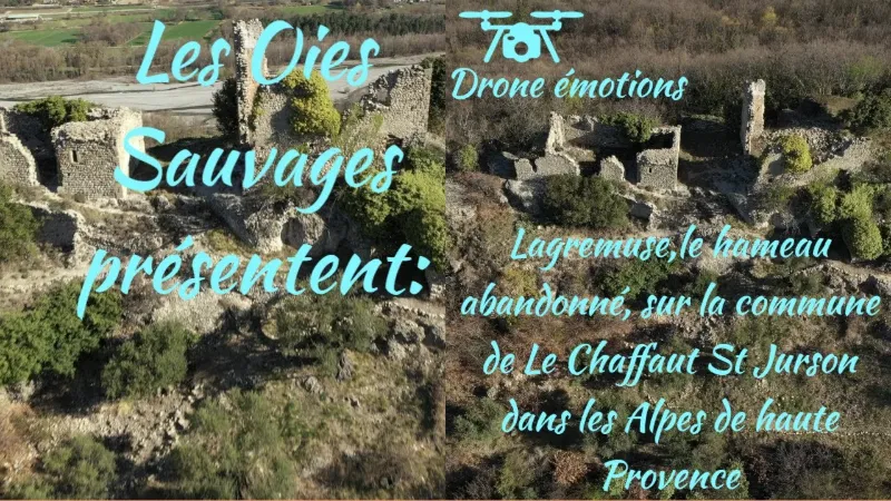
Le Chaffaut Saint Jurson, the abandoned hamlet of Lagremuse
No reviews yet
Have you flown here? Share your experience with other pilots.
+ Write the first reviewDescription
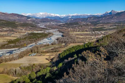
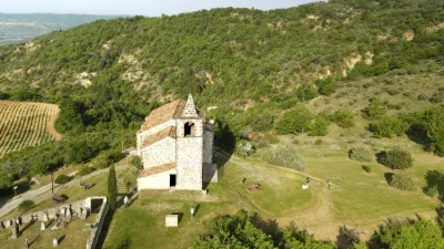
The ruined village of Lagremuse This hilltop site still bears witness to its defensive past. The ruins of the old fortified castle, built on three rocks, overlook the entire Bléone valley. The Sainte-Agathe chapel, adjoining the castle, is also built on rock.
The village, if tradition is to be believed, owes its name to the wall lizards that live here, "li lagramuso" in Provençal. The land is arid and the sunshine exceptional. In the 19th century, Abbé Féraud wrote: "The climate is good, the inhabitants very poor, the soil stony and producing little grain and a lot of wood." Rural depopulation was therefore massive in Lagremuse. The population fell from 80 inhabitants in 1765 to 66 in 1844. In 1867, the municipality of Lagremuse was merged with Le Chaffaut-St-Jurson. After the First World War, the village was completely deserted. Of the old terraced gardens below Lagremuse, only a few stone walls remain, and of the vines planted to the southwest, only a few abandoned vine stocks. Only the old olive groves have recently been carefully restored by their owners.
Map and restricted areas
Open in the main mapNearby aerodromes
Open aerodromes within 25 km of the spot, heliports included, with their distance and direction from the spot. Near an aerodrome, drone flying is prohibited or height-limited: check the UAS zones map.
| Aerodrome | Type | Distance | Elevation | Difference |
|---|---|---|---|---|
| Aérodrome de Château-Arnoux - Saint-Auban | Aerodrome | 11 km W | 460 m | spot 184 m higher |
| Puimoisson Airfield | Aerodrome | 18 km S | 769 m | spot 125 m lower |
Aviation weather (METAR and TAF)
No METAR station within 50 km.
Weather and Kp index
Sunrise and sunset
| Day | Dawn | Sunrise | Golden hour | Sunset | Dusk | Day length |
|---|---|---|---|---|---|---|
| Sat 21 Nov | 07:07 | 07:38 | 07:38–08:23 · 16:20–17:04 | 17:04 | 17:36 | 9 h 26 |
| Sun 22 Nov | 07:08 | 07:39 | 07:39–08:24 · 16:19–17:04 | 17:04 | 17:35 | 9 h 24 |
| Mon 23 Nov | 07:09 | 07:41 | 07:41–08:26 · 16:18–17:03 | 17:03 | 17:35 | 9 h 22 |
| Tue 24 Nov | 07:10 | 07:42 | 07:42–08:27 · 16:17–17:02 | 17:02 | 17:34 | 9 h 20 |
| Wed 25 Nov | 07:11 | 07:43 | 07:43–08:29 · 16:16–17:02 | 17:02 | 17:34 | 9 h 18 |
| Thu 26 Nov | 07:12 | 07:44 | 07:44–08:30 · 16:16–17:01 | 17:01 | 17:33 | 9 h 16 |
| Fri 27 Nov | 07:14 | 07:46 | 07:46–08:31 · 16:15–17:01 | 17:01 | 17:33 | 9 h 15 |

Reviews
Log in to review this spot. Log in · Create a free account
No reviews yet. Share yours!