

Etang de Bages
No reviews yet
Have you flown here? Share your experience with other pilots.
+ Write the first reviewDescription
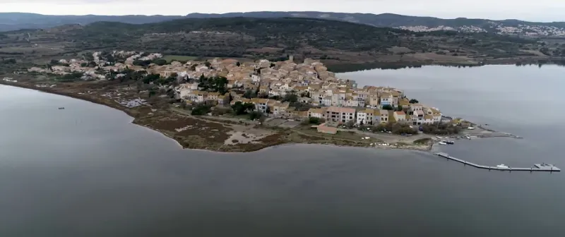
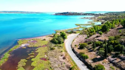
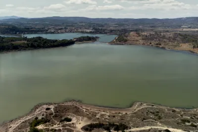
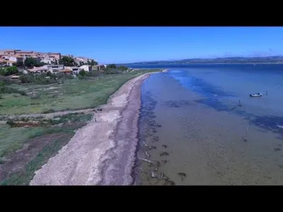
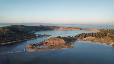
Dating from the 11th century, it is located south of Narbonne and is part of the Narbonnaise Regional Natural Park. The coast of the Aude remains fairly unspoiled today. Indeed, despite the construction of a few "new" seaside resorts in the 1970s, vast sandy expanses remain. For me, the mosaic of landscapes offers one of the most beautiful scenes in the region, with the lagoons, the sea, the mountains, the islands, the lagoon, the wildlife (350 bird species here), the canals... everything blends together, and mass tourism is far away. 12,000 ha is the size of these expanses between land and sea, between fresh water, brackish water and salt water. Several villages sit on the shores of the lagoons, including Bages and Peyriac de Mer. The main activity on the lagoons is still small-scale fishing: sea bass, sea bream, sole, mullet and above all... eel, the local star! Here it is cooked in a stew (delicious) or in a bourride, among other ways. A good place to taste eel in all its forms: the restaurant le Portanel in Bages. There is even a special eel menu where it is served in 9 recipes, with the best Languedoc wines to go with it. I recommend the walk around the Doul lagoon from the village of Peyriac (there are well-marked trails). And you have to take the plunge, you'll see, you float. Yes, the lagoon has a salinity of between 50 and 60 grams per liter, about twice that of the sea! Makes sense, they are former salt works...
Map and restricted areas
Open in the main mapNearby aerodromes
Open aerodromes within 25 km of the spot, heliports included, with their distance and direction from the spot. Near an aerodrome, drone flying is prohibited or height-limited: check the UAS zones map.
| Aerodrome | Type | Distance | Elevation |
|---|---|---|---|
| St Crescent Heliport | Heliport | 5.5 km N | 9 m |
| Narbonne | Aerodrome | 9.0 km NE | 3 m |
| Lézignan-Corbières Airfield | Aerodrome | 22 km W | 63 m |
Aviation weather (METAR and TAF)
LFMU – Béziers-Vias Airport VFR
METAR
METAR LFMU 211030Z AUTO 04004KT 350V080 CAVOK 16/10 Q1020 NOSIG
- Wind
- 040°, 7 km/h
- Visibility
- 10 km or more
- Clouds
- –
- Temperature
- 16 °C, dew point 10 °C
- QNH
- 1020 hPa
- Flight category
- VFR: ceiling > 3,000 ft and visibility > 5 mi
TAF
TAF LFMU 210800Z 2109/2209 VRB04KT CAVOK BECMG 2112/2114 06010KT TEMPO 2120/2203 BKN014 BECMG 2205/2207 27020G40KT
| Period (local time) | Change | Wind | Visibility | Weather | Clouds |
|---|---|---|---|---|---|
| 21/11 10:00 → 21/11 13:00 | Initial conditions | Variable, 7 km/h | 10 km or more | No significant weather | No significant cloud |
| 21/11 13:00 → 22/11 06:00 | Becoming | 060°, 19 km/h | 10 km or more | No significant weather | No significant cloud |
| 21/11 21:00 → 22/11 04:00 | Temporarily | Broken (5-7/8) at 1,400 ft (430 m) | |||
| 22/11 06:00 → 22/11 10:00 | Becoming | 270°, 37 km/h, gusts 74 km/h | 10 km or more | No significant weather | No significant cloud |
Weather and Kp index
Sunrise and sunset
| Day | Dawn | Sunrise | Golden hour | Sunset | Dusk | Day length |
|---|---|---|---|---|---|---|
| Sat 21 Nov | 07:17 | 07:48 | 07:48–08:32 · 16:36–17:20 | 17:20 | 17:51 | 9 h 31 |
| Sun 22 Nov | 07:18 | 07:49 | 07:49–08:33 · 16:35–17:19 | 17:19 | 17:50 | 9 h 29 |
| Mon 23 Nov | 07:19 | 07:51 | 07:51–08:35 · 16:34–17:18 | 17:18 | 17:49 | 9 h 27 |
| Tue 24 Nov | 07:21 | 07:52 | 07:52–08:36 · 16:33–17:18 | 17:18 | 17:49 | 9 h 25 |
| Wed 25 Nov | 07:22 | 07:53 | 07:53–08:37 · 16:33–17:17 | 17:17 | 17:48 | 9 h 23 |
| Thu 26 Nov | 07:23 | 07:54 | 07:54–08:39 · 16:32–17:16 | 17:16 | 17:48 | 9 h 22 |
| Fri 27 Nov | 07:24 | 07:55 | 07:55–08:40 · 16:31–17:16 | 17:16 | 17:47 | 9 h 20 |

Reviews
Log in to review this spot. Log in · Create a free account
No reviews yet. Share yours!