

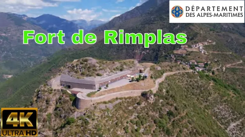
FORT DE RIMPLAS, Tinée Valley
1 pilot review
“Salut , NON ma chaîne n'est pas configurée pour les enfants , on peut visualiser toutes me…” — jypai83, 4 years ago
Read the reviews + Write my reviewDescription
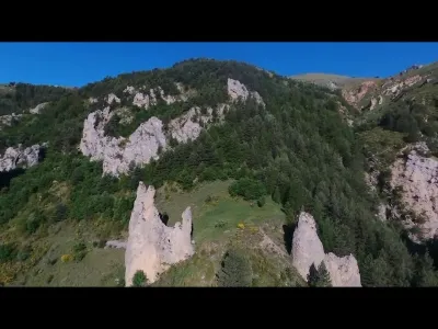
This is a large artillery fortification, located at an altitude of 1,102 meters, blocking passage through the Tinée valley from this summit and covering the small works of Fressinéa and Valdeblore (which are at the bottom of the valley). The Rimplas fortification offers views over the Haute-Tinée to the north, and as far as Saint-Dalmas de Valdeblore and La Colmiane to the east; it could therefore bring fire to bear on the Haute-Tinée road and the one leading to Saint-Martin-Vésubie.
Map and restricted areas
Open in the main mapNearby aerodromes
Open aerodromes within 25 km of the spot, heliports included, with their distance and direction from the spot. Near an aerodrome, drone flying is prohibited or height-limited: check the UAS zones map.
| Aerodrome | Type | Distance | Elevation | Difference |
|---|---|---|---|---|
| Altisurface d'Isola 2000 | Aerodrome | 13 km N | 2,500 m | spot 1,414 m lower |
| Altisurface de Valberg | Aerodrome | 16 km W | 683 m | spot 403 m higher |
Aviation weather (METAR and TAF)
LFMN – Nice-Côte d'Azur Airport VFR
METAR
METAR LFMN 211100Z 08007KT CAVOK 17/10 Q1016 NOSIG
- Wind
- 080°, 13 km/h
- Visibility
- 10 km or more
- Clouds
- –
- Temperature
- 17 °C, dew point 10 °C
- QNH
- 1016 hPa
- Flight category
- VFR: ceiling > 3,000 ft and visibility > 5 mi
TAF
TAF LFMN 210800Z 2109/2215 VRB02KT CAVOK PROB40 2113/2121 25010KT BECMG 2121/2123 34010KT TEMPO 2123/2210 4000 RA BKN014 SCT030TCU BECMG 2210/2214 25018G30KT
| Period (local time) | Change | Wind | Visibility | Weather | Clouds |
|---|---|---|---|---|---|
| 21/11 10:00 → 21/11 22:00 | Initial conditions | Variable, 4 km/h | 10 km or more | No significant weather | No significant cloud |
| 21/11 14:00 → 21/11 22:00 | probability 40% | 250°, 19 km/h | |||
| 21/11 22:00 → 22/11 11:00 | Becoming | 340°, 19 km/h | 10 km or more | No significant weather | No significant cloud |
| 22/11 00:00 → 22/11 11:00 | Temporarily | 4.0 km | Rain | Broken (5-7/8) at 1,400 ft (430 m) ; Scattered (3-4/8) at 3,000 ft (910 m) (towering cumulus) | |
| 22/11 11:00 → 22/11 16:00 | Becoming | 250°, 33 km/h, gusts 56 km/h | 10 km or more | No significant weather | No significant cloud |
Weather and Kp index
Sunrise and sunset
| Day | Dawn | Sunrise | Golden hour | Sunset | Dusk | Day length |
|---|---|---|---|---|---|---|
| Sat 21 Nov | 07:03 | 07:34 | 07:34–08:19 · 16:16–17:00 | 17:00 | 17:32 | 9 h 26 |
| Sun 22 Nov | 07:04 | 07:36 | 07:36–08:20 · 16:15–17:00 | 17:00 | 17:31 | 9 h 24 |
| Mon 23 Nov | 07:05 | 07:37 | 07:37–08:22 · 16:14–16:59 | 16:59 | 17:31 | 9 h 22 |
| Tue 24 Nov | 07:06 | 07:38 | 07:38–08:23 · 16:13–16:58 | 16:58 | 17:30 | 9 h 20 |
| Wed 25 Nov | 07:07 | 07:39 | 07:39–08:25 · 16:12–16:58 | 16:58 | 17:30 | 9 h 18 |
| Thu 26 Nov | 07:09 | 07:40 | 07:40–08:26 · 16:12–16:57 | 16:57 | 17:29 | 9 h 16 |
| Fri 27 Nov | 07:10 | 07:42 | 07:42–08:27 · 16:11–16:57 | 16:57 | 17:29 | 9 h 14 |

Reviews
Log in to review this spot. Log in · Create a free account
jypai83
Salut , NON ma chaîne n'est pas configurée pour les enfants , on peut visualiser toutes mes vidéos sans commentaire , je réalise des vidéos juste pour le plaisir. Pour les vidéos tournées avec drones et postées sur drone spot les commentaires sont ouverts.le bonjour du Var.