

The towers of Chignin
No reviews yet
Have you flown here? Share your experience with other pilots.
+ Write the first reviewDescription
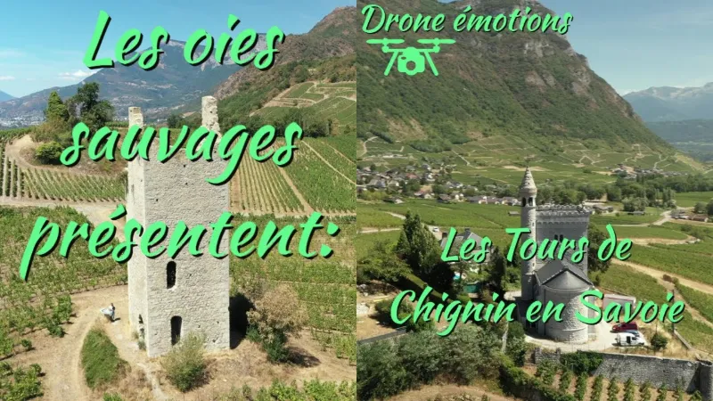
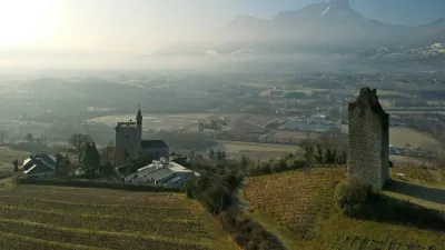
The towers of Chignin Seven! That is the number of towers rising at Chignin, on the plateau overlooking the Chambéry gap and the road to Italy. Very close to one another, square or round, they were built in the 13th century when the lordship of Chignin was divided up, with each descendant building his own tower! Very quickly the Counts of Savoy noticed the defensive value of the site and had a rampart built linking the towers together. The castle then became part of the defensive system of the county and later the duchy. Occupied by the French in 1690 and then by Sardinian troops in 1792, it suffered damage and underwent renovations that took away its role as a fortress. The towers are isolated from one another.
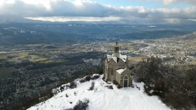
In 1877, the Biguerne tower was converted by the Carthusian brothers into a chapel in honor of Saint Anthelm, prior of the Grande Chartreuse and bishop of Belley, born at the castle of Chignin in the 12th century. Apart from the chapel and the "la Place" tower, still very visible in the landscape and restored, the other towers are in a state of ruins. Their positions nevertheless give a good idea of the scale of this former stronghold.
Map and restricted areas
Open in the main mapNearby aerodromes
Open aerodromes within 25 km of the spot, heliports included, with their distance and direction from the spot. Near an aerodrome, drone flying is prohibited or height-limited: check the UAS zones map.
| Aerodrome | Type | Distance | Elevation | Difference |
|---|---|---|---|---|
| Aérodrome de Chambéry Challes-les-Eaux | Aerodrome | 4.4 km NW | 297 m | spot 135 m higher |
| Centre Hospitalier Heliport | Heliport | 8.0 km NW | 319 m | spot 113 m higher |
| Chambéry-Savoie Airport | Airport | 16 km NW | 237 m | spot 195 m higher |
| La Fullie | Heliport | 16 km NE | 1,394 m | spot 962 m lower |
| Hôtel Ariana Heliport | Heliport | 18 km NW | 247 m | spot 185 m higher |
Aviation weather (METAR and TAF)
LFLB – Chambéry-Savoie Airport VFR
METAR
METAR LFLB 211100Z AUTO 14003KT 080V200 9999 SCT015 BKN060 12/09 Q1021 NOSIG
- Wind
- 140°, 6 km/h
- Visibility
- 10 km or more
- Clouds
- Scattered (3-4/8) at 1,500 ft (460 m) ; Broken (5-7/8) at 6,000 ft (1830 m)
- Temperature
- 12 °C, dew point 9 °C
- QNH
- 1021 hPa
- Flight category
- VFR: ceiling > 3,000 ft and visibility > 5 mi
TAF
TAF LFLB 210800Z 2109/2209 VRB03KT 9999 SCT050 BECMG 2122/2124 RA BKN050 TEMPO 2203/2209 3000 RA SCT012 BKN020 SCT040TCU BECMG 2205/2207 20010KT
| Period (local time) | Change | Wind | Visibility | Weather | Clouds |
|---|---|---|---|---|---|
| 21/11 10:00 → 21/11 23:00 | Initial conditions | Variable, 6 km/h | 10 km or more | Scattered (3-4/8) at 5,000 ft (1520 m) | |
| 21/11 23:00 → 22/11 06:00 | Becoming | Variable, 6 km/h | 10 km or more | Rain | Broken (5-7/8) at 5,000 ft (1520 m) |
| 22/11 04:00 → 22/11 10:00 | Temporarily | 3.0 km | Rain | Scattered (3-4/8) at 1,200 ft (370 m) ; Broken (5-7/8) at 2,000 ft (610 m) ; Scattered (3-4/8) at 4,000 ft (1220 m) (towering cumulus) | |
| 22/11 06:00 → 22/11 10:00 | Becoming | 200°, 19 km/h | 10 km or more | Rain | Broken (5-7/8) at 5,000 ft (1520 m) |
Weather and Kp index
Sunrise and sunset
| Day | Dawn | Sunrise | Golden hour | Sunset | Dusk | Day length |
|---|---|---|---|---|---|---|
| Sat 21 Nov | 07:11 | 07:43 | 07:43–08:30 · 16:14–17:01 | 17:01 | 17:33 | 9 h 17 |
| Sun 22 Nov | 07:12 | 07:45 | 07:45–08:31 · 16:13–17:00 | 17:00 | 17:32 | 9 h 15 |
| Mon 23 Nov | 07:13 | 07:46 | 07:46–08:33 · 16:12–16:59 | 16:59 | 17:32 | 9 h 13 |
| Tue 24 Nov | 07:14 | 07:47 | 07:47–08:34 · 16:11–16:58 | 16:58 | 17:31 | 9 h 11 |
| Wed 25 Nov | 07:16 | 07:48 | 07:48–08:35 · 16:10–16:58 | 16:58 | 17:30 | 9 h 09 |
| Thu 26 Nov | 07:17 | 07:50 | 07:50–08:37 · 16:10–16:57 | 16:57 | 17:30 | 9 h 07 |
| Fri 27 Nov | 07:18 | 07:51 | 07:51–08:38 · 16:09–16:56 | 16:56 | 17:29 | 9 h 05 |


Reviews
Log in to review this spot. Log in · Create a free account
No reviews yet. Share yours!