

La petite Camargue - Saint-Chamas
No reviews yet
Have you flown here? Share your experience with other pilots.
+ Write the first reviewDescription
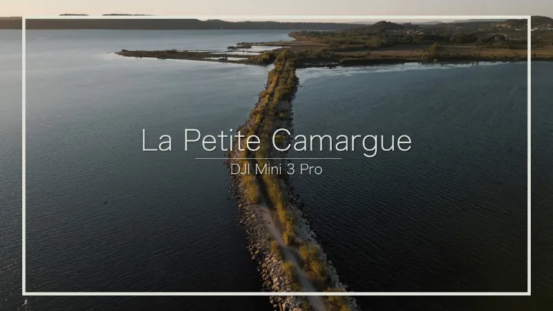
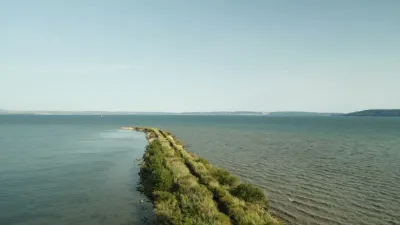
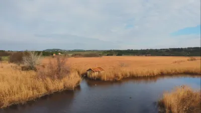
The "Petite Camargue" site is located in the commune of Saint-Chamas, in the Bouches-du-Rhône department. Covering 94 ha, the site lies at the mouth of the Touloubre, where this stream meets the brackish waters of the Étang de Berre. Fed by both fresh water (Touloubre) and brackish water (Étang de Berre), the Petite Camargue of Saint-Chamas hosts a variety of natural habitats (shell-covered coastal strip, salt flats, reed beds, wet meadows, riparian forest along the Touloubre, garrigue…) that support a diverse and remarkable flora and fauna. The site adjoins an area that is also known for its richness, particularly for birdlife: the Palous, located southwest of the Petite Camargue and owned by the commune of Saint-Chamas.
Map and restricted areas
Open in the main mapNearby aerodromes
Open aerodromes within 25 km of the spot, heliports included, with their distance and direction from the spot. Near an aerodrome, drone flying is prohibited or height-limited: check the UAS zones map.
| Aerodrome | Type | Distance | Elevation |
|---|---|---|---|
| Societe Europeenne de Propulsion Heliport | Heliport | 8.6 km W | 22 m |
| Berre-la-Fare Airfield | Aerodrome | 10 km E | 33 m |
| Istres Le Tubé Air Base | Airport | 10 km W | 25 m |
| Salon-de-Provence (BA 701) Air Base | Airport | 11 km NE | 59 m |
| Centre De Secours Heliport | Heliport | 11 km S | 41 m |
Aviation weather (METAR and TAF)
LFMI – Istres Le Tubé Air Base VFR
METAR
METAR LFMI 210900Z AUTO 33005KT CAVOK 10/08 Q1020 NOSIG
- Wind
- 330°, 9 km/h
- Visibility
- 10 km or more
- Clouds
- –
- Temperature
- 10 °C, dew point 8 °C
- QNH
- 1020 hPa
- Flight category
- VFR: ceiling > 3,000 ft and visibility > 5 mi
TAF
TAF LFMI 210800Z 2109/2209 VRB03KT CAVOK TX18/2117Z TN12/2205Z BECMG 2114/2116 12010KT TEMPO 2120/2209 15015KT 4000 SHRA BKN012 BKN025TCU BECMG 2206/2208 25015KT
| Period (local time) | Change | Wind | Visibility | Weather | Clouds |
|---|---|---|---|---|---|
| 21/11 10:00 → 21/11 15:00 | Initial conditions | Variable, 6 km/h | 10 km or more | No significant cloud | |
| 21/11 15:00 → 22/11 07:00 | Becoming | 120°, 19 km/h | 10 km or more | No significant cloud | |
| 21/11 21:00 → 22/11 10:00 | Temporarily | 150°, 28 km/h | 4.0 km | Showers of rain | Broken (5-7/8) at 1,200 ft (370 m) ; Broken (5-7/8) at 2,500 ft (760 m) (towering cumulus) |
| 22/11 07:00 → 22/11 10:00 | Becoming | 250°, 28 km/h | 10 km or more | No significant cloud |
Weather and Kp index
| Day | Weather | Temp. min. / max. | Wind | Rain | Max Kp |
|---|---|---|---|---|---|
| Sat 21 Nov | Fair | 12° / 15° | 19 km/h E | 0.6 mm | 2 |
| Sun 22 Nov | Fair | 12° / 16° | 31 km/h W | 4.8 mm | 2 |
| Mon 23 Nov | Fair | 9° / 14° | 26 km/h W | – | 4 |
| Tue 24 Nov | Cloudy | 5° / 12° | 24 km/h NW | 0.4 mm | 2 |
| Wed 25 Nov | Showers | 9° / 12° | 36 km/h E | 34 mm | – |
| Thu 26 Nov | Clear sky | 7° / 12° | 8 km/h NW | 0.1 mm | – |
| Fri 27 Nov | Fair | 4° / 10° | 8 km/h NW | – | – |
Hour by hour: Saturday 21 November
| Time | Weather | Temp. | Wind | Rain | Clouds | Kp |
|---|---|---|---|---|---|---|
| 10:00 | Cloudy | 12° | 9 km/h W | – | 100 % | 2 |
| 11:00 | Cloudy | 13° | 8 km/h W | – | 93 % | 2 |
| 12:00 | Partly cloudy | 14° | 9 km/h W | – | 52 % | 2 |
| 13:00 | Fair | 15° | 9 km/h W | – | 36 % | 1 |
| 14:00 | Partly cloudy | 15° | 8 km/h W | – | 52 % | 1 |
| 15:00 | Partly cloudy | 15° | 6 km/h NW | – | 41 % | 1 |
| 16:00 | Partly cloudy | 15° | 4 km/h W | – | 74 % | 2 |
| 17:00 | Partly cloudy | 14° | 6 km/h S | – | 94 % | 2 |
| 18:00 | Partly cloudy | 13° | 8 km/h SE | – | 98 % | 2 |
| 19:00 | Cloudy | 13° | 10 km/h SE | – | 99 % | 2 |
| 20:00 | Cloudy | 12° | 12 km/h E | – | 98 % | 2 |
| 21:00 | Cloudy | 12° | 14 km/h E | – | 100 % | 2 |
| 22:00 | Light rain | 13° | 17 km/h E | 0.3 mm | 100 % | 2 |
Hour by hour: Sunday 22 November
| Time | Weather | Temp. | Wind | Rain | Clouds | Kp |
|---|---|---|---|---|---|---|
| 06:00 | Light rain | 15° | 25 km/h S | 0.3 mm | 100 % | 2 |
| 07:00 | Rain | 15° | 19 km/h S | 0.9 mm | 100 % | 2 |
| 08:00 | Light rain | 15° | 16 km/h SW | 0.2 mm | 100 % | 2 |
| 09:00 | Cloudy | 15° | 28 km/h W | – | 96 % | 2 |
| 10:00 | Cloudy | 14° | 27 km/h W | – | 92 % | 2 |
| 11:00 | Partly cloudy | 15° | 26 km/h W | – | 71 % | 2 |
| 12:00 | Fair | 15° | 27 km/h W | – | 20 % | 2 |
| 13:00 | Fair | 16° | 31 km/h W | – | 18 % | 2 |
| 14:00 | Fair | 16° | 30 km/h NW | – | 22 % | 2 |
| 15:00 | Clear sky | 15° | 29 km/h NW | – | 12 % | 2 |
| 16:00 | Fair | 15° | 25 km/h W | – | 15 % | 2 |
| 17:00 | Clear sky | 14° | 22 km/h W | – | 10 % | 2 |
| 18:00 | Fair | 13° | 22 km/h W | – | 15 % | 2 |
| 19:00 | Fair | 13° | 24 km/h W | – | 23 % | 2 |
| 20:00 | Fair | 12° | 28 km/h W | – | 16 % | 2 |
| 21:00 | Fair | 12° | 29 km/h W | – | 16 % | 2 |
| 22:00 | Fair | 12° | 27 km/h W | – | 14 % | 2 |
Sunrise and sunset
| Day | Dawn | Sunrise | Golden hour | Sunset | Dusk | Day length |
|---|---|---|---|---|---|---|
| Sat 21 Nov | 07:10 | 07:41 | 07:41–08:25 · 16:26–17:10 | 17:10 | 17:41 | 9 h 29 |
| Sun 22 Nov | 07:11 | 07:42 | 07:42–08:27 · 16:25–17:09 | 17:09 | 17:41 | 9 h 27 |
| Mon 23 Nov | 07:12 | 07:44 | 07:44–08:28 · 16:24–17:09 | 17:09 | 17:40 | 9 h 25 |
| Tue 24 Nov | 07:13 | 07:45 | 07:45–08:29 · 16:24–17:08 | 17:08 | 17:40 | 9 h 23 |
| Wed 25 Nov | 07:14 | 07:46 | 07:46–08:31 · 16:23–17:08 | 17:08 | 17:39 | 9 h 21 |
| Thu 26 Nov | 07:16 | 07:47 | 07:47–08:32 · 16:22–17:07 | 17:07 | 17:39 | 9 h 19 |
| Fri 27 Nov | 07:17 | 07:48 | 07:48–08:33 · 16:21–17:06 | 17:06 | 17:38 | 9 h 18 |



Reviews
Log in to review this spot. Log in · Create a free account
No reviews yet. Share yours!