

Saint Chamas, la Petite Camargue
No reviews yet
Have you flown here? Share your experience with other pilots.
+ Write the first reviewDescription
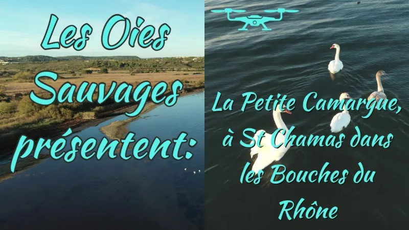
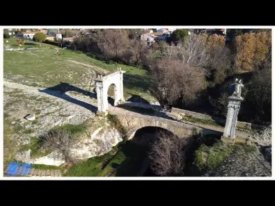
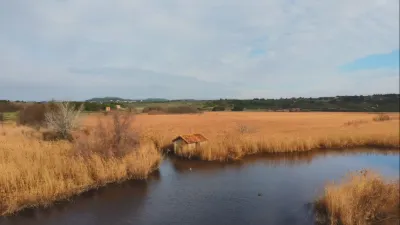
The "Petite Camargue" site is located in the commune of Saint-Chamas, in the Bouches-du-Rhône department. Covering 94 ha, this site lies at the mouth of the Touloubre, where this stream meets the brackish waters of the Étang de Berre. Fed by both fresh water (Touloubre) and brackish water (Étang de Berre), the Petite Camargue of Saint-Chamas hosts a variety of natural habitats (shell-covered coastal barrier, saltmarshes, reed beds, wet meadows, Touloubre riparian forest, garrigue…) that support a diverse and remarkable flora and fauna. This site adjoins an area also known for its richness, especially for birdlife: the Palous, located to the south-west of the Petite Camargue and owned by the commune of Saint-Chamas. Human presence along the banks of the Touloubre goes back a very long way, as a settlement is thought to date from the Mesolithic (6,000 BC). North of the Signolles marsh, archaeological clues suggest the presence of an Etruscan city. The Flavian bridge, now listed as a Historic Monument, is the main remnant of the Roman era.
In the 19th century, the Touloubre was embanked to allow irrigation of a growing number of crops.
Between the two World Wars, two farms were present on the site. These small subsistence farms were diversified, including livestock.
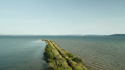
In 1964, EDF built the Saint-Chamas hydroelectric plant and in 1966 bought the site to carry out hydraulic works, including the dike, which, by limiting exchanges with the Étang de Berre, changed the site considerably.
In 1985, the site was the subject of a marina project intended to welcome Dutch clientele. The project was contested and abandoned. This is what allowed the Conservatoire du littoral to step in and acquire it in 1998. Wildlife
There are several remarkable insect species, often tied to wetlands, including two dragonflies: the Mercury Bluet and the Slender Emerald, and a butterfly: the Southern Festoon.
With more than 200 species observed over 94 ha, the site is also a major area for nesting, migration and wintering birds. Great Reed Warbler, Western Marsh Harrier, Little Tern and Red-rumped Swallow are among the remarkable nesting species.
Among the protected reptiles are the Ocellated Lizard, the European Pond Turtle and Edwards's Sand Racer.
The Touloubre is home to 2 species of heritage value among fish: the Freshwater Blenny and the European Eel.
Finally, the Lesser Mouse-eared Bat and the Greater Horseshoe Bat are among the bats that roost in the Sambre quarry.
Flora
Very rare in the Bouches-du-Rhône department, the Small-flowered Viper's-grass is one of the species of heritage value known on the site and represents a major conservation issue.
The same goes for the Marum-leaved Rock-rose, which grows in the garrigue with Kermes Oak and Rosemary, as well as the Provence Sea Lavender, found on the coastal cliffs bordering the Étang de Berre. The Conservatoire des Espaces Naturels de Provence-Alpes-Côte-d'Azur (CEN PACA) has managed this site since 1999. Since 2002, 3 successive management plans have set the following main objectives:
- restoring natural habitats of high heritage value such as the reed bed and the Touloubre riparian forest (maintaining water levels favorable to the wetland birds of the Signolles reed bed, monitoring water levels, etc.);
- knowing and monitoring biodiversity (fauna and flora monitoring);
- maintaining agricultural activity compatible with conservation goals; since 2016, a herd of Aubrac cows has grazed the site extensively;
- controlling invasive alien species (water primrose removal work, watching for the appearance of invasive alien species, etc.);
- welcoming the public and raising awareness of the site's riches (creation of a parking and visitor area, installation of information and awareness signs, guided tours, etc.).
Map and restricted areas
Open in the main mapNearby aerodromes
Open aerodromes within 25 km of the spot, heliports included, with their distance and direction from the spot. Near an aerodrome, drone flying is prohibited or height-limited: check the UAS zones map.
| Aerodrome | Type | Distance | Elevation |
|---|---|---|---|
| Societe Europeenne de Propulsion Heliport | Heliport | 8.4 km W | 22 m |
| Berre-la-Fare Airfield | Aerodrome | 10 km E | 33 m |
| Istres Le Tubé Air Base | Airport | 10 km W | 25 m |
| Salon-de-Provence (BA 701) Air Base | Airport | 10 km NE | 59 m |
| Centre De Secours Heliport | Heliport | 11 km S | 41 m |
Aviation weather (METAR and TAF)
LFMI – Istres Le Tubé Air Base VFR
METAR
METAR LFMI 210900Z AUTO 33005KT CAVOK 10/08 Q1020 NOSIG
- Wind
- 330°, 9 km/h
- Visibility
- 10 km or more
- Clouds
- –
- Temperature
- 10 °C, dew point 8 °C
- QNH
- 1020 hPa
- Flight category
- VFR: ceiling > 3,000 ft and visibility > 5 mi
TAF
TAF LFMI 210800Z 2109/2209 VRB03KT CAVOK TX18/2117Z TN12/2205Z BECMG 2114/2116 12010KT TEMPO 2120/2209 15015KT 4000 SHRA BKN012 BKN025TCU BECMG 2206/2208 25015KT
| Period (local time) | Change | Wind | Visibility | Weather | Clouds |
|---|---|---|---|---|---|
| 21/11 10:00 → 21/11 15:00 | Initial conditions | Variable, 6 km/h | 10 km or more | No significant cloud | |
| 21/11 15:00 → 22/11 07:00 | Becoming | 120°, 19 km/h | 10 km or more | No significant cloud | |
| 21/11 21:00 → 22/11 10:00 | Temporarily | 150°, 28 km/h | 4.0 km | Showers of rain | Broken (5-7/8) at 1,200 ft (370 m) ; Broken (5-7/8) at 2,500 ft (760 m) (towering cumulus) |
| 22/11 07:00 → 22/11 10:00 | Becoming | 250°, 28 km/h | 10 km or more | No significant cloud |
Weather and Kp index
| Day | Weather | Temp. min. / max. | Wind | Rain | Max Kp |
|---|---|---|---|---|---|
| Sat 21 Nov | Fair | 12° / 15° | 19 km/h E | 0.6 mm | 2 |
| Sun 22 Nov | Fair | 12° / 16° | 31 km/h W | 4.8 mm | 2 |
| Mon 23 Nov | Fair | 9° / 14° | 26 km/h W | – | 4 |
| Tue 24 Nov | Cloudy | 5° / 12° | 24 km/h NW | 0.4 mm | 2 |
| Wed 25 Nov | Showers | 9° / 12° | 36 km/h E | 34 mm | – |
| Thu 26 Nov | Clear sky | 7° / 12° | 8 km/h NW | 0.1 mm | – |
| Fri 27 Nov | Fair | 4° / 10° | 8 km/h NW | – | – |
Hour by hour: Saturday 21 November
| Time | Weather | Temp. | Wind | Rain | Clouds | Kp |
|---|---|---|---|---|---|---|
| 10:00 | Cloudy | 12° | 9 km/h W | – | 100 % | 2 |
| 11:00 | Cloudy | 13° | 8 km/h W | – | 93 % | 2 |
| 12:00 | Partly cloudy | 14° | 9 km/h W | – | 52 % | 2 |
| 13:00 | Fair | 15° | 9 km/h W | – | 36 % | 1 |
| 14:00 | Partly cloudy | 15° | 8 km/h W | – | 52 % | 1 |
| 15:00 | Partly cloudy | 15° | 6 km/h NW | – | 41 % | 1 |
| 16:00 | Partly cloudy | 15° | 4 km/h W | – | 74 % | 2 |
| 17:00 | Partly cloudy | 14° | 6 km/h S | – | 94 % | 2 |
| 18:00 | Partly cloudy | 13° | 8 km/h SE | – | 98 % | 2 |
| 19:00 | Cloudy | 13° | 10 km/h SE | – | 99 % | 2 |
| 20:00 | Cloudy | 12° | 12 km/h E | – | 98 % | 2 |
| 21:00 | Cloudy | 12° | 14 km/h E | – | 100 % | 2 |
| 22:00 | Light rain | 13° | 17 km/h E | 0.3 mm | 100 % | 2 |
Hour by hour: Sunday 22 November
| Time | Weather | Temp. | Wind | Rain | Clouds | Kp |
|---|---|---|---|---|---|---|
| 06:00 | Light rain | 15° | 25 km/h S | 0.3 mm | 100 % | 2 |
| 07:00 | Rain | 15° | 19 km/h S | 0.9 mm | 100 % | 2 |
| 08:00 | Light rain | 15° | 16 km/h SW | 0.2 mm | 100 % | 2 |
| 09:00 | Cloudy | 15° | 28 km/h W | – | 96 % | 2 |
| 10:00 | Cloudy | 14° | 27 km/h W | – | 92 % | 2 |
| 11:00 | Partly cloudy | 15° | 26 km/h W | – | 71 % | 2 |
| 12:00 | Fair | 15° | 27 km/h W | – | 20 % | 2 |
| 13:00 | Fair | 16° | 31 km/h W | – | 18 % | 2 |
| 14:00 | Fair | 16° | 30 km/h NW | – | 22 % | 2 |
| 15:00 | Clear sky | 15° | 29 km/h NW | – | 12 % | 2 |
| 16:00 | Fair | 15° | 25 km/h W | – | 15 % | 2 |
| 17:00 | Clear sky | 14° | 22 km/h W | – | 10 % | 2 |
| 18:00 | Fair | 13° | 22 km/h W | – | 15 % | 2 |
| 19:00 | Fair | 13° | 24 km/h W | – | 23 % | 2 |
| 20:00 | Fair | 12° | 28 km/h W | – | 16 % | 2 |
| 21:00 | Fair | 12° | 29 km/h W | – | 16 % | 2 |
| 22:00 | Fair | 12° | 27 km/h W | – | 14 % | 2 |
Sunrise and sunset
| Day | Dawn | Sunrise | Golden hour | Sunset | Dusk | Day length |
|---|---|---|---|---|---|---|
| Sat 21 Nov | 07:10 | 07:41 | 07:41–08:25 · 16:26–17:10 | 17:10 | 17:41 | 9 h 29 |
| Sun 22 Nov | 07:11 | 07:42 | 07:42–08:27 · 16:25–17:09 | 17:09 | 17:41 | 9 h 27 |
| Mon 23 Nov | 07:12 | 07:44 | 07:44–08:28 · 16:24–17:09 | 17:09 | 17:40 | 9 h 25 |
| Tue 24 Nov | 07:13 | 07:45 | 07:45–08:29 · 16:24–17:08 | 17:08 | 17:40 | 9 h 23 |
| Wed 25 Nov | 07:14 | 07:46 | 07:46–08:31 · 16:23–17:08 | 17:08 | 17:39 | 9 h 21 |
| Thu 26 Nov | 07:16 | 07:47 | 07:47–08:32 · 16:22–17:07 | 17:07 | 17:39 | 9 h 19 |
| Fri 27 Nov | 07:17 | 07:48 | 07:48–08:33 · 16:21–17:06 | 17:06 | 17:38 | 9 h 18 |



Reviews
Log in to review this spot. Log in · Create a free account
No reviews yet. Share yours!