

Bréhat Island

No reviews yet
Have you flown here? Share your experience with other pilots.
+ Write the first reviewDescription
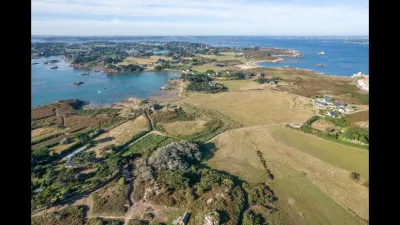
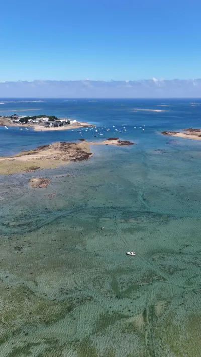
L'Île-de-Bréhat is a French commune located in the Côtes-d'Armor department, north of the Pointe de l'Arcouest in Brittany. It is made up of the Bréhat archipelago, excluding Île Maudez. It takes its name from the main island, called Bréhat, whose Breton name is Enez Vriad. L'Île-de-Bréhat belongs to the historic region of Goëlo. The commune is part of the canton of Paimpol (arrondissement of Saint-Brieuc). As it is an island, it can only be reached by boat and all travel on the island is on foot; allow a good 3 hours to walk around it. The boat leaves from L'Arcouest, which is the nearest embarkation quay and the only one operating all year round. It is located in the commune of Ploubazlanec. The companies "Sur Mer Bréhat" (April to September) and "Les vedettes de Bréhat" (year-round service) provide access to the island by a shuttle that crosses the Ferlas channel in about ten minutes all year round, from L'Arcouest to Port Clos (on the south coast of the island, facing the mainland). Allow 10 euros round trip per person.
Map and restricted areas
Open in the main mapNearby aerodromes
Open aerodromes within 25 km of the spot, heliports included, with their distance and direction from the spot. Near an aerodrome, drone flying is prohibited or height-limited: check the UAS zones map.
| Aerodrome | Type | Distance | Elevation | Difference |
|---|---|---|---|---|
| Base ULM de Kerfot | Aerodrome | 15 km S | 99 m | spot 97 m lower |
Aviation weather (METAR and TAF)
LFRO – Lannion-Côte de Granit Airport VFR
METAR
METAR LFRO 210700Z AUTO 14007KT CAVOK 05/05 Q1015
- Wind
- 140°, 13 km/h
- Visibility
- 10 km or more
- Clouds
- –
- Temperature
- 5 °C, dew point 5 °C
- QNH
- 1015 hPa
- Flight category
- VFR: ceiling > 3,000 ft and visibility > 5 mi
TAF
Weather and Kp index
Sunrise and sunset
| Day | Dawn | Sunrise | Golden hour | Sunset | Dusk | Day length |
|---|---|---|---|---|---|---|
| Sat 21 Nov | 07:55 | 08:30 | 08:30–09:21 · 16:35–17:26 | 17:26 | 18:01 | 8 h 55 |
| Sun 22 Nov | 07:56 | 08:32 | 08:32–09:23 · 16:33–17:25 | 17:25 | 18:00 | 8 h 52 |
| Mon 23 Nov | 07:58 | 08:33 | 08:33–09:25 · 16:32–17:24 | 17:24 | 17:59 | 8 h 50 |
| Tue 24 Nov | 07:59 | 08:35 | 08:35–09:26 · 16:31–17:23 | 17:23 | 17:58 | 8 h 48 |
| Wed 25 Nov | 08:00 | 08:36 | 08:36–09:28 · 16:30–17:22 | 17:22 | 17:58 | 8 h 46 |
| Thu 26 Nov | 08:02 | 08:37 | 08:37–09:30 · 16:29–17:21 | 17:21 | 17:57 | 8 h 43 |
| Fri 27 Nov | 08:03 | 08:39 | 08:39–09:31 · 16:28–17:21 | 17:21 | 17:56 | 8 h 41 |




Reviews
Log in to review this spot. Log in · Create a free account
No reviews yet. Share yours!