

Belvédère du Revard

1 pilot review
“Salut, j'aime tes réalisations, je te suis . Avec ton code on ne te trouve pas sur! . Le b…” — jypai83, 3 years ago
Read the reviews + Write my reviewDescription
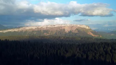
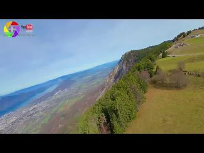
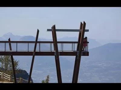
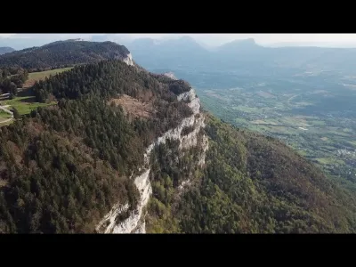
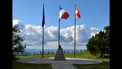
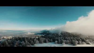
The Belvédère du Revard is one of the most visited sites in Savoie. There are several good reasons for this: the site is easily accessible all year round, winter and summer, by car or by bus; it is completely free (except the panoramic restaurant, of course); and it is a naturally beautiful site offering an exceptional 360° panorama of the surrounding mountains, as well as of Lac du Bourget and the towns of Aix-les-Bains and Chambéry. Since 2013, three walkways installed above the void have offered thrills in addition to the panorama opening onto four successive valleys and Lac du Bourget spreading out in the foreground. One of the platforms has a glass floor, giving the impression of walking on thin air. Note that the parking lot is very small. On beautiful summer days, it is often full. The glass walkway is closed in winter. A glass orientation table lets you identify the Alpine peaks in 360°. There is a restaurant on site, also with a terrace offering panoramic views. Enjoy the facilities of the Revard resort in every season with many outdoor activities: sledding, dog sledding, biathlon, mountain biking and fat biking, paragliding or hiking. From the Belvédère du Revard, set off on a hike of about 1 hour on a trail toward the Jardin d'altitude and the Golet de la Pierre. It is a lovely walk suitable for families through the forest (watch out for roots...) with superb viewpoints to take in the Alpine landscapes.
Map and restricted areas
Open in the main mapNearby aerodromes
Open aerodromes within 25 km of the spot, heliports included, with their distance and direction from the spot. Near an aerodrome, drone flying is prohibited or height-limited: check the UAS zones map.
| Aerodrome | Type | Distance | Elevation | Difference |
|---|---|---|---|---|
| Hôtel Ariana Heliport | Heliport | 5.2 km W | 247 m | spot 1,289 m higher |
| Chambéry-Savoie Airport | Airport | 8.8 km SW | 237 m | spot 1,299 m higher |
| Aérodrome de Chambéry Challes-les-Eaux | Aerodrome | 13 km S | 297 m | spot 1,239 m higher |
| La Fullie | Heliport | 14 km E | 1,394 m | spot 142 m higher |
| Centre Hospitalier Heliport | Heliport | 14 km S | 319 m | spot 1,217 m higher |
Aviation weather (METAR and TAF)
LFLB – Chambéry-Savoie Airport VFR
METAR
METAR LFLB 210630Z AUTO 22004KT 180V260 9999 FEW048 OVC056 09/08 Q1020 NOSIG
- Wind
- 220°, 7 km/h
- Visibility
- 10 km or more
- Clouds
- Few (1-2/8) at 4,800 ft (1460 m) ; Overcast (8/8) at 5,600 ft (1710 m)
- Temperature
- 9 °C, dew point 8 °C
- QNH
- 1020 hPa
- Flight category
- VFR: ceiling > 3,000 ft and visibility > 5 mi
TAF
TAF LFLB 210200Z 2103/2203 17008KT 9999 BKN050 PROB40 TEMPO 2103/2106 4000 -SHRA SCT040TCU BKN050 TEMPO 2200/2203 4000 RA
| Period (local time) | Change | Wind | Visibility | Weather | Clouds |
|---|---|---|---|---|---|
| 21/11 04:00 → 22/11 04:00 | Initial conditions | 170°, 15 km/h | 10 km or more | Broken (5-7/8) at 5,000 ft (1520 m) | |
| 21/11 04:00 → 21/11 07:00 | Temporarily, probability 40% | 4.0 km | Showers of rain light | Scattered (3-4/8) at 4,000 ft (1220 m) (towering cumulus) ; Broken (5-7/8) at 5,000 ft (1520 m) | |
| 22/11 01:00 → 22/11 04:00 | Temporarily | 4.0 km | Rain |
Weather and Kp index
Sunrise and sunset
| Day | Dawn | Sunrise | Golden hour | Sunset | Dusk | Day length |
|---|---|---|---|---|---|---|
| Sat 21 Nov | 07:11 | 07:44 | 07:44–08:30 · 16:14–17:00 | 17:00 | 17:33 | 9 h 16 |
| Sun 22 Nov | 07:12 | 07:45 | 07:45–08:32 · 16:13–16:59 | 16:59 | 17:32 | 9 h 14 |
| Mon 23 Nov | 07:14 | 07:46 | 07:46–08:33 · 16:12–16:59 | 16:59 | 17:31 | 9 h 12 |
| Tue 24 Nov | 07:15 | 07:48 | 07:48–08:35 · 16:11–16:58 | 16:58 | 17:31 | 9 h 10 |
| Wed 25 Nov | 07:16 | 07:49 | 07:49–08:36 · 16:10–16:57 | 16:57 | 17:30 | 9 h 08 |
| Thu 26 Nov | 07:17 | 07:50 | 07:50–08:38 · 16:09–16:57 | 16:57 | 17:30 | 9 h 06 |
| Fri 27 Nov | 07:18 | 07:51 | 07:51–08:39 · 16:08–16:56 | 16:56 | 17:29 | 9 h 04 |
Reviews
Log in to review this spot. Log in · Create a free account
jypai83
Salut, j'aime tes réalisations, je te suis . Avec ton code on ne te trouve pas sur! . Le bonjour du var