

Lake Rousson
No reviews yet
Have you flown here? Share your experience with other pilots.
+ Write the first reviewDescription
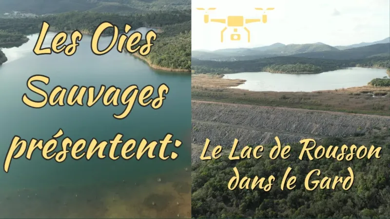
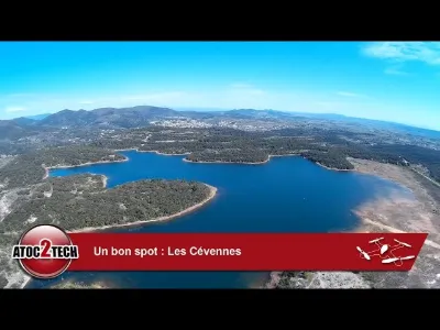
A relic of an industrial past Located in the north-east of the commune, not far from its border with Les Mages, the Ségoussac lake, set on an area of 70 hectares in total, is nothing other than a relic of the local industrial past.
Indeed, the "Péchiney" plant in the commune of Salindres, later renamed "Rio Tinto", was one of the largest alumina producers from 1908 to 1984. The "red muds", residues from extracting alumina through the chemical treatment of bauxite, were first stored in basins built inside the plant's perimeter.
But from 1964 until production stopped in 1984, 3,900,000 tonnes of toxic waste were dumped on this site, and a dam was built in several stages, from 1964 to 1977, as the muds piled up. Successful rehabilitation In 1986, the DRIRE (Direction régionale de l'Industrie, de la Recherche et de l'Environnement) called for the site to be rehabilitated. Rehabilitation work began in 1991 with the complete draining of the basin and treatment of the water, followed by natural filling with rainwater and springs, covering the muds with a thick layer of limestone, and replanting vegetation. Since 2015, a treatment station has been processing the water collected in a small basin located downstream of the dam. The site's ecosystem is gradually rebuilding today, thanks to the continued respectful use of the site, which is open for walking. In and around the lake, wildlife and plants have returned. The reed beds and poplars shelter scalloped (dentate) Magicicada-like insects known as "magiciennes dentelées" (Saga pedo-type bush-crickets), great crested grebes, little egrets and grey herons, while black kites hunt perch… The site is still monitored, and the water quality is regularly checked and analysed. If the transformation of the place continues while respecting natural balances, perhaps in a few decades we could allow ourselves to dream of setting up a large outdoor leisure site open to all?
In the meantime, feel free to walk the peaceful trail that goes around the lake, offering unusual landscapes linked to the history of the place.
Map and restricted areas
Open in the main mapNearby aerodromes
Open aerodromes within 25 km of the spot, heliports included, with their distance and direction from the spot. Near an aerodrome, drone flying is prohibited or height-limited: check the UAS zones map.
| Aerodrome | Type | Distance | Elevation | Difference |
|---|---|---|---|---|
| La Grand'combe Airfield | Aerodrome | 13 km W | 502 m | spot 237 m lower |
| Aérodrome d'Alès Cévennes | Airport | 15 km S | 204 m | spot 61 m higher |
| Uzès Airfield | Aerodrome | 23 km SE | 270 m | spot 5 m lower |
Aviation weather (METAR and TAF)
No METAR station within 50 km.
Weather and Kp index
Sunrise and sunset
| Day | Dawn | Sunrise | Golden hour | Sunset | Dusk | Day length |
|---|---|---|---|---|---|---|
| Sat 21 Nov | 07:15 | 07:47 | 07:47–08:31 · 16:27–17:12 | 17:12 | 17:43 | 9 h 25 |
| Sun 22 Nov | 07:16 | 07:48 | 07:48–08:33 · 16:26–17:11 | 17:11 | 17:43 | 9 h 23 |
| Mon 23 Nov | 07:17 | 07:49 | 07:49–08:34 · 16:25–17:10 | 17:10 | 17:42 | 9 h 21 |
| Tue 24 Nov | 07:18 | 07:50 | 07:50–08:36 · 16:24–17:10 | 17:10 | 17:42 | 9 h 19 |
| Wed 25 Nov | 07:20 | 07:52 | 07:52–08:37 · 16:24–17:09 | 17:09 | 17:41 | 9 h 17 |
| Thu 26 Nov | 07:21 | 07:53 | 07:53–08:38 · 16:23–17:08 | 17:08 | 17:40 | 9 h 15 |
| Fri 27 Nov | 07:22 | 07:54 | 07:54–08:40 · 16:22–17:08 | 17:08 | 17:40 | 9 h 13 |
Reviews
Log in to review this spot. Log in · Create a free account
No reviews yet. Share yours!