

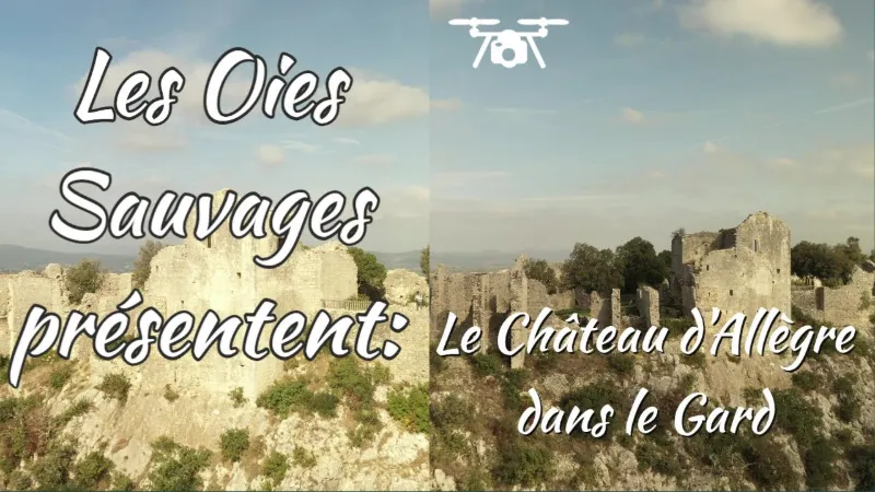
Le Château d' Allègre
No reviews yet
Have you flown here? Share your experience with other pilots.
+ Write the first reviewDescription
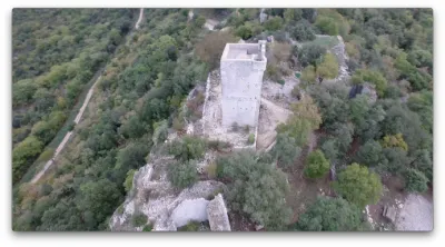
The Château d'Allègre is a castle located in the commune of Allègre-les-Fumades in the department of Gard. History The first mention of the castrum de Alegrio dates from 1163, when Bernard de Ferreyroles paid homage to Bernard Pelet, baron of Alès.
In 1211, a parchment of Philippe Auguste indicates that the castrum de Allegrio diocesis Uticensis belonged to several noble families who shared the domain of Allègre under the suzerainty of the Bishop of Uzès.
In 1313, Guillaume de Randon, the dominant lord of the castrum, received the homage of the eight co-lords: Jaussin de Naves, Pierre Jourdan, Pierre Guilhem Bérard, Raymond de Guilhefred, Guerin and Raymond d'Allègre, Raymond de Cadoine and Bernard del Puech.
In 1314, the main share of the lordship passed from Guillaume de Randon to the Budos family, who kept it until the family died out at the end of the 17th century. The family estate then passed to the Prince of Conti, a descendant of Henriette de Budos, Duchess of Montmorency. In 1780, what remained of the Allègre estate was sold to Jacques-Marcellin-Denis de Bérard, Viscount of Montalet.
The monument has been listed as a historic monument since July 25, 1997.
Description
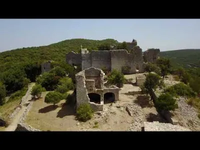
Its elevated position and unobstructed panorama make it a key point for observing and controlling the region. The complexity of the lordship's history remains inscribed in the layout of the site. The division among the co-lords led them to assert their authority by building residential buildings separate from one another. Six different ones can still be counted, each with its own tower and hall, overlooked by the main residence, at the edge of the cliff. The whole formed a sort of "village of knights".
The various co-lords, who owned other residences, gradually stopped living there. Tenant farmers were installed to work the land. By the 17th century, the whole site had long since fallen into ruin.
Map and restricted areas
Open in the main mapNearby aerodromes
Open aerodromes within 25 km of the spot, heliports included, with their distance and direction from the spot. Near an aerodrome, drone flying is prohibited or height-limited: check the UAS zones map.
| Aerodrome | Type | Distance | Elevation | Difference |
|---|---|---|---|---|
| Uzès Airfield | Aerodrome | 16 km SE | 270 m | same altitude as the spot |
| Aérodrome d'Alès Cévennes | Airport | 17 km SW | 204 m | spot 63 m higher |
| La Grand'combe Airfield | Aerodrome | 21 km W | 502 m | spot 235 m lower |
Aviation weather (METAR and TAF)
LFMO – Orange-Caritat (BA 115) Air Base VFR
METAR
METAR LFMO 210630Z AUTO 36004KT 320V020 CAVOK 04/04 Q1020 NOSIG
- Wind
- 360°, 7 km/h
- Visibility
- 10 km or more
- Clouds
- –
- Temperature
- 4 °C, dew point 4 °C
- QNH
- 1020 hPa
- Flight category
- VFR: ceiling > 3,000 ft and visibility > 5 mi
TAF
TAF LFMO 210200Z 2103/2203 32003KT CAVOK TX16/2115Z TN05/2105Z PROB30 TEMPO 2122/2203 4000 -RA BECMG 2201/2203 13015G25KT
| Period (local time) | Change | Wind | Visibility | Weather | Clouds |
|---|---|---|---|---|---|
| 21/11 04:00 → 22/11 02:00 | Initial conditions | 320°, 6 km/h | 10 km or more | No significant cloud | |
| 21/11 23:00 → 22/11 04:00 | Temporarily, probability 30% | 4.0 km | Rain light | ||
| 22/11 02:00 → 22/11 04:00 | Becoming | 130°, 28 km/h, gusts 46 km/h | 10 km or more | No significant cloud |
Weather and Kp index
Sunrise and sunset
| Day | Dawn | Sunrise | Golden hour | Sunset | Dusk | Day length |
|---|---|---|---|---|---|---|
| Sat 21 Nov | 07:15 | 07:46 | 07:46–08:31 · 16:27–17:11 | 17:11 | 17:43 | 9 h 25 |
| Sun 22 Nov | 07:16 | 07:47 | 07:47–08:32 · 16:26–17:11 | 17:11 | 17:42 | 9 h 23 |
| Mon 23 Nov | 07:17 | 07:49 | 07:49–08:34 · 16:25–17:10 | 17:10 | 17:42 | 9 h 21 |
| Tue 24 Nov | 07:18 | 07:50 | 07:50–08:35 · 16:24–17:09 | 17:09 | 17:41 | 9 h 19 |
| Wed 25 Nov | 07:19 | 07:51 | 07:51–08:37 · 16:23–17:09 | 17:09 | 17:41 | 9 h 17 |
| Thu 26 Nov | 07:20 | 07:52 | 07:52–08:38 · 16:22–17:08 | 17:08 | 17:40 | 9 h 15 |
| Fri 27 Nov | 07:21 | 07:54 | 07:54–08:39 · 16:22–17:08 | 17:08 | 17:40 | 9 h 13 |

Reviews
Log in to review this spot. Log in · Create a free account
No reviews yet. Share yours!