

Lake Saint-Cassien
No reviews yet
Have you flown here? Share your experience with other pilots.
+ Write the first reviewDescription
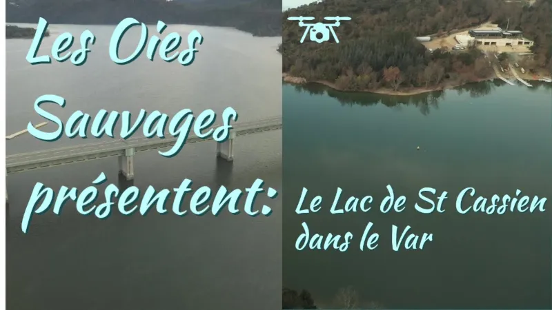
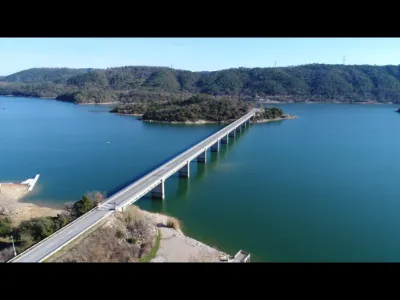
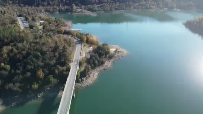
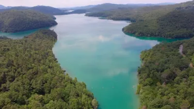
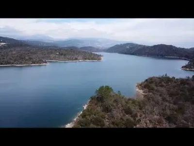
Lake Saint-Cassien and its cool waters are among the most popular spots for locals and tourists in the Pays de Fayence. The Saint-Cassien dam on the Biançon river, a tributary of the Siagne, was built in 1966. It has a dual purpose: it produces electricity and supplies water to certain towns in the Var and the west of the Alpes-Maritimes. It also helps control floods to prevent flooding. Today, Lake Saint-Cassien has become a popular leisure area. BEACHES AND ACTIVITIES On this 420-hectare body of water, many water activities are available to vacationers. On the beach, children can swim safely while parents enjoy the sun to work on their tan and relax.
Whether with family or friends, fun is guaranteed on the floating inflatable obstacle course on Lake Saint-Cassien.
To explore the lake at your own pace, nothing beats a kayak or canoe trip. In just a few paddle strokes, vacationers find themselves in the middle of this crystal-clear lake, immersed in the surrounding nature. The calm waters of Saint-Cassien are ideal for trying the latest trendy sport: stand-up paddleboarding.
For a fun time with family or friends, just rent a pedal boat and set off to explore the small coves dotted along the lake's shores.
Lake Saint-Cassien is a favorite site for anglers fishing for predators and carp. Various practices, such as float-tubing or recreational fishing for bleak, are allowed on the site.
Why not discover Lake Saint-Cassien in an original way by going horseback riding? Several riding centers located near the lake offer rides suitable for beginners and experienced riders alike. This unforgettable experience in the heart of nature will leave you with an unforgettable memory of your vacation in the south of France.
The nature around Lake Saint-Cassien remains fragile. The eastern part is protected by the Fondurane biological reserve, managed by the Conservatoire d'espaces naturels de Provence Alpes Côte d'Azur. 182 bird species have found refuge in this natural habitat. The wildlife and plants there are varied: European pond turtle, red-rumped swallow, Algerian oak, Turkey oak, and more. An observation point has been built so that young and old can spot the different animals living in the reserve.
Map and restricted areas
Open in the main mapNearby aerodromes
Open aerodromes within 25 km of the spot, heliports included, with their distance and direction from the spot. Near an aerodrome, drone flying is prohibited or height-limited: check the UAS zones map.
| Aerodrome | Type | Distance | Elevation | Difference |
|---|---|---|---|---|
| Fayence Glider Field | Aerodrome | 8.8 km W | 226 m | spot 70 m lower |
| Hôpital Clavary Heliport | Heliport | 11 km E | 168 m | spot 12 m lower |
| Cannes-Mandelieu Airport | Airport | 13 km E | 4 m | spot 152 m higher |
| Hôpital Bonnet Heliport | Heliport | 17 km S | 21 m | spot 135 m higher |
| Quai Du Large Heliport | Heliport | 18 km E | 3 m | spot 153 m higher |
Aviation weather (METAR and TAF)
LFMD – Cannes-Mandelieu Airport VFR
METAR
METAR LFMD 210630Z AUTO VRB02KT CAVOK 09/05 Q1015 NOSIG
- Wind
- Variable, 4 km/h
- Visibility
- 10 km or more
- Clouds
- –
- Temperature
- 9 °C, dew point 5 °C
- QNH
- 1015 hPa
- Flight category
- VFR: ceiling > 3,000 ft and visibility > 5 mi
TAF
TAF AMD LFMD 210526Z 2105/2203 25010KT CAVOK TEMPO 2105/2109 VRB05KT TEMPO 2110/2116 26015G25KT BECMG 2117/2119 VRB04KT TEMPO 2200/2203 RA BKN020
| Period (local time) | Change | Wind | Visibility | Weather | Clouds |
|---|---|---|---|---|---|
| 21/11 06:00 → 21/11 18:00 | Initial conditions | 250°, 19 km/h | 10 km or more | No significant weather | No significant cloud |
| 21/11 06:00 → 21/11 10:00 | Temporarily | Variable, 9 km/h | |||
| 21/11 11:00 → 21/11 17:00 | Temporarily | 260°, 28 km/h, gusts 46 km/h | |||
| 21/11 18:00 → 22/11 04:00 | Becoming | Variable, 7 km/h | 10 km or more | No significant weather | No significant cloud |
| 22/11 01:00 → 22/11 04:00 | Temporarily | Rain | Broken (5-7/8) at 2,000 ft (610 m) |
Weather and Kp index
Sunrise and sunset
| Day | Dawn | Sunrise | Golden hour | Sunset | Dusk | Day length |
|---|---|---|---|---|---|---|
| Sat 21 Nov | 07:03 | 07:34 | 07:34–08:18 · 16:19–17:03 | 17:03 | 17:34 | 9 h 28 |
| Sun 22 Nov | 07:04 | 07:36 | 07:36–08:20 · 16:18–17:02 | 17:02 | 17:34 | 9 h 26 |
| Mon 23 Nov | 07:05 | 07:37 | 07:37–08:21 · 16:17–17:02 | 17:02 | 17:33 | 9 h 24 |
| Tue 24 Nov | 07:06 | 07:38 | 07:38–08:23 · 16:16–17:01 | 17:01 | 17:32 | 9 h 23 |
| Wed 25 Nov | 07:08 | 07:39 | 07:39–08:24 · 16:16–17:00 | 17:00 | 17:32 | 9 h 21 |
| Thu 26 Nov | 07:09 | 07:40 | 07:40–08:25 · 16:15–17:00 | 17:00 | 17:31 | 9 h 19 |
| Fri 27 Nov | 07:10 | 07:42 | 07:42–08:27 · 16:14–16:59 | 16:59 | 17:31 | 9 h 17 |


Reviews
Log in to review this spot. Log in · Create a free account
No reviews yet. Share yours!