

La Saulce, the watchtower
No reviews yet
Have you flown here? Share your experience with other pilots.
+ Write the first reviewDescription
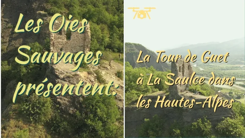
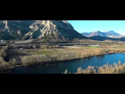
The La Saulce watchtower: centuries of history and even a miracle! We all know the town of La Saulce for its economic side, with its large business park, or for its fruit-growing sector thanks to the rich Durance plain.
But its historical side is less well known. That is what we wanted to discover in partnership with the municipality, and as you will see, from the La Saulce watchtower you can take in centuries of history and even a miracle!
Several moments of history were indeed written in La Saulce, as this watchtower first shows, a beacon now lit up every night above the town, exactly where the original village stood before the inhabitants moved down to the valley as the famous Durance floods were gradually brought under control.
Thus, La Saulce, as a gateway to the Alps, was the setting for important events, such as the famous "battle of Les Piles" between Bonapartists and Royalists in 1815.
Even less well known, the village was the site of one of the apparitions of Benoîte Rancurel, the young shepherdess at the origin of the sanctuary of Notre-Dame du Laus, on 11 August 1692, allowing her to flee just as the Savoyard hordes were sowing chaos throughout the department.
Map and restricted areas
Open in the main mapNearby aerodromes
Open aerodromes within 25 km of the spot, heliports included, with their distance and direction from the spot. Near an aerodrome, drone flying is prohibited or height-limited: check the UAS zones map.
| Aerodrome | Type | Distance | Elevation | Difference |
|---|---|---|---|---|
| Gap - Tallard Airfield | Aerodrome | 3.7 km NE | 605 m | spot 87 m higher |
| La Motte du Caire Glider Field | Aerodrome | 12 km S | 650 m | spot 43 m higher |
| Hôpital Heliport | Heliport | 15 km N | 759 m | spot 66 m lower |
| Aérodrome de Sistéron-Vaumeilh | Aerodrome | 17 km S | 540 m | spot 153 m higher |
| Serres - La Bâtie-Montsaléon Airfield | Aerodrome | 23 km W | 715 m | spot 22 m lower |
Aviation weather (METAR and TAF)
No METAR station within 50 km.
Weather and Kp index
Sunrise and sunset
| Day | Dawn | Sunrise | Golden hour | Sunset | Dusk | Day length |
|---|---|---|---|---|---|---|
| Sat 21 Nov | 07:08 | 07:40 | 07:40–08:25 · 16:19–17:04 | 17:04 | 17:36 | 9 h 23 |
| Sun 22 Nov | 07:09 | 07:41 | 07:41–08:26 · 16:18–17:03 | 17:03 | 17:35 | 9 h 21 |
| Mon 23 Nov | 07:10 | 07:42 | 07:42–08:28 · 16:17–17:02 | 17:02 | 17:34 | 9 h 19 |
| Tue 24 Nov | 07:12 | 07:44 | 07:44–08:29 · 16:16–17:02 | 17:02 | 17:34 | 9 h 17 |
| Wed 25 Nov | 07:13 | 07:45 | 07:45–08:31 · 16:15–17:01 | 17:01 | 17:33 | 9 h 16 |
| Thu 26 Nov | 07:14 | 07:46 | 07:46–08:32 · 16:14–17:00 | 17:00 | 17:33 | 9 h 14 |
| Fri 27 Nov | 07:15 | 07:47 | 07:47–08:33 · 16:14–17:00 | 17:00 | 17:32 | 9 h 12 |



Reviews
Log in to review this spot. Log in · Create a free account
No reviews yet. Share yours!