

Pointe de Plouézec
No reviews yet
Have you flown here? Share your experience with other pilots.
+ Write the first reviewDescription
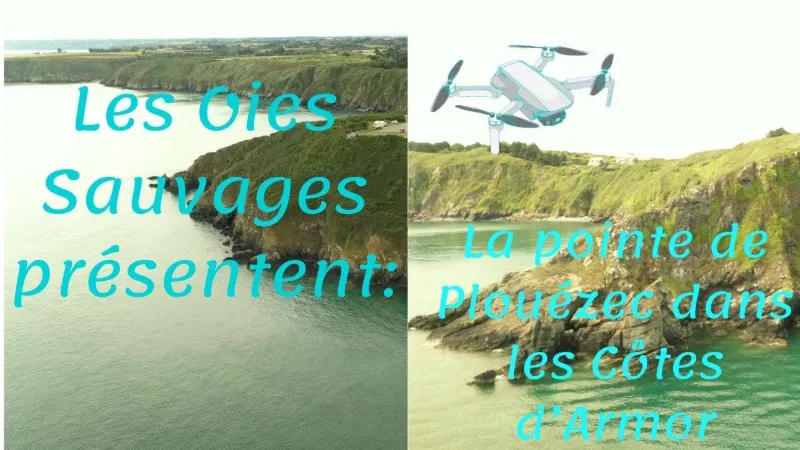
The Pointe de Plouézec, or Pointe de Bilfot From its highest point, sixty meters above sea level, the Pointe de Plouézec offers you two faces, depending on whether the tide is low or high. Is that why it has two names?
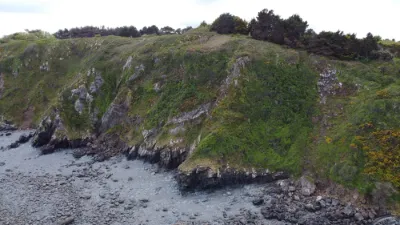
Pointe de Plouézec and Pointe de Bilfot are indeed the two names found on maps and postcards. This headland is the result of very ancient volcanic eruptions, with magma from the bowels of the earth that became covered in low vegetation over the millennia. When people settled in the area, it served for several centuries as pasture for their meager livestock. The slow rise of the sea has permanently cut off its last rocks, which have now become true islands.
Pointe de Plouezec At low tide, the Pointe de Bilfot reveals the remains of old maritime farms bordering a first rock, the Petit Taurel. Here and around the islets of Mez Goëlo, flat oyster farming concessions were reserved for sailors' widows and disabled former sailors. The spat was "sown" directly on the ground covered by the tide, then harvested after three or four years. To retrieve the oysters, which buried themselves in the sand to protect themselves, the seabed had to be raked with hooks and rakes. This farming gradually disappeared from 1981, the year a virus began to decimate the beds of these wild shellfish. It has since been replaced by the farming of Pacific oysters in the Port Lazo roadstead, which opens onto the Bay of Paimpol.
Farther out looms the Grand Taurel, and farther still the rocky plateau of the Grand Mez de Goëlo, on which the Hospic beacon was built, giving it the look of a small lighthouse. A little further west lies the island of Lemenez, also called Goat Island, which has become isolated in the sea. Only a few centuries ago, these rocks were still accessible at low tide, and the famous "sheep of Plouézec" were put out to graze there.
Pointe de Plouezec These little islands seem within arm's reach, and if you are fit enough, they are actually within fin's reach. The currents there can sometimes be strong, however, when the tide rises or falls.
Little green paradises, highlighted from May onward by the yellow of the broom bushes, these rocks are a refuge for many birds that settle there in large flocks from spring.
They are also a haven for crustaceans, and it is not unusual to see a crab or lobster scuttling along under a few centimeters of water, hurrying to find shelter before the rock is completely exposed.
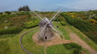
This special spot can surprise you depending on the height of the sea: it looks desert-like and arid when the tide goes out, and when it comes back in, only the gentle cliffs remain visible, as if the rocks had disappeared. Whether you continue your walk to the east or to the west, the hiking trail that runs along it offers landscapes at every turn dotted with the blue of the sea and the lush vegetation lining it.
To the east, it will take you to the Pointe de Minard; to the west, it runs along the vast beach of Port Lazo.
Map and restricted areas
Open in the main mapNearby aerodromes
Open aerodromes within 25 km of the spot, heliports included, with their distance and direction from the spot. Near an aerodrome, drone flying is prohibited or height-limited: check the UAS zones map.
| Aerodrome | Type | Distance | Elevation | Difference |
|---|---|---|---|---|
| Base ULM de Kerfot | Aerodrome | 7.8 km SW | 99 m | spot 99 m lower |
Aviation weather (METAR and TAF)
LFRT – Saint-Brieuc-Armor Airport LIFR
METAR
METAR LFRT 211130Z AUTO 14005KT 090V200 9999 OVC003 11/10 Q1014
- Wind
- 140°, 9 km/h
- Visibility
- 10 km or more
- Clouds
- Overcast (8/8) at 300 ft (90 m)
- Temperature
- 11 °C, dew point 10 °C
- QNH
- 1014 hPa
- Flight category
- LIFR: ceiling < 500 ft or visibility < 1 mi
TAF
Weather and Kp index
| Day | Weather | Temp. min. / max. | Wind | Rain | Max Kp |
|---|---|---|---|---|---|
| Sat 21 Nov | Cloudy | 11° / 12° | 33 km/h SE | 3.7 mm | 2 |
| Sun 22 Nov | Rain | 11° / 12° | 49 km/h W | 9.3 mm | 2 |
| Mon 23 Nov | Partly cloudy | 8° / 13° | 36 km/h W | 0.8 mm | 4 |
| Tue 24 Nov | Partly cloudy | 8° / 11° | 23 km/h SE | 0.6 mm | 2 |
| Wed 25 Nov | Light rain | 7° / 9° | 20 km/h NE | 3.2 mm | – |
| Thu 26 Nov | Clear sky | 4° / 7° | 19 km/h NE | – | – |
| Fri 27 Nov | Cloudy | -0° / 6° | 23 km/h SE | 1.3 mm | – |
Hour by hour: Saturday 21 November
| Time | Weather | Temp. | Wind | Rain | Clouds | Kp |
|---|---|---|---|---|---|---|
| 12:00 | Cloudy | 11° | 19 km/h SE | – | 100 % | 2 |
| 13:00 | Cloudy | 11° | 21 km/h SE | – | 100 % | 1 |
| 14:00 | Cloudy | 12° | 23 km/h SE | – | 100 % | 1 |
| 15:00 | Cloudy | 12° | 25 km/h SE | – | 100 % | 1 |
| 16:00 | Partly cloudy | 12° | 28 km/h SE | – | 77 % | 2 |
| 17:00 | Partly cloudy | 12° | 27 km/h SE | – | 72 % | 2 |
| 18:00 | Cloudy | 11° | 31 km/h SE | – | 99 % | 2 |
| 19:00 | Cloudy | 11° | 32 km/h SE | – | 100 % | 2 |
| 20:00 | Cloudy | 11° | 32 km/h SE | – | 100 % | 2 |
| 21:00 | Rain | 11° | 33 km/h SE | 0.7 mm | 100 % | 2 |
| 22:00 | Heavy rain | 11° | 33 km/h SE | 2.3 mm | 100 % | 2 |
Hour by hour: Sunday 22 November
| Time | Weather | Temp. | Wind | Rain | Clouds | Kp |
|---|---|---|---|---|---|---|
| 06:00 | Rain | 11° | 15 km/h SW | 0.7 mm | 100 % | 2 |
| 07:00 | Cloudy | 11° | 20 km/h SW | – | 100 % | 2 |
| 08:00 | Light rain | 11° | 24 km/h W | 0.2 mm | 100 % | 2 |
| 09:00 | Rain | 11° | 31 km/h W | 0.5 mm | 100 % | 2 |
| 10:00 | Heavy rain | 11° | 33 km/h W | 1.0 mm | 100 % | 2 |
| 11:00 | Rain | 11° | 36 km/h W | 0.6 mm | 100 % | 2 |
| 12:00 | Rain | 11° | 37 km/h W | 0.8 mm | 100 % | 2 |
| 13:00 | Rain | 11° | 39 km/h W | 0.4 mm | 100 % | 2 |
| 14:00 | Cloudy | 11° | 41 km/h W | – | 100 % | 2 |
| 15:00 | Cloudy | 12° | 49 km/h W | – | 100 % | 2 |
| 16:00 | Cloudy | 12° | 45 km/h W | – | 100 % | 2 |
| 17:00 | Cloudy | 12° | 45 km/h W | – | 100 % | 2 |
| 18:00 | Cloudy | 11° | 43 km/h W | – | 100 % | 2 |
| 19:00 | Cloudy | 11° | 45 km/h W | – | 100 % | 2 |
| 20:00 | Cloudy | 11° | 44 km/h W | – | 100 % | 2 |
| 21:00 | Cloudy | 11° | 40 km/h W | – | 99 % | 2 |
| 22:00 | Cloudy | 11° | 37 km/h W | – | 91 % | 2 |
Sunrise and sunset
| Day | Dawn | Sunrise | Golden hour | Sunset | Dusk | Day length |
|---|---|---|---|---|---|---|
| Sat 21 Nov | 07:55 | 08:30 | 08:30–09:20 · 16:35–17:26 | 17:26 | 18:01 | 8 h 55 |
| Sun 22 Nov | 07:56 | 08:31 | 08:31–09:22 · 16:34–17:25 | 17:25 | 18:00 | 8 h 53 |
| Mon 23 Nov | 07:57 | 08:33 | 08:33–09:24 · 16:33–17:24 | 17:24 | 17:59 | 8 h 51 |
| Tue 24 Nov | 07:59 | 08:34 | 08:34–09:26 · 16:31–17:23 | 17:23 | 17:58 | 8 h 48 |
| Wed 25 Nov | 08:00 | 08:35 | 08:35–09:27 · 16:30–17:22 | 17:22 | 17:58 | 8 h 46 |
| Thu 26 Nov | 08:01 | 08:37 | 08:37–09:29 · 16:29–17:21 | 17:21 | 17:57 | 8 h 44 |
| Fri 27 Nov | 08:03 | 08:38 | 08:38–09:30 · 16:28–17:21 | 17:21 | 17:56 | 8 h 42 |



Reviews
Log in to review this spot. Log in · Create a free account
No reviews yet. Share yours!