

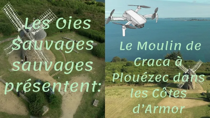
The Craca Mill in Plouézec.
No reviews yet
Have you flown here? Share your experience with other pilots.
+ Write the first reviewDescription
Located 80 meters from the sea and at an altitude of 65 meters, it served as a landmark for navigation in the bay of Paimpol and its approaches, which earned it a place in the contest organized by "Ouest-France" and "Chasse-Marée" dedicated to the heritage of the coasts and rivers of France.
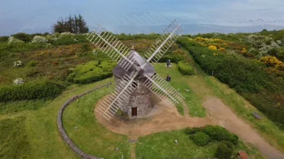
For greater flexibility and lightness (the frame rotates 360° to turn the sails into the wind for maximum power), it is covered with about 5,000 chestnut shingles, which, with the sea air and the few years that have passed, now look like slate.
On 18 June 1999 the first handful of flour came out of the millstones. All that remained was to separate the flour from the bran and the middlings; the sifter was installed in 2001 for this purpose.
On 28 May 2007 a north wind gust caused the sails to fall, and they were not replaced until March 2008.
Standing 11 meters high with a maximum diameter of 5.75 meters, the Craca mill is a small-footed mill with a flat corbelled base, typical of the Trégor region.
The new sails have a span of 16.50 meters and a width of 2.65 meters. The millstones have a diameter of one toise, or 1.95 meters, and each weighs about 1.5 tonnes. The movable assembly of frame, roof, sails and internal mechanism weighs about 13 tonnes and is moved by means of the lever formed by the tail of the mill, or guivre, with the roof. The sails drive the rotation of the millstones through the great wheel and the lantern pinion, which multiply the number of revolutions by six.
Les Amis du moulin de Craca (a volunteer association created in 1998 for the day-to-day management of the mill) organize guided tours of the mill. Two free guided tours every Wednesday and Sunday at 5:00 pm and 6:00 pm, from 16 June 2019 until 22 September. During the same period, grinding sessions (the mill actually operating after the cloths are fitted on the sails) are held on several occasions that vary from year to year. During these grinding sessions the mill is open from 3:00 pm to 6:30 pm with free guided tours.
Built in 1844, the Craca mill was then one of the 12 mills in the commune of Plouézec (one mill for about 300 inhabitants). The last miller, Pierre le Cozannet, left it in 1928 and the building gradually deteriorated until 1993, when the commune of Plouézec bought the ruin.
The restoration begun in 1995 by Jean Peillet, a millwright in Etables-sur-mer, continued until 1999.
The first step was to restore the shape and solidity of the tower and give it a roof.
After the sails were fitted in spring 1996, the ribbon was cut on 16 June in the presence of, among others, Mrs Crenn, who initiated the renovation project, and Mr Raymond Charles, mayor of Plouézec. The sails were clothed in 1997 and the first turn of the sails took place on 30 May, but it was not until 1999 that the mill fulfilled its primary function: grinding grain. To get there, a second phase of work was undertaken, which consisted of making it easier to turn the roof, and therefore the sails, as well as reconditioning the millstones dating from 1844.
In 1848, 103 tonnes of grain were ground by its millstones, as indicated by a statistical document from France-Industrie. Of this total, 34 tonnes were wheat and 10 were buckwheat, the rest being rye, barley, oats and maslin (rye and wheat mixed from sowing). At that time the miller was assisted by 2 workers who received a daily wage of one franc. 100 kg of wheat was worth 20 francs and the processing earned the mill 1 franc. The miller himself was paid in kind.
These grinding sessions can only take place if the weather conditions are favorable, in particular the presence and strength of the wind. Outside this period, group visits can be organized for associations and school groups. Visits, but also festivities: the Craca mill is wonderfully suited to folk evenings such as the Noz-ar-Vilin festival organized by the Twinning Committee or the festival of the Breton dance club "Klask eun Tu".
Finally, whatever the purpose of your visit to Craca, you will have a splendid view of the bay of Paimpol from the Pointe de Bilfot and the Lost-Pic lighthouse to the Pointe de l'Arcouest and the island of Bréhat.
Map and restricted areas
Open in the main mapNearby aerodromes
Open aerodromes within 25 km of the spot, heliports included, with their distance and direction from the spot. Near an aerodrome, drone flying is prohibited or height-limited: check the UAS zones map.
| Aerodrome | Type | Distance | Elevation | Difference |
|---|---|---|---|---|
| Base ULM de Kerfot | Aerodrome | 5.7 km SW | 99 m | spot 48 m lower |
Aviation weather (METAR and TAF)
LFRT – Saint-Brieuc-Armor Airport LIFR
METAR
METAR LFRT 211130Z AUTO 14005KT 090V200 9999 OVC003 11/10 Q1014
- Wind
- 140°, 9 km/h
- Visibility
- 10 km or more
- Clouds
- Overcast (8/8) at 300 ft (90 m)
- Temperature
- 11 °C, dew point 10 °C
- QNH
- 1014 hPa
- Flight category
- LIFR: ceiling < 500 ft or visibility < 1 mi
TAF
Weather and Kp index
| Day | Weather | Temp. min. / max. | Wind | Rain | Max Kp |
|---|---|---|---|---|---|
| Sat 21 Nov | Cloudy | 11° / 12° | 33 km/h SE | 3.7 mm | 2 |
| Sun 22 Nov | Rain | 11° / 12° | 49 km/h W | 9.3 mm | 2 |
| Mon 23 Nov | Partly cloudy | 8° / 13° | 36 km/h W | 0.8 mm | 4 |
| Tue 24 Nov | Partly cloudy | 8° / 11° | 23 km/h SE | 0.6 mm | 2 |
| Wed 25 Nov | Light rain | 7° / 9° | 20 km/h NE | 3.2 mm | – |
| Thu 26 Nov | Clear sky | 4° / 7° | 19 km/h NE | – | – |
| Fri 27 Nov | Cloudy | -0° / 6° | 23 km/h SE | 1.3 mm | – |
Hour by hour: Saturday 21 November
| Time | Weather | Temp. | Wind | Rain | Clouds | Kp |
|---|---|---|---|---|---|---|
| 12:00 | Cloudy | 11° | 19 km/h SE | – | 100 % | 2 |
| 13:00 | Cloudy | 11° | 21 km/h SE | – | 100 % | 1 |
| 14:00 | Cloudy | 12° | 23 km/h SE | – | 100 % | 1 |
| 15:00 | Cloudy | 12° | 25 km/h SE | – | 100 % | 1 |
| 16:00 | Partly cloudy | 12° | 28 km/h SE | – | 77 % | 2 |
| 17:00 | Partly cloudy | 12° | 27 km/h SE | – | 72 % | 2 |
| 18:00 | Cloudy | 11° | 31 km/h SE | – | 99 % | 2 |
| 19:00 | Cloudy | 11° | 32 km/h SE | – | 100 % | 2 |
| 20:00 | Cloudy | 11° | 32 km/h SE | – | 100 % | 2 |
| 21:00 | Rain | 11° | 33 km/h SE | 0.7 mm | 100 % | 2 |
| 22:00 | Heavy rain | 11° | 33 km/h SE | 2.3 mm | 100 % | 2 |
Hour by hour: Sunday 22 November
| Time | Weather | Temp. | Wind | Rain | Clouds | Kp |
|---|---|---|---|---|---|---|
| 06:00 | Rain | 11° | 15 km/h SW | 0.7 mm | 100 % | 2 |
| 07:00 | Cloudy | 11° | 20 km/h SW | – | 100 % | 2 |
| 08:00 | Light rain | 11° | 24 km/h W | 0.2 mm | 100 % | 2 |
| 09:00 | Rain | 11° | 31 km/h W | 0.5 mm | 100 % | 2 |
| 10:00 | Heavy rain | 11° | 33 km/h W | 1.0 mm | 100 % | 2 |
| 11:00 | Rain | 11° | 36 km/h W | 0.6 mm | 100 % | 2 |
| 12:00 | Rain | 11° | 37 km/h W | 0.8 mm | 100 % | 2 |
| 13:00 | Rain | 11° | 39 km/h W | 0.4 mm | 100 % | 2 |
| 14:00 | Cloudy | 11° | 41 km/h W | – | 100 % | 2 |
| 15:00 | Cloudy | 12° | 49 km/h W | – | 100 % | 2 |
| 16:00 | Cloudy | 12° | 45 km/h W | – | 100 % | 2 |
| 17:00 | Cloudy | 12° | 45 km/h W | – | 100 % | 2 |
| 18:00 | Cloudy | 11° | 43 km/h W | – | 100 % | 2 |
| 19:00 | Cloudy | 11° | 45 km/h W | – | 100 % | 2 |
| 20:00 | Cloudy | 11° | 44 km/h W | – | 100 % | 2 |
| 21:00 | Cloudy | 11° | 40 km/h W | – | 99 % | 2 |
| 22:00 | Cloudy | 11° | 37 km/h W | – | 91 % | 2 |
Sunrise and sunset
| Day | Dawn | Sunrise | Golden hour | Sunset | Dusk | Day length |
|---|---|---|---|---|---|---|
| Sat 21 Nov | 07:55 | 08:30 | 08:30–09:21 · 16:35–17:26 | 17:26 | 18:01 | 8 h 56 |
| Sun 22 Nov | 07:56 | 08:31 | 08:31–09:22 · 16:34–17:25 | 17:25 | 18:00 | 8 h 53 |
| Mon 23 Nov | 07:57 | 08:33 | 08:33–09:24 · 16:33–17:24 | 17:24 | 17:59 | 8 h 51 |
| Tue 24 Nov | 07:59 | 08:34 | 08:34–09:26 · 16:32–17:23 | 17:23 | 17:58 | 8 h 49 |
| Wed 25 Nov | 08:00 | 08:35 | 08:35–09:27 · 16:31–17:22 | 17:22 | 17:58 | 8 h 46 |
| Thu 26 Nov | 08:01 | 08:37 | 08:37–09:29 · 16:30–17:21 | 17:21 | 17:57 | 8 h 44 |
| Fri 27 Nov | 08:03 | 08:38 | 08:38–09:30 · 16:29–17:21 | 17:21 | 17:56 | 8 h 42 |




Reviews
Log in to review this spot. Log in · Create a free account
No reviews yet. Share yours!