

Le Yaudet
No reviews yet
Have you flown here? Share your experience with other pilots.
+ Write the first reviewDescription
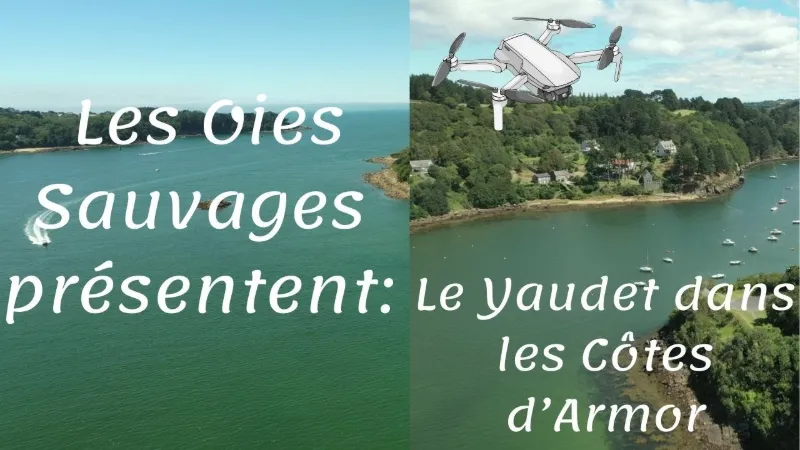
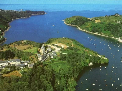
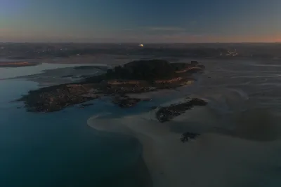
Away from the major tourist routes, the departmental site of Yaudet, a true natural fortress overlooking the Léguer estuary, covers 10 ha. The picturesque village, dominated by the chapel's bell tower, is located 3 km from the town center of Ploulec'h.
In 2019, the site was awarded the Port d'Intérêt Patrimonial label for its commitment to the strong values of safeguarding and promoting maritime heritage in all its forms.
Bounded to the north by the Léguer valley and to the west by the cliffs overlooking the Baie de la Vierge, the site offers a remarkable panorama of moorland and gorse.
A strategic location occupied since the Iron Age, fortified in the 3rd and 4th centuries and occupied until the Middle Ages, the site has been the subject of archaeological excavations that revealed remains showing human presence as early as the Mesolithic (between -10000 and -5000).
At the beginning of the 18th century, a guardhouse was built to face English ships.
The chapel, built in the 11th century on the ruins of a Roman temple, was later destroyed and then rebuilt in the 19th century. Of this first chapel, only the north and south doors and the altarpiece sheltering the reclining Virgin have been preserved.
The discovery trail highlights the historical and natural heritage of the site: you can see the Pierre branlante (rocking stone), the rocks of Pythéas, and the fountain "Feuteun Goz". Other remains remain a mystery, such as the stone wall in the Anse de la Vierge cove, which could be the remnant of the location of 2 tide mills.
Map and restricted areas
Open in the main mapNearby aerodromes
Open aerodromes within 25 km of the spot, heliports included, with their distance and direction from the spot. Near an aerodrome, drone flying is prohibited or height-limited: check the UAS zones map.
| Aerodrome | Type | Distance | Elevation | Difference |
|---|---|---|---|---|
| Centre Hospitalier Heliport | Heliport | 6.2 km E | 28 m | spot 28 m lower |
| Lannion-Côte de Granit Airport | Airport | 6.3 km NE | 88 m | spot 88 m lower |
| Morlaix-Ploujean Airport | Airport | 24 km SW | 83 m | spot 83 m lower |
Aviation weather (METAR and TAF)
LFRO – Lannion-Côte de Granit Airport VFR
METAR
METAR LFRO 210630Z AUTO 14008KT CAVOK 05/05 Q1015
- Wind
- 140°, 15 km/h
- Visibility
- 10 km or more
- Clouds
- –
- Temperature
- 5 °C, dew point 5 °C
- QNH
- 1015 hPa
- Flight category
- VFR: ceiling > 3,000 ft and visibility > 5 mi
TAF
Weather and Kp index
Sunrise and sunset
| Day | Dawn | Sunrise | Golden hour | Sunset | Dusk | Day length |
|---|---|---|---|---|---|---|
| Sat 21 Nov | 07:57 | 08:32 | 08:32–09:23 · 16:37–17:28 | 17:28 | 18:03 | 8 h 56 |
| Sun 22 Nov | 07:58 | 08:33 | 08:33–09:24 · 16:36–17:27 | 17:27 | 18:02 | 8 h 53 |
| Mon 23 Nov | 08:00 | 08:35 | 08:35–09:26 · 16:35–17:26 | 17:26 | 18:02 | 8 h 51 |
| Tue 24 Nov | 08:01 | 08:36 | 08:36–09:28 · 16:34–17:25 | 17:25 | 18:01 | 8 h 49 |
| Wed 25 Nov | 08:02 | 08:38 | 08:38–09:29 · 16:33–17:25 | 17:25 | 18:00 | 8 h 47 |
| Thu 26 Nov | 08:04 | 08:39 | 08:39–09:31 · 16:32–17:24 | 17:24 | 17:59 | 8 h 44 |
| Fri 27 Nov | 08:05 | 08:40 | 08:40–09:33 · 16:31–17:23 | 17:23 | 17:59 | 8 h 42 |


Reviews
Log in to review this spot. Log in · Create a free account
No reviews yet. Share yours!