

The Source of the Ciron - La Roustouse

1 pilot review
“Bonjour, cet endroit est inaccessible en voiture ???” — Former member, 8 months ago
Read the reviews + Write my reviewDescription
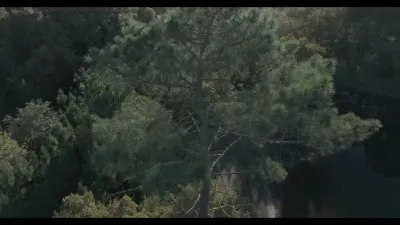
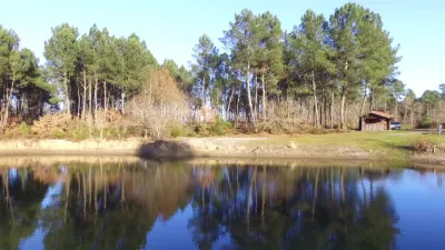
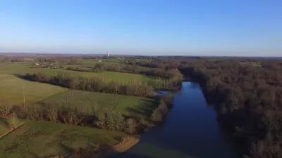
It is located between the municipalities of Lubbon, Losse and Allons, in the Landes department (40). The place is wild and very hard to reach, but so unique. The Ciron disappears underground and reappears further on, very close to the Château de Lubbon. You feel like you're alone in the world. The sky blends with the water, the earth, ... Using the drone was especially essential. I used a Mavic Mini 2 (4K), whose noise is much lower than a Mavic Pro's. I didn't want to scare the various animal species, resident or not. You can hear cranes, it was the right season, but I wasn't lucky enough to photograph them. At one point, I thought I saw elves and gnomes ....
Map and restricted areas
Open in the main mapNearby aerodromes
Open aerodromes within 25 km of the spot, heliports included, with their distance and direction from the spot. Near an aerodrome, drone flying is prohibited or height-limited: check the UAS zones map.
No known open aerodrome within 25 km.
Aviation weather (METAR and TAF)
LFBM – Mont-de-Marsan (BA 118) Air Base VFR
METAR
METAR LFBM 211030Z AUTO 10005KT CAVOK 12/08 Q1016 NOSIG
- Wind
- 100°, 9 km/h
- Visibility
- 10 km or more
- Clouds
- –
- Temperature
- 12 °C, dew point 8 °C
- QNH
- 1016 hPa
- Flight category
- VFR: ceiling > 3,000 ft and visibility > 5 mi
TAF
TAF LFBM 210800Z 2109/2209 10005KT CAVOK TEMPO 2116/2124 4000 RA BECMG 2200/2202 26015KT TEMPO 2203/2209 26020G35KT 4000 SHRA BKN030CB PROB40 TEMPO 2203/2209 2000 TSRA BKN020CB
| Period (local time) | Change | Wind | Visibility | Weather | Clouds |
|---|---|---|---|---|---|
| 21/11 10:00 → 22/11 01:00 | Initial conditions | 100°, 9 km/h | 10 km or more | No significant weather | No significant cloud |
| 21/11 17:00 → 22/11 01:00 | Temporarily | 4.0 km | Rain | ||
| 22/11 01:00 → 22/11 10:00 | Becoming | 260°, 28 km/h | 10 km or more | No significant weather | No significant cloud |
| 22/11 04:00 → 22/11 10:00 | Temporarily | 260°, 37 km/h, gusts 65 km/h | 4.0 km | Showers of rain | Broken (5-7/8) at 3,000 ft (910 m) (cumulonimbus) |
| 22/11 04:00 → 22/11 10:00 | Temporarily, probability 40% | 2.0 km | Thunderstorm rain | Broken (5-7/8) at 2,000 ft (610 m) (cumulonimbus) |
Weather and Kp index
Sunrise and sunset
| Day | Dawn | Sunrise | Golden hour | Sunset | Dusk | Day length |
|---|---|---|---|---|---|---|
| Sat 21 Nov | 07:32 | 08:03 | 08:03–08:48 · 16:44–17:29 | 17:29 | 18:01 | 9 h 25 |
| Sun 22 Nov | 07:33 | 08:04 | 08:04–08:49 · 16:43–17:28 | 17:28 | 18:00 | 9 h 23 |
| Mon 23 Nov | 07:34 | 08:06 | 08:06–08:51 · 16:42–17:28 | 17:28 | 17:59 | 9 h 21 |
| Tue 24 Nov | 07:35 | 08:07 | 08:07–08:52 · 16:42–17:27 | 17:27 | 17:59 | 9 h 19 |
| Wed 25 Nov | 07:36 | 08:08 | 08:08–08:54 · 16:41–17:26 | 17:26 | 17:58 | 9 h 18 |
| Thu 26 Nov | 07:37 | 08:09 | 08:09–08:55 · 16:40–17:26 | 17:26 | 17:58 | 9 h 16 |
| Fri 27 Nov | 07:39 | 08:11 | 08:11–08:56 · 16:39–17:25 | 17:25 | 17:57 | 9 h 14 |
Reviews
Log in to review this spot. Log in · Create a free account
Former member
Bonjour, cet endroit est inaccessible en voiture ???