

Water
Nabias Lagoon
Description
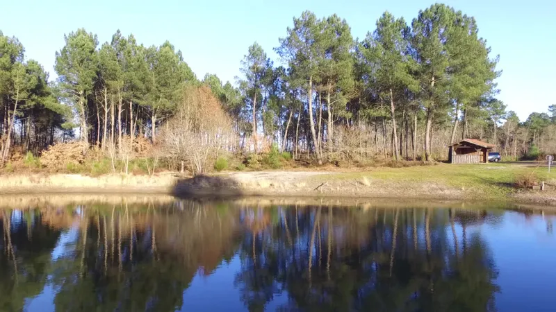
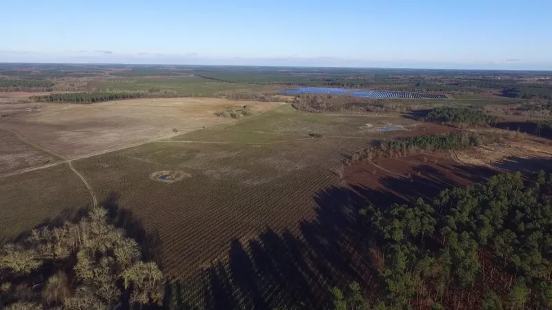
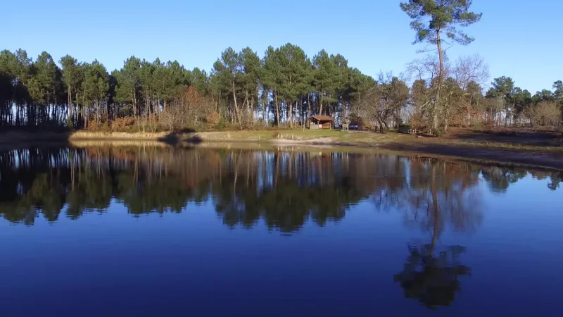
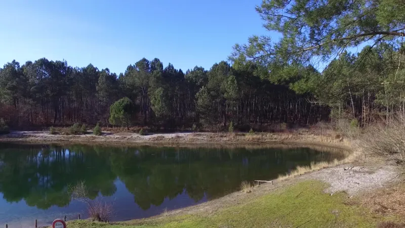
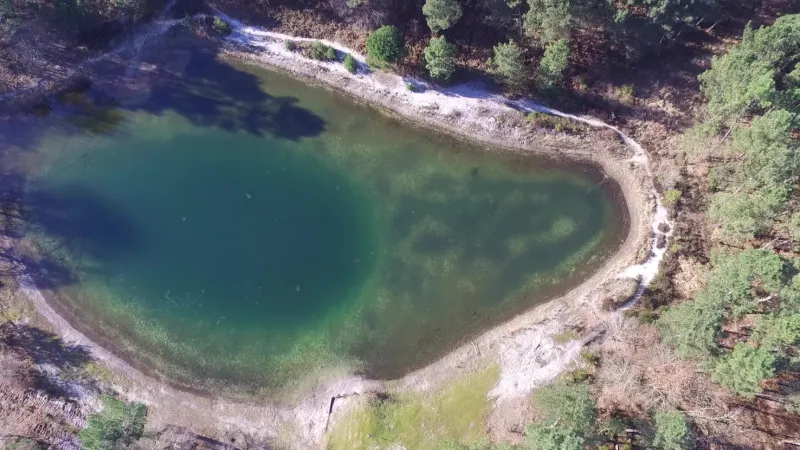
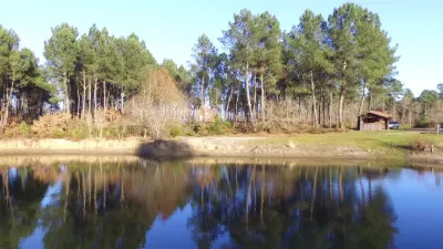
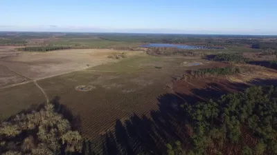
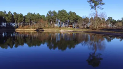
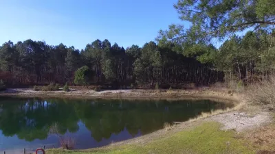
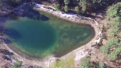
On the way out of the village of Roquefort des Landes, heading toward Bordeaux, a small body of water in a typical corner of the Landes forests. Ideal for a bucolic picnic.
Map and restricted areas
Open in the main mapNearby aerodromes
Open aerodromes within 25 km of the spot, heliports included, with their distance and direction from the spot. Near an aerodrome, drone flying is prohibited or height-limited: check the UAS zones map.
| Aerodrome | Type | Distance | Elevation | Difference |
|---|---|---|---|---|
| Mont-de-Marsan (BA 118) Air Base | Airport | 23 km SW | 62 m | spot 20 m higher |
| Centre Hospitalier Heliport | Heliport | 24 km SW | 60 m | spot 21 m higher |
Aviation weather (METAR and TAF)
LFBM – Mont-de-Marsan (BA 118) Air Base VFR
METAR
METAR LFBM 211030Z AUTO 10005KT CAVOK 12/08 Q1016 NOSIG
- Wind
- 100°, 9 km/h
- Visibility
- 10 km or more
- Clouds
- –
- Temperature
- 12 °C, dew point 8 °C
- QNH
- 1016 hPa
- Flight category
- VFR: ceiling > 3,000 ft and visibility > 5 mi
TAF
TAF LFBM 210800Z 2109/2209 10005KT CAVOK TEMPO 2116/2124 4000 RA BECMG 2200/2202 26015KT TEMPO 2203/2209 26020G35KT 4000 SHRA BKN030CB PROB40 TEMPO 2203/2209 2000 TSRA BKN020CB
| Period (local time) | Change | Wind | Visibility | Weather | Clouds |
|---|---|---|---|---|---|
| 21/11 10:00 → 22/11 01:00 | Initial conditions | 100°, 9 km/h | 10 km or more | No significant weather | No significant cloud |
| 21/11 17:00 → 22/11 01:00 | Temporarily | 4.0 km | Rain | ||
| 22/11 01:00 → 22/11 10:00 | Becoming | 260°, 28 km/h | 10 km or more | No significant weather | No significant cloud |
| 22/11 04:00 → 22/11 10:00 | Temporarily | 260°, 37 km/h, gusts 65 km/h | 4.0 km | Showers of rain | Broken (5-7/8) at 3,000 ft (910 m) (cumulonimbus) |
| 22/11 04:00 → 22/11 10:00 | Temporarily, probability 40% | 2.0 km | Thunderstorm rain | Broken (5-7/8) at 2,000 ft (610 m) (cumulonimbus) |
Weather and Kp index
| Day | Weather | Temp. min. / max. | Wind | Rain | Max Kp |
|---|---|---|---|---|---|
| Sat 21 Nov | Cloudy | 11° / 17° | 16 km/h SE | 6.1 mm | 2 |
| Sun 22 Nov | Showers | 9° / 13° | 30 km/h W | 10 mm | 2 |
| Mon 23 Nov | Cloudy | 7° / 14° | 15 km/h SW | 0.4 mm | 4 |
| Tue 24 Nov | Cloudy | 6° / 11° | 10 km/h E | 1.2 mm | 2 |
| Wed 25 Nov | Rain | 8° / 10° | 17 km/h SW | 8.2 mm | – |
| Thu 26 Nov | Light rain | 5° / 12° | 17 km/h SW | 1.1 mm | – |
| Fri 27 Nov | Cloudy | 7° / 12° | 10 km/h SE | 0.4 mm | – |
Hour by hour: Saturday 21 November
| Time | Weather | Temp. | Wind | Rain | Clouds | Kp |
|---|---|---|---|---|---|---|
| 11:00 | Cloudy | 14° | 11 km/h SE | – | 99 % | 2 |
| 12:00 | Cloudy | 15° | 13 km/h SE | – | 98 % | 2 |
| 13:00 | Cloudy | 16° | 15 km/h SE | – | 100 % | 1 |
| 14:00 | Cloudy | 16° | 15 km/h SE | – | 100 % | 1 |
| 15:00 | Cloudy | 17° | 15 km/h SE | – | 99 % | 1 |
| 16:00 | Cloudy | 16° | 15 km/h SE | – | 100 % | 2 |
| 17:00 | Light rain | 15° | 16 km/h SE | 0.2 mm | 100 % | 2 |
| 18:00 | Heavy rain | 13° | 14 km/h SE | 1.6 mm | 100 % | 2 |
| 19:00 | Heavy rain | 11° | 14 km/h SE | 1.1 mm | 100 % | 2 |
| 20:00 | Light rain | 11° | 14 km/h SE | 0.2 mm | 100 % | 2 |
| 21:00 | Heavy rain | 11° | 14 km/h SE | 1.1 mm | 100 % | 2 |
| 22:00 | Rain | 11° | 13 km/h SE | 0.8 mm | 100 % | 2 |
Hour by hour: Sunday 22 November
| Time | Weather | Temp. | Wind | Rain | Clouds | Kp |
|---|---|---|---|---|---|---|
| 06:00 | Showers | 11° | 26 km/h W | 0.3 mm | 56 % | 2 |
| 07:00 | Showers | 10° | 28 km/h W | 0.3 mm | 54 % | 2 |
| 08:00 | Showers | 10° | 24 km/h W | 0.3 mm | 73 % | 2 |
| 09:00 | Showers | 10° | 24 km/h W | 0.3 mm | 66 % | 2 |
| 10:00 | Showers | 11° | 24 km/h W | 0.8 mm | 39 % | 2 |
| 11:00 | Showers | 12° | 26 km/h W | 0.4 mm | 41 % | 2 |
| 12:00 | Showers | 13° | 27 km/h W | 0.3 mm | 35 % | 2 |
| 13:00 | Showers | 13° | 29 km/h W | 0.5 mm | 69 % | 2 |
| 14:00 | Showers | 12° | 23 km/h W | 0.2 mm | 56 % | 2 |
| 15:00 | Showers | 13° | 28 km/h W | 0.3 mm | 41 % | 2 |
| 16:00 | Showers | 12° | 28 km/h W | 0.4 mm | 72 % | 2 |
| 17:00 | Showers | 11° | 22 km/h W | 0.2 mm | 52 % | 2 |
| 18:00 | Partly cloudy | 10° | 20 km/h W | – | 74 % | 2 |
| 19:00 | Showers | 10° | 17 km/h W | 0.1 mm | 56 % | 2 |
| 20:00 | Showers | 9° | 17 km/h W | 0.2 mm | 62 % | 2 |
| 21:00 | Showers | 9° | 14 km/h SW | 0.3 mm | 41 % | 2 |
| 22:00 | Clear sky | 9° | 14 km/h W | – | 12 % | 2 |
Sunrise and sunset
| Day | Dawn | Sunrise | Golden hour | Sunset | Dusk | Day length |
|---|---|---|---|---|---|---|
| Sat 21 Nov | 07:33 | 08:04 | 08:04–08:49 · 16:45–17:30 | 17:30 | 18:02 | 9 h 26 |
| Sun 22 Nov | 07:34 | 08:05 | 08:05–08:50 · 16:44–17:29 | 17:29 | 18:01 | 9 h 24 |
| Mon 23 Nov | 07:35 | 08:07 | 08:07–08:52 · 16:44–17:29 | 17:29 | 18:00 | 9 h 22 |
| Tue 24 Nov | 07:36 | 08:08 | 08:08–08:53 · 16:43–17:28 | 17:28 | 18:00 | 9 h 20 |
| Wed 25 Nov | 07:37 | 08:09 | 08:09–08:54 · 16:42–17:27 | 17:27 | 17:59 | 9 h 18 |
| Thu 26 Nov | 07:38 | 08:10 | 08:10–08:56 · 16:41–17:27 | 17:27 | 17:59 | 9 h 16 |
| Fri 27 Nov | 07:39 | 08:11 | 08:11–08:57 · 16:41–17:26 | 17:26 | 17:58 | 9 h 14 |

Reviews
Log in to review this spot. Log in · Create a free account
JEFF40
CE JOUR
JEFF40
Alex, vol sur ce lieu ce jour, aucun problème, beau temps et tranquillité. Le niveau de l'eau est au plus bas, mais il y a encore quelques poissons visible du haut. Cordialement.
JEFF40
Tu as eu de la chance, au bout de 5 mn j’avais une golf noire et 4 individus qui tournaient autour …. Dommage j’ai dû remballer. Mais effectivement je me retenterai. On a certains spot en commun.Cordialement JF
Alex
J'y suis allé plusieurs fois et je ne vois vraiment pas où il peut y avoir un problème de sécurité.
JEFF40
Pas mal ce petit coin. Mais j'éviterai d'y aller seul pour sa propre sécurité.