

The Puy-de-Dôme, the Highest of the Auvergne Volcanoes
1 pilot review
“Bonjour, ce n'est malheureusement pas le plus haut volcan d'Auvergne... de la chaîne des P…” — BebMilo, 2 years ago
Read the reviews + Write my reviewDescription
THE HIGHEST VOLCANO OF THE CHAÎNE DES PUYS - LIMAGNE FAULT
EXPLORE THE PUY DE DÔME, A GRAND SITE DE FRANCE
At the gates of the Clermont metropolitan area, the most beautiful volcanoes of the Chaîne des Puys trace a horizon of rounded volcanic ridges
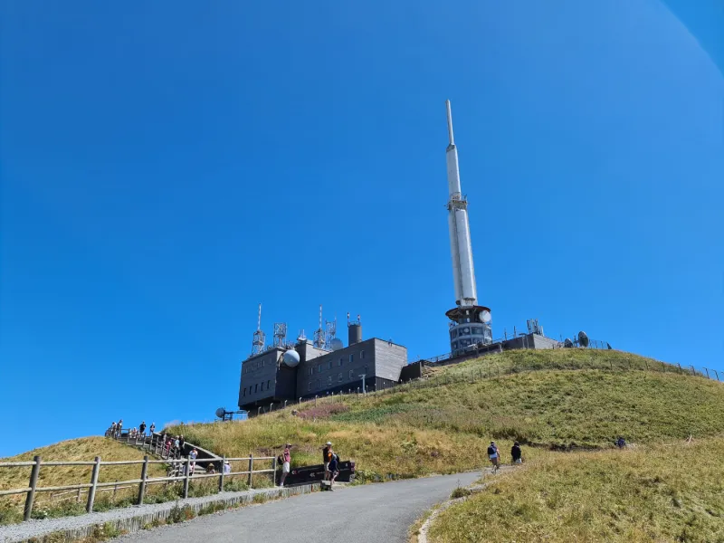
THE PUY DE DÔME
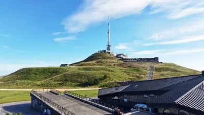
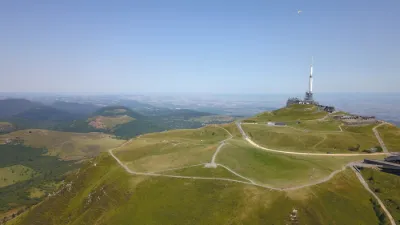
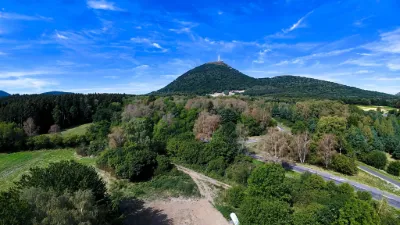
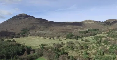
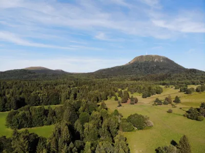
The Puy de Dôme is the highest summit of the Chaîne des Puys - Limagne Fault tectonic site, listed as a UNESCO World Heritage Site in July 2018. It offers visitors a breathtaking 360° view over the 80 volcanoes of varied shapes lined up over 45 km in length and 5 km in width...
A GRAND SITE DE FRANCE, the Puy de Dôme is both protected and developed. This symbolic place, steeped in history, can be visited all year round. The trails that run through it and its altitude of 1465 m make it a true escape, on land as in the air.
Before heading to the Puy de Dôme, how can you be sure the view will be clear? Two webcams installed by the Observatoire de Physique du Globe de Clermont-Ferrand continuously film the view from the summit of the Puy de Dôme, and the Puy de Dôme from the Cézeaux campus. The images are updated every 10 minutes. http://wwwobs.univ-bpclermont.fr/opgc...
HOW TO GET TO THE SUMMIT OF THE PUY DE DÔME?
The very first thing to do is check the weather, just to be sure the view will be clear. To do so, check the live weather at the summit.
Then make your choice: climb the muleteers' path or ride the panoramic train.
On foot or by Panoramique train, the summit of the Puy de Dôme is accessible to everyone.
At the foot of the Puy de Dôme, a large parking lot is set up near the Maison de site. This is where the shuttle from Clermont drops off its passengers
#drone #dji #volcan #puydedome Cinematic shot DJI MINI 2
Map and restricted areas
Open in the main mapNearby aerodromes
Open aerodromes within 25 km of the spot, heliports included, with their distance and direction from the spot. Near an aerodrome, drone flying is prohibited or height-limited: check the UAS zones map.
| Aerodrome | Type | Distance | Elevation | Difference |
|---|---|---|---|---|
| Centre Hospitalier Heliport | Heliport | 10 km E | 416 m | spot 1,017 m higher |
| Clermont-Ferrand Auvergne Airport | Airport | 16 km E | 332 m | spot 1,101 m higher |
Aviation weather (METAR and TAF)
LFLC – Clermont-Ferrand Auvergne Airport VFR
METAR
METAR LFLC 211030Z AUTO 15003KT 080V230 CAVOK 11/07 Q1019 NOSIG
- Wind
- 150°, 6 km/h
- Visibility
- 10 km or more
- Clouds
- –
- Temperature
- 11 °C, dew point 7 °C
- QNH
- 1019 hPa
- Flight category
- VFR: ceiling > 3,000 ft and visibility > 5 mi
TAF
TAF LFLC 210500Z 2106/2206 19005KT 9999 BKN030
| Period (local time) | Change | Wind | Visibility | Weather | Clouds |
|---|---|---|---|---|---|
| 21/11 07:00 → 22/11 07:00 | Initial conditions | 190°, 9 km/h | 10 km or more | Broken (5-7/8) at 3,000 ft (910 m) |
Weather and Kp index
| Day | Weather | Temp. min. / max. | Wind | Rain | Max Kp |
|---|---|---|---|---|---|
| Sat 21 Nov | Cloudy | 6° / 10° | 12 km/h SE | 1.3 mm | 2 |
| Sun 22 Nov | Light rain | 4° / 7° | 38 km/h W | 12 mm | 2 |
| Mon 23 Nov | Cloudy | 3° / 4° | 32 km/h W | 1.6 mm | 4 |
| Tue 24 Nov | Cloudy | -2° / 3° | 8 km/h SE | – | 2 |
| Wed 25 Nov | Rain | 2° / 3° | 10 km/h SE | 19 mm | – |
| Thu 26 Nov | Partly cloudy | 1° / 6° | 15 km/h SW | 0.2 mm | – |
| Fri 27 Nov | Cloudy | 0° / 6° | 10 km/h SW | – | – |
Hour by hour: Saturday 21 November
| Time | Weather | Temp. | Wind | Rain | Clouds | Kp |
|---|---|---|---|---|---|---|
| 11:00 | Partly cloudy | 8° | 7 km/h SE | – | 94 % | 2 |
| 12:00 | Partly cloudy | 9° | 8 km/h SE | – | 79 % | 2 |
| 13:00 | Cloudy | 10° | 8 km/h SE | – | 98 % | 1 |
| 14:00 | Cloudy | 10° | 8 km/h SE | – | 99 % | 1 |
| 15:00 | Cloudy | 9° | 10 km/h SE | – | 98 % | 1 |
| 16:00 | Cloudy | 8° | 10 km/h SE | – | 99 % | 2 |
| 17:00 | Cloudy | 7° | 9 km/h SE | – | 100 % | 2 |
| 18:00 | Cloudy | 6° | 8 km/h SE | – | 100 % | 2 |
| 19:00 | Cloudy | 6° | 7 km/h S | – | 100 % | 2 |
| 20:00 | Cloudy | 6° | 8 km/h S | – | 100 % | 2 |
| 21:00 | Cloudy | 6° | 12 km/h SE | – | 100 % | 2 |
| 22:00 | Rain | 6° | 12 km/h S | 0.6 mm | 100 % | 2 |
Hour by hour: Sunday 22 November
| Time | Weather | Temp. | Wind | Rain | Clouds | Kp |
|---|---|---|---|---|---|---|
| 06:00 | Heavy rain | 7° | 21 km/h SW | 1.8 mm | 100 % | 2 |
| 07:00 | Heavy rain | 7° | 31 km/h SW | 1.9 mm | 100 % | 2 |
| 08:00 | Cloudy | 6° | 35 km/h W | – | 100 % | 2 |
| 09:00 | Light rain | 6° | 36 km/h W | 0.3 mm | 95 % | 2 |
| 10:00 | Light rain | 6° | 33 km/h W | 0.2 mm | 100 % | 2 |
| 11:00 | Light rain | 6° | 35 km/h W | 0.3 mm | 98 % | 2 |
| 12:00 | Showers | 6° | 38 km/h W | 0.5 mm | 69 % | 2 |
| 13:00 | Light rain | 6° | 38 km/h W | 0.4 mm | 99 % | 2 |
| 14:00 | Showers | 6° | 36 km/h W | 0.1 mm | 86 % | 2 |
| 15:00 | Showers | 6° | 35 km/h W | 0.2 mm | 31 % | 2 |
| 16:00 | Partly cloudy | 5° | 36 km/h W | – | 66 % | 2 |
| 17:00 | Partly cloudy | 5° | 36 km/h W | – | 51 % | 2 |
| 18:00 | Light rain | 4° | 35 km/h W | 0.1 mm | 93 % | 2 |
| 19:00 | Light rain | 4° | 35 km/h W | 0.1 mm | 100 % | 2 |
| 20:00 | Cloudy | 4° | 36 km/h W | – | 99 % | 2 |
| 21:00 | Cloudy | 4° | 35 km/h W | – | 98 % | 2 |
| 22:00 | Cloudy | 4° | 34 km/h W | – | 100 % | 2 |
Sunrise and sunset
| Day | Dawn | Sunrise | Golden hour | Sunset | Dusk | Day length |
|---|---|---|---|---|---|---|
| Sat 21 Nov | 07:23 | 07:56 | 07:56–08:43 · 16:25–17:12 | 17:12 | 17:45 | 9 h 15 |
| Sun 22 Nov | 07:25 | 07:57 | 07:57–08:44 · 16:24–17:11 | 17:11 | 17:44 | 9 h 13 |
| Mon 23 Nov | 07:26 | 07:59 | 07:59–08:46 · 16:23–17:10 | 17:10 | 17:43 | 9 h 11 |
| Tue 24 Nov | 07:27 | 08:00 | 08:00–08:47 · 16:22–17:10 | 17:10 | 17:43 | 9 h 09 |
| Wed 25 Nov | 07:28 | 08:01 | 08:01–08:49 · 16:22–17:09 | 17:09 | 17:42 | 9 h 07 |
| Thu 26 Nov | 07:29 | 08:03 | 08:03–08:50 · 16:21–17:08 | 17:08 | 17:41 | 9 h 05 |
| Fri 27 Nov | 07:31 | 08:04 | 08:04–08:52 · 16:20–17:08 | 17:08 | 17:41 | 9 h 03 |
Reviews
Log in to review this spot. Log in · Create a free account
BebMilo
Bonjour, ce n'est malheureusement pas le plus haut volcan d'Auvergne... de la chaîne des Puys, oui, mais le Puy de Sancy est un volcan aussi, comme le Plomb du Cantal, le Puy Mary, qui sont tous plus haut que le Puy-de-Dôme.