

Lac du Bouchet at the Top of the Volcano
No reviews yet
Have you flown here? Share your experience with other pilots.
+ Write the first reviewDescription
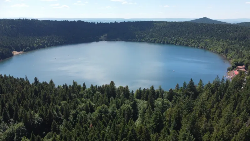
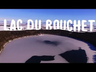
Lac du Bouchet
The most visited natural site in the Département, the volcanic Lac du Bouchet is a haven of peace in a forest setting. It is a protected site. Every year it welcomes thousands of visitors drawn by sports activities, the beauty of the natural surroundings and the quality of the water.
Since 2016, new facilities have been built on the site by the Communauté de Communes du Pays de Cayres et de Pradelles, the Département de la Haute-Loire and the Office National des Forêts, to showcase the exceptional natural qualities of this lake and improve the welcome for the public.
Lac du Bouchet offers the chance to enjoy outdoor activities. It is also a great place for families, with a playground and picnic areas.
Boating on the Lake
It is regulated by a navigation police order.
Fishing
It is managed under an agreement with the Fédération départementale pour la Pêche et la Protection des Milieux Aquatiques.
Two fishing seasons are offered:
- General public fishing between January 1 and August 31.
- Sport fishing between September 1 and December 31.
For more information:
Fédération de Haute Loire pour la Pêche et la Protection du Milieu Aquatique.
Scuba diving
This activity is run by the Club Vellave de Plongée, which has an agreement with the Département de la Haute-Loire.
For more information:
Tel. 04-71-08-90-46 - www.clubvellavedeplongee.com
Swimming
Information at the Pradelles Tourist Office - Tel. 04 71 00 82 65
At the site center, the Communauté de Communes offers many other activities: hiking, trail running, electric quadricycles, electric bikes, mountain bike trails, equipment for people with reduced mobility (joëlette, tiralo)
Tel. 04 71 09 09 44
#drone #dji #volcan #lac ---------------------------------------------------------------------
Music provided by La Musique Libre
Scandinavianz - Around The Sea : • |Musique libre de droits| Scandinavia...
Scandinavianz : / scandinavianz
---------------------------------------------------------------------
Map and restricted areas
Open in the main mapNearby aerodromes
Open aerodromes within 25 km of the spot, heliports included, with their distance and direction from the spot. Near an aerodrome, drone flying is prohibited or height-limited: check the UAS zones map.
| Aerodrome | Type | Distance | Elevation | Difference |
|---|---|---|---|---|
| Le Puy-Loudes Airfield | Airport | 19 km N | 832 m | spot 375 m higher |
| Aérodrome de Langogne - Lespéron | Aerodrome | 24 km S | 1,015 m | spot 192 m higher |
Aviation weather (METAR and TAF)
LFHP – Le Puy-Loudes Airfield VFR
METAR
METAR LFHP 211030Z AUTO VRB02KT CAVOK 08/06 Q1020
- Wind
- Variable, 4 km/h
- Visibility
- 10 km or more
- Clouds
- –
- Temperature
- 8 °C, dew point 6 °C
- QNH
- 1020 hPa
- Flight category
- VFR: ceiling > 3,000 ft and visibility > 5 mi
TAF
Weather and Kp index
| Day | Weather | Temp. min. / max. | Wind | Rain | Max Kp |
|---|---|---|---|---|---|
| Sat 21 Nov | Fair | 4° / 9° | 23 km/h S | 0.9 mm | 2 |
| Sun 22 Nov | Showers | 2° / 7° | 39 km/h W | 6.9 mm | 2 |
| Mon 23 Nov | Cloudy | 2° / 4° | 28 km/h NW | – | 4 |
| Tue 24 Nov | Cloudy | -1° / 5° | 21 km/h S | 1.7 mm | 2 |
| Wed 25 Nov | Snow | -0° / 2° | 25 km/h SE | 26 mm | – |
| Thu 26 Nov | Cloudy | -1° / 4° | 9 km/h W | 0.5 mm | – |
| Fri 27 Nov | Partly cloudy | -4° / 4° | 5 km/h S | – | – |
Hour by hour: Saturday 21 November
| Time | Weather | Temp. | Wind | Rain | Clouds | Kp |
|---|---|---|---|---|---|---|
| 12:00 | Fair | 8° | 2 km/h SE | – | 33 % | 2 |
| 13:00 | Fair | 8° | 3 km/h E | – | 32 % | 1 |
| 14:00 | Partly cloudy | 9° | 5 km/h E | – | 85 % | 1 |
| 15:00 | Cloudy | 9° | 7 km/h NE | – | 93 % | 1 |
| 16:00 | Cloudy | 8° | 9 km/h E | – | 98 % | 2 |
| 17:00 | Cloudy | 6° | 14 km/h SE | – | 98 % | 2 |
| 18:00 | Partly cloudy | 5° | 15 km/h S | – | 95 % | 2 |
| 19:00 | Cloudy | 4° | 15 km/h S | – | 98 % | 2 |
| 20:00 | Cloudy | 4° | 16 km/h S | – | 100 % | 2 |
| 21:00 | Cloudy | 5° | 18 km/h S | – | 100 % | 2 |
| 22:00 | Light rain | 5° | 22 km/h S | 0.2 mm | 100 % | 2 |
Hour by hour: Sunday 22 November
| Time | Weather | Temp. | Wind | Rain | Clouds | Kp |
|---|---|---|---|---|---|---|
| 06:00 | Light rain | 7° | 21 km/h S | 0.4 mm | 99 % | 2 |
| 07:00 | Light rain | 7° | 24 km/h SW | 0.3 mm | 100 % | 2 |
| 08:00 | Light rain | 6° | 39 km/h W | 0.3 mm | 100 % | 2 |
| 09:00 | Light rain | 4° | 34 km/h W | 0.2 mm | 92 % | 2 |
| 10:00 | Light rain | 5° | 33 km/h W | 0.2 mm | 97 % | 2 |
| 11:00 | Showers | 5° | 30 km/h W | 0.1 mm | 84 % | 2 |
| 12:00 | Showers | 5° | 32 km/h W | 0.2 mm | 77 % | 2 |
| 13:00 | Showers | 5° | 34 km/h W | 0.3 mm | 70 % | 2 |
| 14:00 | Showers | 5° | 32 km/h W | 0.1 mm | 74 % | 2 |
| 15:00 | Showers | 5° | 33 km/h W | 0.4 mm | 86 % | 2 |
| 16:00 | Partly cloudy | 4° | 28 km/h W | – | 47 % | 2 |
| 17:00 | Partly cloudy | 4° | 26 km/h W | – | 70 % | 2 |
| 18:00 | Partly cloudy | 3° | 25 km/h W | – | 84 % | 2 |
| 19:00 | Cloudy | 3° | 25 km/h W | – | 99 % | 2 |
| 20:00 | Cloudy | 3° | 26 km/h W | – | 94 % | 2 |
| 21:00 | Partly cloudy | 3° | 26 km/h W | – | 73 % | 2 |
| 22:00 | Partly cloudy | 3° | 24 km/h W | – | 64 % | 2 |
Sunrise and sunset
| Day | Dawn | Sunrise | Golden hour | Sunset | Dusk | Day length |
|---|---|---|---|---|---|---|
| Sat 21 Nov | 07:18 | 07:50 | 07:50–08:36 · 16:26–17:11 | 17:11 | 17:43 | 9 h 21 |
| Sun 22 Nov | 07:19 | 07:51 | 07:51–08:37 · 16:25–17:10 | 17:10 | 17:43 | 9 h 18 |
| Mon 23 Nov | 07:20 | 07:53 | 07:53–08:39 · 16:24–17:10 | 17:10 | 17:42 | 9 h 16 |
| Tue 24 Nov | 07:22 | 07:54 | 07:54–08:40 · 16:23–17:09 | 17:09 | 17:41 | 9 h 15 |
| Wed 25 Nov | 07:23 | 07:55 | 07:55–08:42 · 16:22–17:08 | 17:08 | 17:41 | 9 h 13 |
| Thu 26 Nov | 07:24 | 07:56 | 07:56–08:43 · 16:21–17:08 | 17:08 | 17:40 | 9 h 11 |
| Fri 27 Nov | 07:25 | 07:58 | 07:58–08:44 · 16:20–17:07 | 17:07 | 17:40 | 9 h 09 |
Reviews
Log in to review this spot. Log in · Create a free account
No reviews yet. Share yours!