

Beaume Waterfall at 900m Altitude
No reviews yet
Have you flown here? Share your experience with other pilots.
+ Write the first reviewDescription
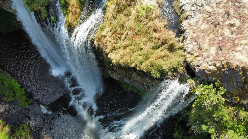
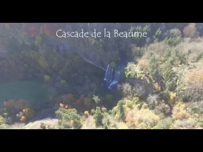
The Beaume Waterfall, A refreshing walk in a spectacular setting! The waterfall is located near the village of Agizoux, at 900 meters altitude, between Solignac-sur-Loire and Le Brignon via the RD 54.
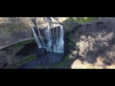
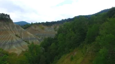
It is the result of erosion: the waters of the Ourzie river cut into the basalt of the plateau and spring from the top of the cliff to fall 27 m below and give birth to the Beaume, a tributary of the Loire. A pleasant walk with a viewing platform.
Lava flows - the basalt valley. The path takes you through walls of dark rock that represent the ancient lava flows making up the vast volcanic plateau above you. Over its history, the stream has cut down far enough to leave only imposing cliffs where volcanic columns dominate. The waterfall site bears witness to the wearing-down work begun by the stream on a large rock mass, where the columns remind us that the gray basalt was once molten lava.
Road signs from Solignac, parking at the site entrance. A round trip on foot takes 40 min from the REYNARDON parking lot.
There is also a trail starting from Solignac/Loire, a 10.5 km loop - 2h50 - Difficulty: moderate.
From the REYNARDON parking lot: 40 min
Bring good shoes for the descent to the waterfall
Avoid strollers.
Prices
Free
Free access. Google Maps link: Cascade de la Beaume https://maps.app.goo.gl/sWzLNQkBM2q37...
Cinematic shot DJI MINI2
Music
TITLE
Divine Assault
ARTIST
Andrés Hernández
LICENSES
Elite Alliance Music; Epic Elite (Music Publishing)
#drone #cascade #djimini2
Map and restricted areas
Open in the main mapNearby aerodromes
Open aerodromes within 25 km of the spot, heliports included, with their distance and direction from the spot. Near an aerodrome, drone flying is prohibited or height-limited: check the UAS zones map.
| Aerodrome | Type | Distance | Elevation | Difference |
|---|---|---|---|---|
| Le Puy-Loudes Airfield | Airport | 18 km NW | 832 m | spot 5 m lower |
Aviation weather (METAR and TAF)
LFHP – Le Puy-Loudes Airfield VFR
METAR
METAR LFHP 211030Z AUTO VRB02KT CAVOK 08/06 Q1020
- Wind
- Variable, 4 km/h
- Visibility
- 10 km or more
- Clouds
- –
- Temperature
- 8 °C, dew point 6 °C
- QNH
- 1020 hPa
- Flight category
- VFR: ceiling > 3,000 ft and visibility > 5 mi
TAF
Weather and Kp index
| Day | Weather | Temp. min. / max. | Wind | Rain | Max Kp |
|---|---|---|---|---|---|
| Sat 21 Nov | Fair | 6° / 11° | 24 km/h S | 0.8 mm | 2 |
| Sun 22 Nov | Showers | 4° / 9° | 35 km/h W | 5.8 mm | 2 |
| Mon 23 Nov | Cloudy | 3° / 6° | 32 km/h NW | – | 4 |
| Tue 24 Nov | Cloudy | 1° / 7° | 23 km/h S | 1.7 mm | 2 |
| Wed 25 Nov | Heavy rain | 2° / 4° | 26 km/h SE | 30 mm | – |
| Thu 26 Nov | Cloudy | 1° / 5° | 7 km/h S | 0.6 mm | – |
| Fri 27 Nov | Partly cloudy | -2° / 5° | 9 km/h SE | – | – |
Hour by hour: Saturday 21 November
| Time | Weather | Temp. | Wind | Rain | Clouds | Kp |
|---|---|---|---|---|---|---|
| 12:00 | Fair | 9° | 2 km/h S | – | 35 % | 2 |
| 13:00 | Fair | 10° | 3 km/h NE | – | 38 % | 1 |
| 14:00 | Partly cloudy | 11° | 5 km/h NE | – | 81 % | 1 |
| 15:00 | Cloudy | 11° | 6 km/h NE | – | 92 % | 1 |
| 16:00 | Cloudy | 10° | 10 km/h E | – | 99 % | 2 |
| 17:00 | Cloudy | 8° | 14 km/h SE | – | 98 % | 2 |
| 18:00 | Partly cloudy | 6° | 15 km/h S | – | 98 % | 2 |
| 19:00 | Cloudy | 6° | 15 km/h S | – | 98 % | 2 |
| 20:00 | Cloudy | 6° | 17 km/h S | – | 100 % | 2 |
| 21:00 | Cloudy | 6° | 19 km/h S | – | 100 % | 2 |
| 22:00 | Light rain | 7° | 23 km/h S | 0.1 mm | 100 % | 2 |
Hour by hour: Sunday 22 November
| Time | Weather | Temp. | Wind | Rain | Clouds | Kp |
|---|---|---|---|---|---|---|
| 06:00 | Light rain | 8° | 23 km/h S | 0.3 mm | 100 % | 2 |
| 07:00 | Light rain | 9° | 20 km/h SW | 0.3 mm | 100 % | 2 |
| 08:00 | Light rain | 8° | 35 km/h W | 0.2 mm | 100 % | 2 |
| 09:00 | Light rain | 6° | 30 km/h W | 0.1 mm | 98 % | 2 |
| 10:00 | Cloudy | 7° | 30 km/h W | – | 97 % | 2 |
| 11:00 | Showers | 7° | 31 km/h W | 0.1 mm | 70 % | 2 |
| 12:00 | Showers | 8° | 31 km/h W | 0.3 mm | 85 % | 2 |
| 13:00 | Showers | 7° | 32 km/h W | 0.2 mm | 69 % | 2 |
| 14:00 | Showers | 7° | 29 km/h W | 0.1 mm | 62 % | 2 |
| 15:00 | Showers | 7° | 31 km/h W | 0.2 mm | 69 % | 2 |
| 16:00 | Partly cloudy | 6° | 28 km/h W | – | 48 % | 2 |
| 17:00 | Partly cloudy | 5° | 25 km/h W | – | 66 % | 2 |
| 18:00 | Partly cloudy | 5° | 26 km/h W | – | 61 % | 2 |
| 19:00 | Cloudy | 4° | 25 km/h W | – | 94 % | 2 |
| 20:00 | Cloudy | 5° | 26 km/h W | – | 93 % | 2 |
| 21:00 | Partly cloudy | 4° | 27 km/h W | – | 66 % | 2 |
| 22:00 | Partly cloudy | 4° | 23 km/h W | – | 53 % | 2 |
Sunrise and sunset
| Day | Dawn | Sunrise | Golden hour | Sunset | Dusk | Day length |
|---|---|---|---|---|---|---|
| Sat 21 Nov | 07:18 | 07:50 | 07:50–08:36 · 16:25–17:11 | 17:11 | 17:43 | 9 h 20 |
| Sun 22 Nov | 07:19 | 07:51 | 07:51–08:37 · 16:24–17:10 | 17:10 | 17:42 | 9 h 18 |
| Mon 23 Nov | 07:20 | 07:52 | 07:52–08:38 · 16:23–17:09 | 17:09 | 17:42 | 9 h 16 |
| Tue 24 Nov | 07:21 | 07:54 | 07:54–08:40 · 16:22–17:09 | 17:09 | 17:41 | 9 h 14 |
| Wed 25 Nov | 07:22 | 07:55 | 07:55–08:41 · 16:21–17:08 | 17:08 | 17:40 | 9 h 12 |
| Thu 26 Nov | 07:24 | 07:56 | 07:56–08:43 · 16:21–17:07 | 17:07 | 17:40 | 9 h 11 |
| Fri 27 Nov | 07:25 | 07:57 | 07:57–08:44 · 16:20–17:07 | 17:07 | 17:39 | 9 h 09 |

Reviews
Log in to review this spot. Log in · Create a free account
No reviews yet. Share yours!