

Baudinard, the chapel of Notre Dame de la Garde

No reviews yet
Have you flown here? Share your experience with other pilots.
+ Write the first reviewDescription
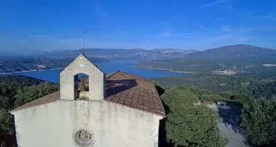
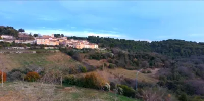
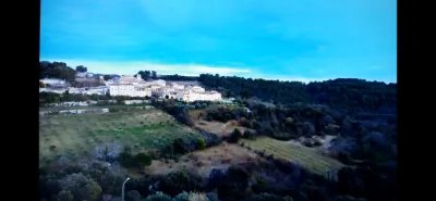
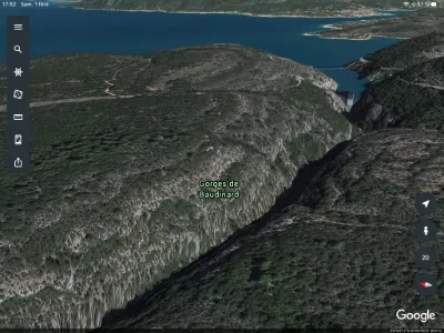
Overlooking the village, its castle and its 12th-century parish church, the chapel of Notre-Dame-de-la-Garde stands at the end of a 700 m high hill, from which there is a magnificent view of the Lac de Sainte-Croix, the Verdon and the surrounding mountains. This site was listed on 21 January 1943.
The chapel was built at the end of the 16th century, as shown by three municipal council resolutions from 1599, 1608 and 1610. A hermit, who served as schoolmaster and as bell ringer in case of storms, had living quarters to the east of the chapel. The remains of this building, still visible in photographs from 1984, were destroyed when the chapel was restored. The plan of this modest building is very simple: a single nave of two bays separated by a transverse arch resting on half-columns set against the side walls, and a three-sided chancel with a rib vault. The whole is buttressed on the outside by five buttresses to the north and south. The west façade, topped by a small bell gable whose bell bears the date of 4 April 1756, is pierced by an oculus. The basket-handle arch of the entrance door is highlighted by a fine molding resting on corbels.
In recent years the chapel, whose pilgrimage on 15 August is still very well attended, was in very poor condition, and the roof and buttresses had to be completely rebuilt. The municipality, which had just made major efforts to restore its parish church, could not take on this work. The association "Les amis de Baudinard", chaired by the great pianist Youri Boukoff, requested assistance from the Sauvegarde de l'Art français. The work was carried out in 1986 and 1989. The Sauvegarde contributed 75,000 F.
Map and restricted areas
Open in the main mapNearby aerodromes
Open aerodromes within 25 km of the spot, heliports included, with their distance and direction from the spot. Near an aerodrome, drone flying is prohibited or height-limited: check the UAS zones map.
| Aerodrome | Type | Distance | Elevation | Difference |
|---|---|---|---|---|
| Puimoisson Airfield | Aerodrome | 16 km N | 769 m | spot 62 m lower |
Aviation weather (METAR and TAF)
LFMC – Le Luc-Le Cannet Airport VFR
METAR
METAR LFMC 211100Z AUTO 26011KT CAVOK 17/06 Q1018
- Wind
- 260°, 20 km/h
- Visibility
- 10 km or more
- Clouds
- –
- Temperature
- 17 °C, dew point 6 °C
- QNH
- 1018 hPa
- Flight category
- VFR: ceiling > 3,000 ft and visibility > 5 mi
TAF
Weather and Kp index
| Day | Weather | Temp. min. / max. | Wind | Rain | Max Kp |
|---|---|---|---|---|---|
| Sat 21 Nov | Fair | 5° / 13° | 15 km/h NW | – | 2 |
| Sun 22 Nov | Clear sky | 6° / 12° | 31 km/h NW | 11 mm | 2 |
| Mon 23 Nov | Partly cloudy | 4° / 10° | 36 km/h NW | – | 4 |
| Tue 24 Nov | Cloudy | 3° / 11° | 19 km/h SE | 0.6 mm | 2 |
| Wed 25 Nov | Cloudy | 6° / 8° | 37 km/h E | 14 mm | – |
| Thu 26 Nov | Partly cloudy | 2° / 9° | 12 km/h N | 14 mm | – |
| Fri 27 Nov | Fair | 1° / 10° | 8 km/h NW | – | – |
Hour by hour: Saturday 21 November
| Time | Weather | Temp. | Wind | Rain | Clouds | Kp |
|---|---|---|---|---|---|---|
| 12:00 | Partly cloudy | 11° | 15 km/h NW | – | 40 % | 2 |
| 13:00 | Fair | 12° | 15 km/h NW | – | 25 % | 1 |
| 14:00 | Partly cloudy | 13° | 15 km/h W | – | 41 % | 1 |
| 15:00 | Partly cloudy | 12° | 15 km/h W | – | 41 % | 1 |
| 16:00 | Partly cloudy | 11° | 15 km/h W | – | 69 % | 2 |
| 17:00 | Partly cloudy | 9° | 10 km/h W | – | 59 % | 2 |
| 18:00 | Partly cloudy | 7° | 10 km/h NW | – | 67 % | 2 |
| 19:00 | Partly cloudy | 6° | 10 km/h NE | – | 86 % | 2 |
| 20:00 | Partly cloudy | 6° | 8 km/h NE | – | 91 % | 2 |
| 21:00 | Partly cloudy | 6° | 8 km/h NE | – | 80 % | 2 |
| 22:00 | Cloudy | 5° | 7 km/h E | – | 100 % | 2 |
Hour by hour: Sunday 22 November
| Time | Weather | Temp. | Wind | Rain | Clouds | Kp |
|---|---|---|---|---|---|---|
| 06:00 | Heavy rain | 10° | 20 km/h SE | 2.1 mm | 100 % | 2 |
| 07:00 | Rain | 10° | 20 km/h SE | 0.6 mm | 100 % | 2 |
| 08:00 | Heavy rain | 10° | 19 km/h SE | 2.4 mm | 100 % | 2 |
| 09:00 | Rain | 10° | 13 km/h S | 0.5 mm | 100 % | 2 |
| 10:00 | Light rain | 10° | 19 km/h W | 0.2 mm | 100 % | 2 |
| 11:00 | Light rain | 10° | 26 km/h W | 0.2 mm | 89 % | 2 |
| 12:00 | Cloudy | 10° | 26 km/h W | – | 92 % | 2 |
| 13:00 | Clear sky | 11° | 29 km/h NW | – | 8 % | 2 |
| 14:00 | Clear sky | 12° | 30 km/h NW | – | 10 % | 2 |
| 15:00 | Fair | 11° | 31 km/h NW | – | 18 % | 2 |
| 16:00 | Clear sky | 10° | 29 km/h NW | – | 10 % | 2 |
| 17:00 | Fair | 9° | 27 km/h NW | – | 27 % | 2 |
| 18:00 | Fair | 8° | 25 km/h W | – | 16 % | 2 |
| 19:00 | Fair | 8° | 24 km/h W | – | 16 % | 2 |
| 20:00 | Clear sky | 7° | 25 km/h W | – | 9 % | 2 |
| 21:00 | Fair | 7° | 26 km/h W | – | 15 % | 2 |
| 22:00 | Fair | 6° | 25 km/h W | – | 27 % | 2 |
Sunrise and sunset
| Day | Dawn | Sunrise | Golden hour | Sunset | Dusk | Day length |
|---|---|---|---|---|---|---|
| Sat 21 Nov | 07:06 | 07:37 | 07:37–08:22 · 16:21–17:05 | 17:05 | 17:37 | 9 h 27 |
| Sun 22 Nov | 07:07 | 07:39 | 07:39–08:23 · 16:20–17:05 | 17:05 | 17:36 | 9 h 26 |
| Mon 23 Nov | 07:08 | 07:40 | 07:40–08:24 · 16:19–17:04 | 17:04 | 17:35 | 9 h 24 |
| Tue 24 Nov | 07:09 | 07:41 | 07:41–08:26 · 16:18–17:03 | 17:03 | 17:35 | 9 h 22 |
| Wed 25 Nov | 07:11 | 07:42 | 07:42–08:27 · 16:18–17:03 | 17:03 | 17:34 | 9 h 20 |
| Thu 26 Nov | 07:12 | 07:43 | 07:43–08:29 · 16:17–17:02 | 17:02 | 17:34 | 9 h 18 |
| Fri 27 Nov | 07:13 | 07:45 | 07:45–08:30 · 16:16–17:02 | 17:02 | 17:33 | 9 h 16 |


Reviews
Log in to review this spot. Log in · Create a free account
No reviews yet. Share yours!