

Berder Island

No reviews yet
Have you flown here? Share your experience with other pilots.
+ Write the first reviewDescription
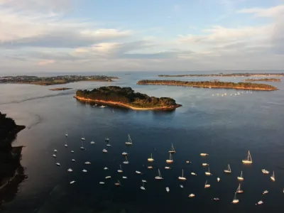
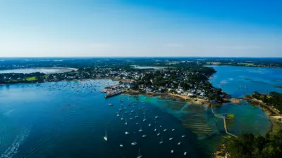
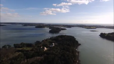
The small island of Berder is linked to Lamor-Baden by an 80-meter submersible causeway that is exposed at low tide. This little corner of paradise reveals splendid scenery along the coastal path. To walk around it, plan your trip according to the tide times. Walking around Berder Island Berder Island remains a very popular walking spot for people living around the Gulf of Morbihan, thanks to its 2.5 km walking loop along the coastal path. It takes a little under an hour to go around. But it is not possible to venture into the heart of the island's 23 hectares, as it remains private property (only the coastal path is public).
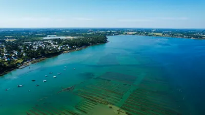
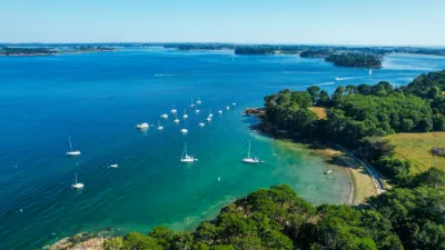
As you stroll around Berder Island, you walk in the shade of trees and vegetation reminiscent of the Mediterranean. You will find magnificent viewpoints over the Gulf of Morbihan, with Île aux Moines in the background. When the tide is low, oyster and mussel farms as well as a boat graveyard come into view as you walk. An island marked by Count Dillon Berder Island is home to several buildings created by Count Arthur Dillon, who bought the island in 1879. He had a castle built there with a five-story hexagonal tower, as well as the Saint-Anne chapel for his son's wedding in 1885. Count Dillon also laid out a 10-hectare ornamental garden on the island with tropical species.
The island was bought in 1920 by the Duchess of Uzès before the whole estate was handed over to the Missionary Oblates of Mary Immaculate in 1927. From 1937, the Little Sisters of Saint Francis of Assisi became its owners until 1991, then sold the island to the cosmetics company Yves Rocher. Between 1984 and 2013, Berder was rented and run by a holiday center. Crossing times at low tide for Berder Island Whether it's Berder, the Sept-Îles or Tascon, to explore an island at low tide in the Gulf of Morbihan, always check the tide times first! An average window of four hours (two hours before and after low tide) allows access.
At the entrance to the submersible crossing, there is a notice board with the crossing times for Berder Island. Be careful, these times are given for guidance only, as they can vary with wind strength and atmospheric pressure.
Of course, don't wait until the last moment to head back, or you risk getting stuck on the island! Allowing a safety margin of 45 minutes before the crossing closes should give you peace of mind.
The Jument current To the south of Berder Island runs a very powerful tidal current: the Jument current. With a blistering speed that can reach nearly 9 knots, it is the second strongest current in Europe. Very popular with kayakers, it offers a fabulous playground for kayak surfing when conditions allow.
Indeed, the submersible crossing is covered again very quickly, so walkers need to be very vigilant when leaving Berder Island safely. It is therefore very important to check the tide times and never try to venture onto the crossing at the last minute!
Map and restricted areas
Open in the main mapNearby aerodromes
Open aerodromes within 25 km of the spot, heliports included, with their distance and direction from the spot. Near an aerodrome, drone flying is prohibited or height-limited: check the UAS zones map.
| Aerodrome | Type | Distance | Elevation | Difference |
|---|---|---|---|---|
| Chubert Centre Hospitalier Heliport | Heliport | 14 km NE | 10 m | spot 10 m lower |
| Quiberon Airport | Aerodrome | 20 km SW | 11 m | spot 11 m lower |
| Vannes-Meucon Airport | Airport | 20 km NE | 136 m | spot 136 m lower |
Aviation weather (METAR and TAF)
LFRV – Vannes-Meucon Airport LIFR
METAR
METAR LFRV 210700Z AUTO 09004KT 0600 FG VV/// 10/10 Q1016
- Wind
- 090°, 7 km/h
- Visibility
- 600 m
- Weather
- Fog
- Clouds
- –
- Temperature
- 10 °C, dew point 10 °C
- QNH
- 1016 hPa
- Flight category
- LIFR: ceiling < 500 ft or visibility < 1 mi
TAF
Weather and Kp index
Sunrise and sunset
| Day | Dawn | Sunrise | Golden hour | Sunset | Dusk | Day length |
|---|---|---|---|---|---|---|
| Sat 21 Nov | 07:51 | 08:25 | 08:25–09:14 · 16:40–17:29 | 17:29 | 18:04 | 9 h 04 |
| Sun 22 Nov | 07:53 | 08:27 | 08:27–09:16 · 16:39–17:29 | 17:29 | 18:03 | 9 h 01 |
| Mon 23 Nov | 07:54 | 08:28 | 08:28–09:18 · 16:38–17:28 | 17:28 | 18:02 | 8 h 59 |
| Tue 24 Nov | 07:55 | 08:30 | 08:30–09:19 · 16:37–17:27 | 17:27 | 18:01 | 8 h 57 |
| Wed 25 Nov | 07:56 | 08:31 | 08:31–09:21 · 16:36–17:26 | 17:26 | 18:01 | 8 h 55 |
| Thu 26 Nov | 07:58 | 08:32 | 08:32–09:22 · 16:35–17:25 | 17:25 | 18:00 | 8 h 53 |
| Fri 27 Nov | 07:59 | 08:34 | 08:34–09:24 · 16:34–17:25 | 17:25 | 17:59 | 8 h 51 |

Reviews
Log in to review this spot. Log in · Create a free account
No reviews yet. Share yours!