Skip to content
Heritage

Kain

Belgium

The video is only loaded from YouTube (youtube-nocookie.com) when you start it.

No reviews yet

Have you flown here? Share your experience with other pilots.

+ Write the first review

Description

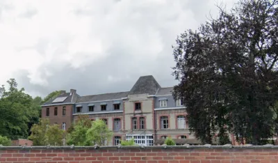
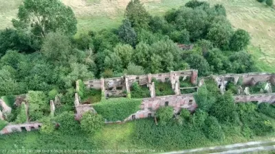
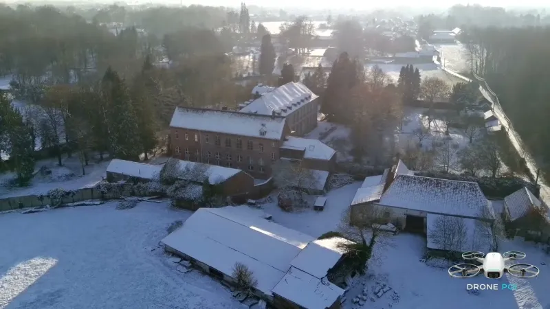
Former abbey of Saulchoir

Automatic translation.

Aviation weather (METAR and TAF)

LFQQ – Lille-Lesquin Airport · 23 km W IFR

METAR

Observed 21/11 08:00 · 33 min ago

METAR LFQQ 210700Z AUTO 00000KT 2900 1000E R26/2200U R08/3600U BR NSC 00/00 Q1018 BECMG CAVOK

Wind
Calm
Visibility
2.9 km
Weather
Mist
Clouds
–
Temperature
0 °C, dew point 0 °C
QNH
1018 hPa
Flight category
IFR: ceiling 500–1,000 ft or visibility 1–3 mi

TAF

Issued 21/11 06:00 · valid from 21/11 07:00 to 22/11 13:00

TAF LFQQ 210500Z 2106/2212 VRB04KT CAVOK PROB40 2106/2108 4000 BR BECMG 2108/2110 17005KT PROB40 2117/2120 4000 BR BKN009 PROB30 2120/2124 BKN013 BECMG 2200/2202 09007KT

Period (local time) Change Wind Visibility Weather Clouds
21/11 07:00 → 21/11 09:00 Initial conditions Variable, 7 km/h 10 km or more No significant weather No significant cloud
21/11 07:00 → 21/11 09:00 probability 40% 4.0 km Mist
21/11 09:00 → 22/11 01:00 Becoming 170°, 9 km/h 10 km or more No significant weather No significant cloud
21/11 18:00 → 21/11 21:00 probability 40% 4.0 km Mist Broken (5-7/8) at 900 ft (270 m)
21/11 21:00 → 22/11 01:00 probability 30% Broken (5-7/8) at 1,300 ft (400 m)
22/11 01:00 → 22/11 13:00 Becoming 090°, 13 km/h 10 km or more No significant weather No significant cloud

Empty cell: no change forecast for that element.

METAR and TAF from NOAA (Aviation Weather Center), for guidance only: they do not replace flight planning with official sources (SIA, Météo-France). Nearest station that issues a METAR, not necessarily the nearest aerodrome.

Plan the light

Weather and Kp index

Loading forecast…

Sunrise and sunset

Local times at the spot (UTC+01:00). The golden hour, the warm, low light sought after for photos and videos, runs from sunrise until the sun reaches 6° above the horizon, and in the evening from 6° until sunset.

Day Dawn Sunrise Golden hour Sunset Dusk Day length
Sat 21 Nov07:34 08:11 08:11–09:05 · 16:00–16:53 16:53 17:308 h 42
Sun 22 Nov07:36 08:13 08:13–09:07 · 15:58–16:52 16:52 17:298 h 39
Mon 23 Nov07:37 08:14 08:14–09:09 · 15:57–16:51 16:51 17:288 h 37
Tue 24 Nov07:39 08:16 08:16–09:10 · 15:56–16:50 16:50 17:288 h 34
Wed 25 Nov07:40 08:17 08:17–09:12 · 15:54–16:50 16:50 17:278 h 32
Thu 26 Nov07:41 08:19 08:19–09:14 · 15:53–16:49 16:49 17:268 h 29
Fri 27 Nov07:43 08:20 08:20–09:16 · 15:52–16:48 16:48 17:258 h 27

Nearby on Wikipedia

  • Abbaye du Saulchoir · 0.1 km away

    L'abbaye du Saulchoir, située à Kain, au nord de la ville de Tournai en Belgique, était un monastère de moniales cisterciennes. Fondée en 1233 à proximité du Melles, sous le nom de Notre-Dame du Sart, elle disparut lors des troubles de la période révolutionnaire (1797) (...)

  • Championnat de Belgique de football D3 1947-1948 · 0.8 km away

    Cette page présente la dix-neuvième édition du championnat de Promotion (D3) belge. Cette saison est la première lors de laquelle le niveau national est disputé en 4 séries de 16 clubs. (...)

  • Stade Luc-Varenne · 0.8 km away

    Le stade Luc-Varenne est un stade situé dans la commune de Tournai. Il est principalement utilisé pour les matchs du RFC Tournai. Il a une capacité de places (dont 2752 assises). Il porte le nom de Luc Varenne en hommage au commentateur sportif de la RTBF d'origine tournaisienne (...)

  • Kain · 1.9 km away

    Kain est une section de la ville belge de Tournai, située en Région wallonne dans la province de Hainaut, proche de la Flandre et de la France. Le village de Kain se situe entre Tournai et le Mont-Saint-Aubert (duquel on peut avoir une vue sur l'entièreté de Kain), sur la rive droite de l'Escaut (...)

  • Gare de Tournai · 1.9 km away

    La gare de Tournai est une gare ferroviaire belge de la ligne 94, de Hal à Froyennes (frontière), située à proximité du centre de la ville de Tournai dans la province de Hainaut en Région wallonne. Elle est mise en service en 1842 (...)

Articles found by GeoNames from the spot's position.

Nearby spots

Reviews

Log in to review this spot. Log in · Create a free account

No reviews yet. Share yours!

Connection to the site lost. Trying again…

The site is not responding. Trying again in seconds.

The site is no longer responding.

The site has been updated. Reloading the page…

This page has expired.

Resuming failed. Please reload the page.

The site is no longer responding.