

The Nez de Jobourg

No reviews yet
Have you flown here? Share your experience with other pilots.
+ Write the first reviewDescription
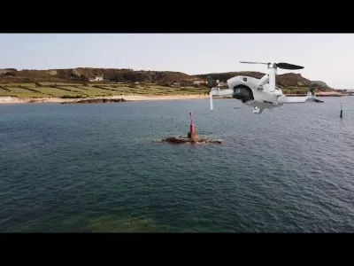
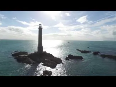
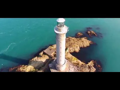
In the fantastic setting of the Cap de la Hague, 128 meters above the sea, rises the Nez de Jobourg. The view stretches as far as the Cap de Flamanville, and in the distance, on the horizon, the island of Alderney stands out. Whether the sun shines, it rains or the wind blows, the spectacle is always a pure and simple encounter with the power of the elements and the beauty of nature. Following the customs officers' path, walkers see nature in all its forms. The landscapes shaped by wind and waves range from dunes to cliffs and from moorland to pebble beaches. Such is the end of the world. This dizzying setting hides the caves of the Lion, the small church and the large church, at the foot of which many ships once ran aground. According to some local legends, they served as a refuge for tobacco smugglers. Higher up, the little village of Jobourg hides away in the depths of the valleys. The hamlets, old stables, bread oven, fountains and old houses with blue slate roofs seem to freeze time. A chameleon of the seasons, the Nez de Jobourg dresses in the yellow of gorse in spring, the purple of heather in summer and the russet of ferns in autumn.
Map and restricted areas
Open in the main mapNearby aerodromes
Open aerodromes within 25 km of the spot, heliports included, with their distance and direction from the spot. Near an aerodrome, drone flying is prohibited or height-limited: check the UAS zones map.
| Aerodrome | Type | Distance | Elevation | Difference |
|---|---|---|---|---|
| Crossma Heliport | Heliport | 2.9 km E | 147 m | spot 147 m lower |
| Aérodrome de Vauville | Aerodrome | 10 km SE | 139 m | spot 139 m lower |
| Flamanville Heliport | Heliport | 17 km S | 82 m | spot 82 m lower |
| Alderney Airport | Airport | 19 km W | 88 m | spot 88 m lower |
| Arsenal-Premar Heliport | Heliport | 22 km E | 8 m | spot 8 m lower |
Aviation weather (METAR and TAF)
EGJA – Alderney Airport VFR
METAR
METAR EGJA 210720Z 15008KT 9999 FEW006 SCT027 11/10 Q1016
- Wind
- 150°, 15 km/h
- Visibility
- 10 km or more
- Clouds
- Few (1-2/8) at 600 ft (180 m) ; Scattered (3-4/8) at 2,700 ft (820 m)
- Temperature
- 11 °C, dew point 10 °C
- QNH
- 1016 hPa
- Flight category
- VFR: ceiling > 3,000 ft and visibility > 5 mi
TAF
Weather and Kp index
Sunrise and sunset
| Day | Dawn | Sunrise | Golden hour | Sunset | Dusk | Day length |
|---|---|---|---|---|---|---|
| Sat 21 Nov | 07:53 | 08:29 | 08:29–09:21 · 16:26–17:18 | 17:18 | 17:54 | 8 h 49 |
| Sun 22 Nov | 07:54 | 08:30 | 08:30–09:23 · 16:25–17:17 | 17:17 | 17:53 | 8 h 46 |
| Mon 23 Nov | 07:56 | 08:32 | 08:32–09:25 · 16:24–17:16 | 17:16 | 17:53 | 8 h 44 |
| Tue 24 Nov | 07:57 | 08:33 | 08:33–09:26 · 16:23–17:16 | 17:16 | 17:52 | 8 h 42 |
| Wed 25 Nov | 07:59 | 08:35 | 08:35–09:28 · 16:21–17:15 | 17:15 | 17:51 | 8 h 39 |
| Thu 26 Nov | 08:00 | 08:36 | 08:36–09:30 · 16:20–17:14 | 17:14 | 17:50 | 8 h 37 |
| Fri 27 Nov | 08:01 | 08:38 | 08:38–09:31 · 16:19–17:13 | 17:13 | 17:50 | 8 h 35 |



Reviews
Log in to review this spot. Log in · Create a free account
No reviews yet. Share yours!