

The bay of Quervière

No reviews yet
Have you flown here? Share your experience with other pilots.
+ Write the first reviewDescription
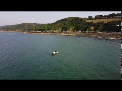
Nestled between cliffs and hedgerow farmland, the bay of Quervière offers a haven of tranquility and wild beauty on the La Hague coast. Far from the hustle and bustle, this unspoiled site appeals to lovers of nature and authentic landscapes, inviting contemplation and discovery. The bay of Quervière, in the commune of La Hague, is a true natural gem of the Cotentin, renowned for its wild, unspoiled landscapes. Lined with pebbles and small green rocky headlands, the bay offers a striking contrast between the turquoise waters and the autumn colors of the surrounding Norman hedgerow farmland. It can be reached by a picturesque path, the GR 223, which runs along the coast and lets you discover the ecological and scenic richness of the region.
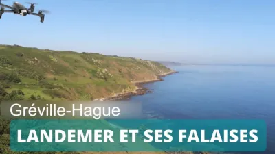
The site is an excellent starting point for hikers wishing to explore the coastline, with routes leading to Landemer or Omonville-la-Rogue. The nearby parking lot makes access easy, although in high season it is quickly taken over by visitors coming to enjoy the peace and beauty of the place.
Beyond its scenic appeal, the bay of Quervière is also appreciated by nature lovers for its biodiversity. The surrounding cliffs and moorland are home to a variety of wildlife, including many species of seabirds and land birds. The mix of elements – rough sea, steep cliffs, hedgerow farmland and ponds – creates a rich and fragile ecosystem, ideal for nature observation.
The neighboring village of Omonville-la-Rogue, reachable by a pleasant hike from the bay, completes this discovery with its authentic charm and picturesque harbor. This area, sometimes nicknamed the "little Ireland" of the Cotentin, appeals with its wild character and breathtaking panoramas.
For boaters, the bay of Quervière also offers a popular anchorage, well sheltered and ideal for discovering the coast from the sea. Wind and current conditions must be taken into account, but the setting remains exceptional.
In short, the bay of Quervière is a must-visit destination for anyone who wants to immerse themselves in the unspoiled nature of the Cap de la Hague, with hiking, nature discovery and relaxing moments by the water.
Map and restricted areas
Open in the main mapNearby aerodromes
Open aerodromes within 25 km of the spot, heliports included, with their distance and direction from the spot. Near an aerodrome, drone flying is prohibited or height-limited: check the UAS zones map.
| Aerodrome | Type | Distance | Elevation | Difference |
|---|---|---|---|---|
| Crossma Heliport | Heliport | 6.5 km W | 147 m | spot 147 m lower |
| Aérodrome de Vauville | Aerodrome | 7.9 km S | 139 m | spot 139 m lower |
| Arsenal-Premar Heliport | Heliport | 14 km E | 8 m | spot 8 m lower |
| Centre Hospitalier Heliport | Heliport | 16 km E | 19 m | spot 19 m lower |
| Flamanville Heliport | Heliport | 18 km S | 82 m | spot 82 m lower |
Aviation weather (METAR and TAF)
LFRC – Cherbourg-Maupertus Airport MVFR
METAR
METAR LFRC 210630Z AUTO 18006KT 7000 NSC 05/05 Q1016 TEMPO 0300 FG VV///
- Wind
- 180°, 11 km/h
- Visibility
- 7 km
- Clouds
- –
- Temperature
- 5 °C, dew point 5 °C
- QNH
- 1016 hPa
- Flight category
- MVFR: ceiling 1,000–3,000 ft or visibility 3–5 mi
TAF
TAF LFRC 210500Z 2106/2115 VRB05KT 9999 SCT020 BECMG 2106/2108 15010KT 3000 BR BKN003 PROB40 TEMPO 2106/2110 0300 FG VV/// BECMG 2110/2112 9999 NSW BECMG 2113/2115 BKN006
| Period (local time) | Change | Wind | Visibility | Weather | Clouds |
|---|---|---|---|---|---|
| 21/11 07:00 → 21/11 16:00 | Initial conditions | Variable, 9 km/h | 10 km or more | Scattered (3-4/8) at 2,000 ft (610 m) | |
| 21/11 07:00 → 21/11 11:00 | Becoming | 150°, 19 km/h | 3.0 km | Mist | Broken (5-7/8) at 300 ft (90 m) |
| 21/11 07:00 → 21/11 11:00 | Temporarily, probability 40% | 300 m | Fog | ||
| 21/11 11:00 → 21/11 14:00 | Becoming | 150°, 19 km/h | 10 km or more | No significant weather | Broken (5-7/8) at 300 ft (90 m) |
| 21/11 14:00 → 21/11 16:00 | Becoming | 150°, 19 km/h | 10 km or more | No significant weather | Broken (5-7/8) at 600 ft (180 m) |
Weather and Kp index
Sunrise and sunset
| Day | Dawn | Sunrise | Golden hour | Sunset | Dusk | Day length |
|---|---|---|---|---|---|---|
| Sat 21 Nov | 07:53 | 08:28 | 08:28–09:21 · 16:26–17:18 | 17:18 | 17:54 | 8 h 49 |
| Sun 22 Nov | 07:54 | 08:30 | 08:30–09:23 · 16:24–17:17 | 17:17 | 17:53 | 8 h 46 |
| Mon 23 Nov | 07:55 | 08:31 | 08:31–09:24 · 16:23–17:16 | 17:16 | 17:52 | 8 h 44 |
| Tue 24 Nov | 07:57 | 08:33 | 08:33–09:26 · 16:22–17:15 | 17:15 | 17:51 | 8 h 42 |
| Wed 25 Nov | 07:58 | 08:34 | 08:34–09:28 · 16:21–17:14 | 17:14 | 17:50 | 8 h 39 |
| Thu 26 Nov | 07:59 | 08:36 | 08:36–09:29 · 16:20–17:13 | 17:13 | 17:50 | 8 h 37 |
| Fri 27 Nov | 08:01 | 08:37 | 08:37–09:31 · 16:19–17:13 | 17:13 | 17:49 | 8 h 35 |



Reviews
Log in to review this spot. Log in · Create a free account
No reviews yet. Share yours!