

Mont-Dauphin
No reviews yet
Have you flown here? Share your experience with other pilots.
+ Write the first reviewDescription
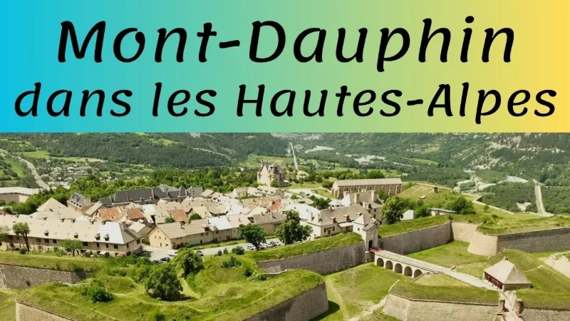
To prevent any invasion from Italy, Vauban decided to build an extraordinary fortress from scratch on a bare plateau at 1050 meters, overlooking the confluence of the Guil and the Durance.
Mont-Dauphin, designed as a modern garrison town, was meant to house 2000 soldiers and as many inhabitants.
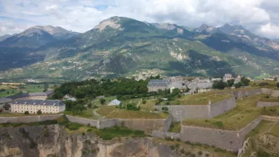
A remarkable and fully preserved ensemble, Mont-Dauphin is the archetype of the mountain fortress, with its arsenal, its two powder magazines, its barracks along the rampart and its church, which was left unfinished.
Map and restricted areas
Open in the main mapNearby aerodromes
Open aerodromes within 25 km of the spot, heliports included, with their distance and direction from the spot. Near an aerodrome, drone flying is prohibited or height-limited: check the UAS zones map.
| Aerodrome | Type | Distance | Elevation | Difference |
|---|---|---|---|---|
| Mont-Dauphin - St-Crépin Airfield | Aerodrome | 4.3 km NW | 903 m | spot 72 m higher |
| Vars Helistrip | Heliport | 15 km S | 2,163 m | spot 1,188 m lower |
Aviation weather (METAR and TAF)
No METAR station within 50 km.
Weather and Kp index
Sunrise and sunset
| Day | Dawn | Sunrise | Golden hour | Sunset | Dusk | Day length |
|---|---|---|---|---|---|---|
| Sat 21 Nov | 07:06 | 07:38 | 07:38–08:23 · 16:15–17:01 | 17:01 | 17:33 | 9 h 22 |
| Sun 22 Nov | 07:07 | 07:39 | 07:39–08:25 · 16:14–17:00 | 17:00 | 17:32 | 9 h 20 |
| Mon 23 Nov | 07:09 | 07:41 | 07:41–08:26 · 16:13–16:59 | 16:59 | 17:31 | 9 h 18 |
| Tue 24 Nov | 07:10 | 07:42 | 07:42–08:28 · 16:13–16:58 | 16:58 | 17:31 | 9 h 16 |
| Wed 25 Nov | 07:11 | 07:43 | 07:43–08:29 · 16:12–16:58 | 16:58 | 17:30 | 9 h 14 |
| Thu 26 Nov | 07:12 | 07:44 | 07:44–08:31 · 16:11–16:57 | 16:57 | 17:30 | 9 h 12 |
| Fri 27 Nov | 07:13 | 07:46 | 07:46–08:32 · 16:10–16:57 | 16:57 | 17:29 | 9 h 11 |




Reviews
Log in to review this spot. Log in · Create a free account
No reviews yet. Share yours!