

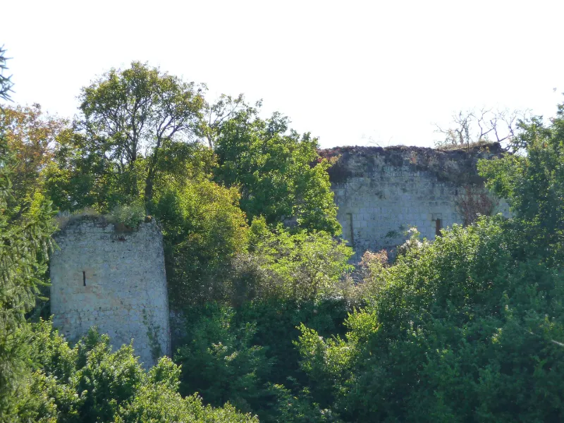
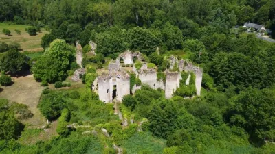
Castle Remains
No reviews yet
Have you flown here? Share your experience with other pilots.
+ Write the first reviewHistory
A la fin du 10e siècle, Foulques Nerra fit élever un donjon de bois. Au 12e siècle fut bâti un donjon carré dont la protection fut accrue par une large tranchée, isolant le rocher de base qui fut alors complètement entouré par l'étang. Au 14e siècle, le donjon fut renforcé par une double enceinte dont l'accès devait se faire par un pont en bois fortifié. Au début du 16e siècle, Jacques de Beaune fit réparer les enceintes et le pont, et élever des bâtiments entre le donjon et la deuxième enceinte. Il bâtit un logis seigneurial et une chapelle à l'est de l'étang.£La première enceinte pentagonale est flanquée de quatre tours rondes et d'un bastion. L'accès se faisait par le pont de la courtine nord, la seule subsistante. La seconde enceinte épouse les formes du rocher et est flanquée de cinq tours dont restent celles du nord et du sud. Celle de l'ouest fut remplacée par un gros contrefort sans doute au début du 16e siècle. Des logis ne subsistent que des pans de murs. Du donjon carré subsistent le rez-de-chausssée et le premier étage.
Map and restricted areas
Open in the main mapRestricted zones
Nearby aerodromes
Open aerodromes within 25 km of the spot, heliports included, with their distance and direction from the spot. Near an aerodrome, drone flying is prohibited or height-limited: check the UAS zones map.
| Aerodrome | Type | Distance | Elevation |
|---|---|---|---|
| Tours-Val-de-Loire Airport | Airport | 13 km SE | 109 m |
| Trousseau Chu Heliport | Heliport | 19 km SE | 84 m |
Aviation weather (METAR and TAF)
No METAR station within 50 km.
Weather and Kp index
Sunrise and sunset
| Day | Dawn | Sunrise | Golden hour | Sunset | Dusk | Day length |
|---|---|---|---|---|---|---|
| Tue 17 Nov | 07:32 | 08:05 | 08:05–08:53 · 16:32–17:20 | 17:20 | 17:53 | 9 h 14 |
| Wed 18 Nov | 07:33 | 08:07 | 08:07–08:55 · 16:30–17:19 | 17:19 | 17:52 | 9 h 11 |
| Thu 19 Nov | 07:35 | 08:08 | 08:08–08:57 · 16:29–17:18 | 17:18 | 17:52 | 9 h 09 |
| Fri 20 Nov | 07:36 | 08:10 | 08:10–08:58 · 16:28–17:17 | 17:17 | 17:51 | 9 h 07 |
| Sat 21 Nov | 07:37 | 08:11 | 08:11–09:00 · 16:27–17:16 | 17:16 | 17:50 | 9 h 04 |
| Sun 22 Nov | 07:38 | 08:13 | 08:13–09:02 · 16:26–17:15 | 17:15 | 17:49 | 9 h 02 |
| Mon 23 Nov | 07:40 | 08:14 | 08:14–09:03 · 16:25–17:14 | 17:14 | 17:48 | 9 h 00 |
Reviews (0)
Log in to review this spot. Log in · Create a free account
No reviews yet. Share yours!