

Tourist site
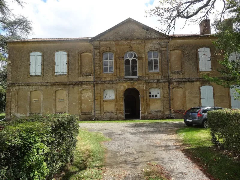
Former Cistercian Abbey
No reviews yet
Have you flown here? Share your experience with other pilots.
+ Write the first reviewHistory
4e quart 12e siècle ; 18e siècle La chapelle date de la fin du 12e siècle. Les trois travées sont voûtées sur ogives toriques qui retombent sur de petites colonnes jumelles engagées. Les chapiteaux sont ornés de volutes. L'escalier qui se développe à l'ouest de cette chapelle se trouve au centre d'une aile du 18e siècle. Il possède une rampe en fer forgé qui porte un écu d'abbé. De petites voûtes plates existent sous les paliers d'angle.
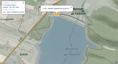
Map and restricted areas
Open in the main mapRestricted zones
| Zone | Category | Limits | Conditions |
|---|---|---|---|
| Voltac Pau Ne | Entrainement Militaire | 0 m above ground level → 15241 m above ground level | Pilotage de drones en vue directe : les aéronefs dont la masse est supérieure à 900 grammes sont soumis à notification préalable selon des modalités publiées sur le site www.ecologie.gouv.fr |
| R 46 G | Zone réglementée | 244 m above ground level → 762 m above sea level | Vols interdits sauf lorsque the official document of the zone l'autorise explicitement ou avec l'accord du gestionnaire de la zone lorsqu'il est désigné par the official document of the zone |
| Zrt Lima 1 | ZRT | FL 195 / FL 285 | SUP AIP 219/26 · Du mardi 20 octobre au jeudi 22 octobre 2026 |
Nearby aerodromes
Open aerodromes within 25 km of the spot, heliports included, with their distance and direction from the spot. Near an aerodrome, drone flying is prohibited or height-limited: check the UAS zones map.
| Aerodrome | Type | Distance | Elevation |
|---|---|---|---|
| Base ULM de Fontrailles | Aerodrome | 15 km S | 274 m |
| Sadournin Airfield | Aerodrome | 17 km S | 280 m |
| Chélan | Aerodrome | 18 km SE | 264 m |
| Centre Hospitalier Heliport | Heliport | 21 km NE | 182 m |
| Castelnau Magnoac Airport | Aerodrome | 24 km S | 300 m |
Aviation weather (METAR and TAF)
No METAR station within 50 km.
Weather and Kp index
Sunrise and sunset
| Day | Dawn | Sunrise | Golden hour | Sunset | Dusk | Day length |
|---|---|---|---|---|---|---|
| Tue 17 Nov | 07:24 | 07:55 | 07:55–08:38 · 16:49–17:32 | 17:32 | 18:03 | 9 h 37 |
| Wed 18 Nov | 07:25 | 07:56 | 07:56–08:39 · 16:48–17:31 | 17:31 | 18:02 | 9 h 35 |
| Thu 19 Nov | 07:26 | 07:57 | 07:57–08:41 · 16:47–17:30 | 17:30 | 18:01 | 9 h 33 |
| Fri 20 Nov | 07:27 | 07:58 | 07:58–08:42 · 16:46–17:30 | 17:30 | 18:01 | 9 h 31 |
| Sat 21 Nov | 07:28 | 08:00 | 08:00–08:44 · 16:45–17:29 | 17:29 | 18:00 | 9 h 29 |
| Sun 22 Nov | 07:30 | 08:01 | 08:01–08:45 · 16:44–17:28 | 17:28 | 17:59 | 9 h 27 |
| Mon 23 Nov | 07:31 | 08:02 | 08:02–08:46 · 16:43–17:27 | 17:27 | 17:59 | 9 h 25 |


Reviews (0)
Log in to review this spot. Log in · Create a free account
No reviews yet. Share yours!