

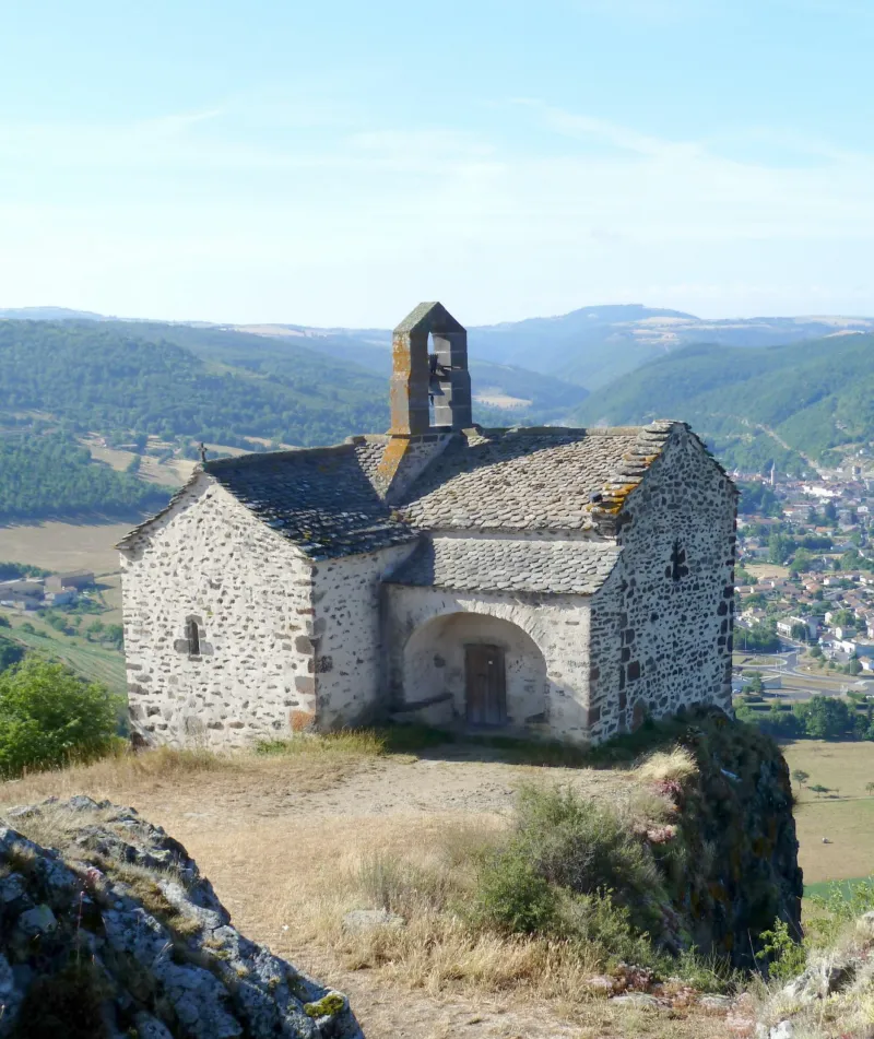
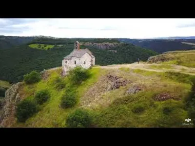
Sainte-Madeleine de Chalet Pilgrimage Chapel
No reviews yet
Have you flown here? Share your experience with other pilots.
+ Write the first reviewHistory
12e siècle ; 13e siècle ; 14e siècle Chapelle de pélerinage édifiée au 12e siècle, au départ chapelle castrale de la forteresse. La chapelle latérale sud daterait du 13e siècle et la nord du 14e. La partie romane comprend une nef voûtée en berceau séparée du sanctuaire par un arc triomphal. Le sanctuaire se compose d'un choeur et d'une abside ronde voûtée en cul-de-four et surélevée de deux marches. Des sondages ont révélé la présence de peintures sous les enduits.
Map and restricted areas
Open in the main mapRestricted zones
| Zone | Category | Limits | Conditions |
|---|---|---|---|
| SETBA Secteur ARDÈCHE | Entrainement Militaire | 0 m above ground level → 15241 m above ground level | Pilotage de drones en vue directe : les aéronefs dont la masse est supérieure à 900 grammes sont soumis à notification préalable selon des modalités publiées sur le site www.ecologie.gouv.fr |
| Zrt Echo Low | ZRT | From the ground up to about 4,100 m above sea level | SUP AIP 219/26 · Du mardi 20 octobre au jeudi 22 octobre 2026 |
Nearby aerodromes
Open aerodromes within 25 km of the spot, heliports included, with their distance and direction from the spot. Near an aerodrome, drone flying is prohibited or height-limited: check the UAS zones map.
| Aerodrome | Type | Distance | Elevation |
|---|---|---|---|
| Brioude Beaumont Airport | Aerodrome | 14 km NE | 452 m |
Aviation weather (METAR and TAF)
LFHP – Le Puy-Loudes Airfield VFR
METAR
METAR LFHP 171330Z AUTO 25016G26KT 210V270 CAVOK 14/08 Q1002
- Wind
- 250°, 30 km/h, gusts 48 km/h
- Visibility
- 10 km or more
- Clouds
- –
- Temperature
- 14 °C, dew point 8 °C
- QNH
- 1002 hPa
- Flight category
- VFR: ceiling > 3,000 ft and visibility > 5 mi
TAF
Weather and Kp index
| Day | Weather | Temp. min. / max. | Wind | Rain | Max Kp |
|---|---|---|---|---|---|
| Tue 17 Nov | Cloudy | 12° / 14° | 39 km/h SW | 1.1 mm | 5 |
| Wed 18 Nov | Light rain | 10° / 12° | 31 km/h SW | 11 mm | 5 |
| Thu 19 Nov | Showers | 8° / 11° | 42 km/h W | 15 mm | 3 |
| Fri 20 Nov | Showers | 8° / 11° | 35 km/h SW | 1.7 mm | 3 |
| Sat 21 Nov | Partly cloudy | 8° / 13° | 8 km/h SW | 0.4 mm | – |
| Sun 22 Nov | Showers | 8° / 11° | 23 km/h W | 7.4 mm | – |
| Mon 23 Nov | Partly cloudy | 5° / 11° | 11 km/h W | 0.3 mm | – |
Hour by hour: Tuesday 17 November
| Time | Weather | Temp. | Wind | Rain | Clouds | Kp |
|---|---|---|---|---|---|---|
| 15:00 | Cloudy | 14° | 30 km/h SW | – | 88 % | 4 |
| 16:00 | Partly cloudy | 14° | 32 km/h SW | – | 82 % | 4 |
| 17:00 | Cloudy | 12° | 30 km/h SW | – | 91 % | 4 |
| 18:00 | Cloudy | 12° | 30 km/h SW | – | 98 % | 4 |
| 19:00 | Cloudy | 12° | 32 km/h SW | – | 100 % | 5 |
| 20:00 | Partly cloudy | 12° | 38 km/h SW | – | 84 % | 5 |
| 21:00 | Cloudy | 12° | 39 km/h SW | – | 100 % | 5 |
| 22:00 | Light rain | 12° | 37 km/h SW | 0.4 mm | 100 % | 5 |
Hour by hour: Wednesday 18 November
| Time | Weather | Temp. | Wind | Rain | Clouds | Kp |
|---|---|---|---|---|---|---|
| 06:00 | Rain | 11° | 25 km/h SW | 0.4 mm | 97 % | 4 |
| 07:00 | Partly cloudy | 11° | 28 km/h SW | – | 86 % | 4 |
| 08:00 | Showers | 10° | 28 km/h W | 0.2 mm | 73 % | 4 |
| 09:00 | Showers | 11° | 29 km/h W | 0.1 mm | 77 % | 4 |
| 10:00 | Light rain | 12° | 30 km/h SW | 0.2 mm | 91 % | 4 |
| 11:00 | Showers | 12° | 30 km/h W | 0.5 mm | 59 % | 4 |
| 12:00 | Showers | 12° | 28 km/h W | 0.3 mm | 75 % | 4 |
| 13:00 | Light rain | 12° | 27 km/h W | 0.3 mm | 88 % | 3 |
| 14:00 | Light rain | 12° | 26 km/h W | 0.4 mm | 89 % | 3 |
| 15:00 | Light rain | 12° | 26 km/h SW | 0.3 mm | 98 % | 3 |
| 16:00 | Light rain | 11° | 26 km/h SW | 0.2 mm | 94 % | 3 |
| 17:00 | Cloudy | 10° | 29 km/h W | – | 98 % | 3 |
| 18:00 | Partly cloudy | 10° | 29 km/h SW | – | 81 % | 3 |
| 19:00 | Partly cloudy | 10° | 28 km/h SW | – | 68 % | 2 |
| 20:00 | Partly cloudy | 10° | 27 km/h SW | – | 77 % | 2 |
| 21:00 | Cloudy | 10° | 24 km/h SW | – | 98 % | 2 |
| 22:00 | Light rain | 10° | 23 km/h SW | 0.1 mm | 99 % | 2 |
Sunrise and sunset
| Day | Dawn | Sunrise | Golden hour | Sunset | Dusk | Day length |
|---|---|---|---|---|---|---|
| Tue 17 Nov | 07:16 | 07:48 | 07:48–08:34 · 16:31–17:16 | 17:16 | 17:48 | 9 h 27 |
| Wed 18 Nov | 07:18 | 07:50 | 07:50–08:35 · 16:30–17:15 | 17:15 | 17:47 | 9 h 25 |
| Thu 19 Nov | 07:19 | 07:51 | 07:51–08:37 · 16:28–17:14 | 17:14 | 17:46 | 9 h 23 |
| Fri 20 Nov | 07:20 | 07:52 | 07:52–08:38 · 16:27–17:13 | 17:13 | 17:46 | 9 h 21 |
| Sat 21 Nov | 07:21 | 07:54 | 07:54–08:40 · 16:26–17:13 | 17:13 | 17:45 | 9 h 18 |
| Sun 22 Nov | 07:22 | 07:55 | 07:55–08:41 · 16:25–17:12 | 17:12 | 17:44 | 9 h 16 |
| Mon 23 Nov | 07:24 | 07:56 | 07:56–08:43 · 16:25–17:11 | 17:11 | 17:43 | 9 h 14 |

Reviews (0)
Log in to review this spot. Log in · Create a free account
No reviews yet. Share yours!