

Tourist site
La Chau Tumuli
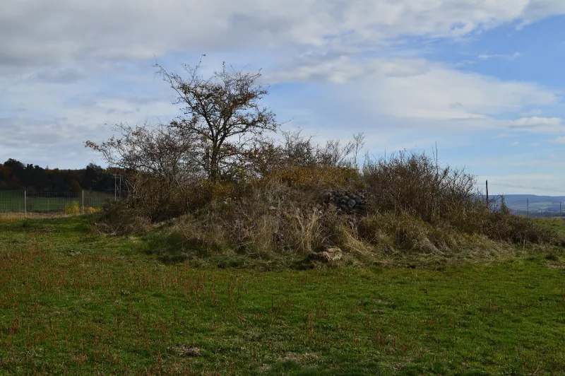
No reviews yet
Have you flown here? Share your experience with other pilots.
+ Write the first reviewHistory
Protohistoire
Map and restricted areas
Open in the main mapRestricted zones
| Zone | Category | Limits | Conditions |
|---|---|---|---|
| SETBA Secteur ARDÈCHE | Entrainement Militaire | 0 m above ground level → 15241 m above ground level | Pilotage de drones en vue directe : les aéronefs dont la masse est supérieure à 900 grammes sont soumis à notification préalable selon des modalités publiées sur le site www.ecologie.gouv.fr |
| Zrt Echo Low | ZRT | From the ground up to about 4,100 m above sea level | SUP AIP 219/26 · Du mardi 20 octobre au jeudi 22 octobre 2026 |
| Zrt Echo | ZRT | FL 195 / FL 235 | SUP AIP 219/26 · Du mardi 20 octobre au jeudi 22 octobre 2026 |
Nearby aerodromes
Open aerodromes within 25 km of the spot, heliports included, with their distance and direction from the spot. Near an aerodrome, drone flying is prohibited or height-limited: check the UAS zones map.
| Aerodrome | Type | Distance | Elevation |
|---|---|---|---|
| Saint-Flour-Coltines Airport | Aerodrome | 10 km W | 981 m |
| Altisurface de La Taillade | Aerodrome | 21 km SW | 888 m |
Aviation weather (METAR and TAF)
No METAR station within 50 km.
Weather and Kp index
Sunrise and sunset
| Day | Dawn | Sunrise | Golden hour | Sunset | Dusk | Day length |
|---|---|---|---|---|---|---|
| Tue 17 Nov | 07:16 | 07:48 | 07:48–08:33 · 16:32–17:17 | 17:17 | 17:49 | 9 h 28 |
| Wed 18 Nov | 07:17 | 07:49 | 07:49–08:35 · 16:31–17:16 | 17:16 | 17:48 | 9 h 26 |
| Thu 19 Nov | 07:19 | 07:51 | 07:51–08:36 · 16:30–17:15 | 17:15 | 17:47 | 9 h 24 |
| Fri 20 Nov | 07:20 | 07:52 | 07:52–08:38 · 16:29–17:14 | 17:14 | 17:46 | 9 h 22 |
| Sat 21 Nov | 07:21 | 07:53 | 07:53–08:39 · 16:28–17:14 | 17:14 | 17:46 | 9 h 20 |
| Sun 22 Nov | 07:22 | 07:55 | 07:55–08:41 · 16:27–17:13 | 17:13 | 17:45 | 9 h 18 |
| Mon 23 Nov | 07:23 | 07:56 | 07:56–08:42 · 16:26–17:12 | 17:12 | 17:44 | 9 h 16 |

Reviews (0)
Log in to review this spot. Log in · Create a free account
No reviews yet. Share yours!