

Saint-Roman d'Aiguille Archaeological Site
No reviews yet
Have you flown here? Share your experience with other pilots.
+ Write the first reviewHistory
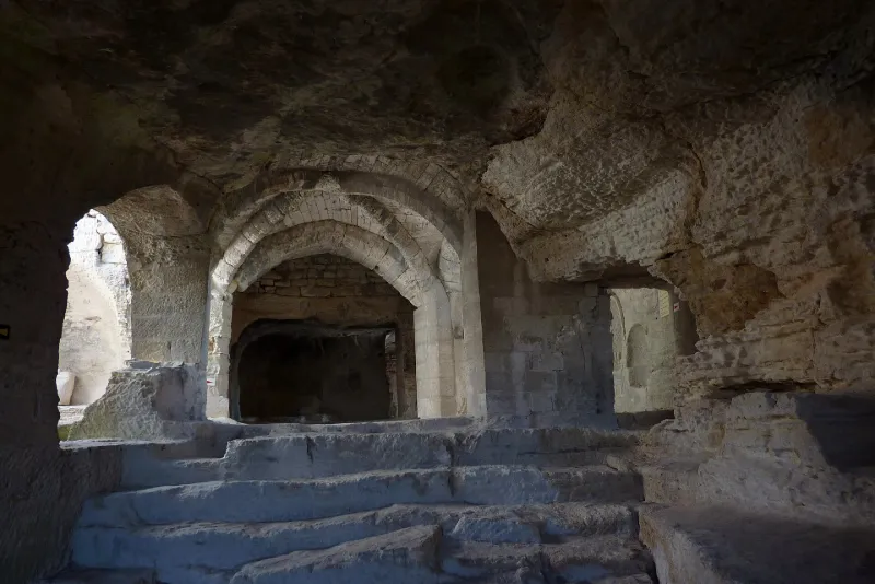
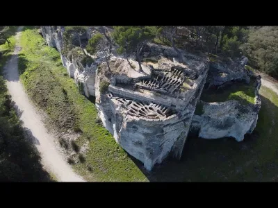
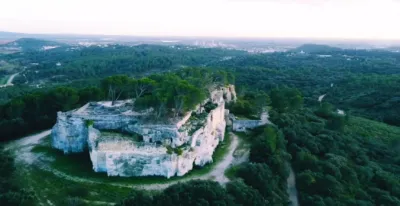
Le plus ancien document trouvé sur le site de l'abbaye est une monnaie du 4e siècle après J-C. Le premier document sur l'histoire de l'abbaye relate l'inféodation de Saint-Roman à l'abbaye de Psalmodi en 1102 par l'archevêque d'Arles Gibelin. Elle devient alors prieuré. En 1360, le pape Urbain V y créé un collège de clercs. En 1537, Saint-Roman est sécularisée en même temps que Psalmodi par une bulle de Paul III. Les religieux abandonnent le monastère. En 1538, François de Conseil échange l'abbaye contre sa maison d'Aigues-Mortes, transformant Saint-Roman en forteresse. Au début du 16e siècle, un château est bâti sur la terrasse supérieure, ainsi qu'un mur d'enceinte inférieur et une barbacane d'entrée. Les matériaux de l'abbaye sont utilisés pour ces constructions. En 1789, la toiture est vendue comme bien national. En 1850, le dernier propriétaire fait abattre ce qui reste du château pour ne pas avoir à payer d'impôts. ££Le site comprend deux parties. Une partie basse avec des vestiges du château (barbacane, poterne, mur) et ceux de l'abbaye, ces derniers étant troglodytiques (cellules de moines ; cavité voûtée ; chapelle ; chaise abbatiale creusée dans la paroi avec décor sculpté et traces de peintures du 9e siècle ; bas-côté nord avec enfeux et tombes ; silos à vivres ; cave à vin). La terrasse supérieure divisée en deux par une profonde entaille. Elle est entièrement recouverte de tombes creusées dans le roc. La plupart ont été comblées lors de la construction du château. Un système de collecte des eaux de pluie avec bassin de décantation, rigoles, citernes, palliait l'absence de source ou de puits dans la partie nord-est et surtout dans la partie basse.
Map and restricted areas
Open in the main mapRestricted zones
| Zone | Category | Limits | Conditions |
|---|---|---|---|
| Istres | Zone réglementée | 5491 m above sea level → 30766 m above sea level | Vols interdits sauf lorsque the official document of the zone l'autorise explicitement ou avec l'accord du gestionnaire de la zone lorsqu'il est désigné par the official document of the zone |
| Istres | Zone réglementée | 5491 m above sea level → 30766 m above sea level | Vols interdits sauf lorsque the official document of the zone l'autorise explicitement ou avec l'accord du gestionnaire de la zone lorsqu'il est désigné par the official document of the zone |
Nearby aerodromes
Open aerodromes within 25 km of the spot, heliports included, with their distance and direction from the spot. Near an aerodrome, drone flying is prohibited or height-limited: check the UAS zones map.
| Aerodrome | Type | Distance | Elevation |
|---|---|---|---|
| Nîmes Courbessac Airport | Aerodrome | 16 km W | 60 m |
| Centre Hospitalier Heliport | Heliport | 18 km NE | 21 m |
| Nîmes-Arles-Camargue Airport | Airport | 18 km SW | 94 m |
| Aérodrome d'Avignon-Pujaut | Aerodrome | 21 km NE | 45 m |
| Le Mazet De Romanin Airfield | Aerodrome | 24 km E | 118 m |
Aviation weather (METAR and TAF)
LFTW – Nîmes-Arles-Camargue Airport VFR
METAR
METAR LFTW 171330Z AUTO 17003KT 130V230 CAVOK 14/12 Q1003 TEMPO 4000 SHRA SCT070TCU
- Wind
- 170°, 6 km/h
- Visibility
- 10 km or more
- Clouds
- –
- Temperature
- 14 °C, dew point 12 °C
- QNH
- 1003 hPa
- Flight category
- VFR: ceiling > 3,000 ft and visibility > 5 mi
TAF
TAF LFTW 170800Z 1709/1809 03005KT 9999 SCT013 PROB40 TEMPO 1709/1719 BKN006 PROB40 TEMPO 1711/1717 4000 SHRA SCT070TCU BECMG 1716/1718 23010KT
| Period (local time) | Change | Wind | Visibility | Weather | Clouds |
|---|---|---|---|---|---|
| 17/11 10:00 → 17/11 17:00 | Initial conditions | 030°, 9 km/h | 10 km or more | Scattered (3-4/8) at 1,300 ft (400 m) | |
| 17/11 10:00 → 17/11 20:00 | Temporarily, probability 40% | Broken (5-7/8) at 600 ft (180 m) | |||
| 17/11 12:00 → 17/11 18:00 | Temporarily, probability 40% | 4.0 km | Showers of rain | Scattered (3-4/8) at 7,000 ft (2130 m) (towering cumulus) | |
| 17/11 17:00 → 18/11 10:00 | Becoming | 230°, 19 km/h | 10 km or more | Scattered (3-4/8) at 1,300 ft (400 m) |
Weather and Kp index
| Day | Weather | Temp. min. / max. | Wind | Rain | Max Kp |
|---|---|---|---|---|---|
| Tue 17 Nov | Rain | 13° / 16° | 16 km/h S | 5.3 mm | 5 |
| Wed 18 Nov | Fair | 12° / 18° | 18 km/h W | – | 5 |
| Thu 19 Nov | Fair | 11° / 17° | 26 km/h W | 11 mm | 3 |
| Fri 20 Nov | Fair | 11° / 15° | 18 km/h SW | – | 3 |
| Sat 21 Nov | Cloudy | 9° / 16° | 10 km/h W | 0.6 mm | – |
| Sun 22 Nov | Clear sky | 12° / 17° | 15 km/h W | 3.2 mm | – |
| Mon 23 Nov | Partly cloudy | 9° / 15° | 17 km/h W | – | – |
Hour by hour: Tuesday 17 November
| Time | Weather | Temp. | Wind | Rain | Clouds | Kp |
|---|---|---|---|---|---|---|
| 15:00 | Rain | 16° | 8 km/h SW | 0.4 mm | 100 % | 4 |
| 16:00 | Rain | 15° | 16 km/h S | 0.9 mm | 100 % | 4 |
| 17:00 | Rain | 14° | 11 km/h S | 0.6 mm | 98 % | 4 |
| 18:00 | Light rain | 14° | 9 km/h S | 0.1 mm | 100 % | 4 |
| 19:00 | Heavy rain | 14° | 10 km/h S | 1.0 mm | 98 % | 5 |
| 20:00 | Heavy rain | 14° | 8 km/h S | 1.2 mm | 100 % | 5 |
| 21:00 | Rain | 13° | 7 km/h SW | 0.7 mm | 100 % | 5 |
| 22:00 | Light rain | 14° | 7 km/h S | 0.4 mm | 100 % | 5 |
Hour by hour: Wednesday 18 November
| Time | Weather | Temp. | Wind | Rain | Clouds | Kp |
|---|---|---|---|---|---|---|
| 06:00 | Partly cloudy | 13° | 14 km/h SW | – | 79 % | 4 |
| 07:00 | Cloudy | 13° | 15 km/h SW | – | 100 % | 4 |
| 08:00 | Fair | 14° | 15 km/h SW | – | 34 % | 4 |
| 09:00 | Partly cloudy | 15° | 17 km/h SW | – | 82 % | 4 |
| 10:00 | Fair | 16° | 18 km/h W | – | 35 % | 4 |
| 11:00 | Partly cloudy | 18° | 17 km/h W | – | 48 % | 4 |
| 12:00 | Partly cloudy | 18° | 17 km/h W | – | 62 % | 4 |
| 13:00 | Fair | 18° | 17 km/h SW | – | 34 % | 3 |
| 14:00 | Clear sky | 18° | 17 km/h W | – | 1 % | 3 |
| 15:00 | Clear sky | 18° | 18 km/h W | – | 5 % | 3 |
| 16:00 | Clear sky | 17° | 16 km/h W | – | 7 % | 3 |
| 17:00 | Clear sky | 16° | 13 km/h W | – | 8 % | 3 |
| 18:00 | Partly cloudy | 15° | 13 km/h W | – | 38 % | 3 |
| 19:00 | Partly cloudy | 14° | 11 km/h W | – | 91 % | 2 |
| 20:00 | Partly cloudy | 13° | 11 km/h SW | – | 88 % | 2 |
| 21:00 | Partly cloudy | 12° | 10 km/h SW | – | 70 % | 2 |
| 22:00 | Partly cloudy | 12° | 9 km/h S | – | 92 % | 2 |
Sunrise and sunset
| Day | Dawn | Sunrise | Golden hour | Sunset | Dusk | Day length |
|---|---|---|---|---|---|---|
| Tue 17 Nov | 07:08 | 07:39 | 07:39–08:23 · 16:31–17:14 | 17:14 | 17:45 | 9 h 35 |
| Wed 18 Nov | 07:09 | 07:40 | 07:40–08:24 · 16:29–17:13 | 17:13 | 17:45 | 9 h 33 |
| Thu 19 Nov | 07:10 | 07:41 | 07:41–08:25 · 16:28–17:13 | 17:13 | 17:44 | 9 h 31 |
| Fri 20 Nov | 07:11 | 07:42 | 07:42–08:27 · 16:28–17:12 | 17:12 | 17:43 | 9 h 29 |
| Sat 21 Nov | 07:12 | 07:44 | 07:44–08:28 · 16:27–17:11 | 17:11 | 17:42 | 9 h 27 |
| Sun 22 Nov | 07:13 | 07:45 | 07:45–08:30 · 16:26–17:10 | 17:10 | 17:42 | 9 h 25 |
| Mon 23 Nov | 07:15 | 07:46 | 07:46–08:31 · 16:25–17:10 | 17:10 | 17:41 | 9 h 23 |


Reviews (0)
Log in to review this spot. Log in · Create a free account
No reviews yet. Share yours!