

Saint-Roman Abbey
No reviews yet
Have you flown here? Share your experience with other pilots.
+ Write the first reviewDescription
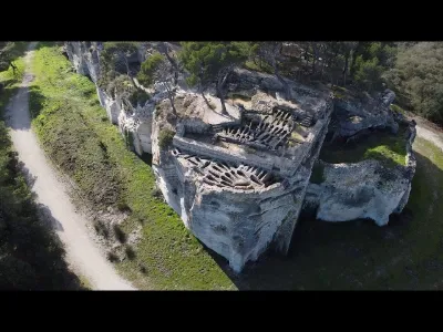
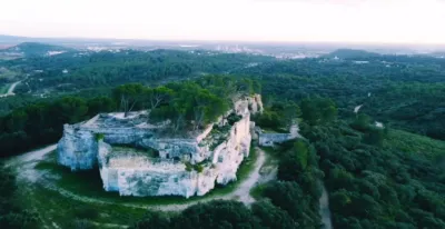
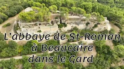
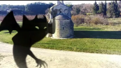
History and occupation of the site Prehistory: first occupations of the site The limestone massif where the abbey was later built is dotted with caves. These are occupied by hunting tribes. 5th century: first hermits The abbey is situated on a limestone rock overhanging above the confluence of the Gardon and the Rhône. Probably from the end of the 5th century onwards, the premises were occupied by hermits whose eastern monastic lifestyle was in line with that of the Desert Fathers. They gradually developed and enlarged the natural cavities. The Abbey was supposed to have a cloister which was to rise over the tombs but this has probably disappeared. 7th century: adoption of the rule of Saint Benedict Around the 7th century, the community of hermits adopted the rule of St. Benedict and became a Benedictine abbey. The abbey then included a chapel, monastic cells, a few other rooms and a necropolis, all carved in stone. In the 11th century, the abbey came under the tutelage of the Abbey of Psalmody. Pilgrims flocked to the abbey to contemplate relics attributed to Saint Roman and Saint Trophime. In the 14th century, the abbey is fortified: a moat is dug all around and walls are raised. The site is now home to a studium (college for teenagers) set up by the pope of Avignon Urbain V. The aim is to provide instruction to young people gifted for studies, poor or rich. 16th century: construction of a castle In 1538, Psalmody was secularized in a college of canons at Aigues-Mortes. After this period, the abbey gradually declined. The monks left the abbey, which was sold to a private individual, who had a small castle built on top of the rock. The castle was later demolished, and the site was definitively abandoned. 20th century: excavations and restorations from the 1960s. The commune of Beaucaire became the owner of the abbey in 1988. In 1991, the abbey is classified as a Historic Monument. XXIst century: further work and an attempt to better develop the site for the tourist offer[ Aware that public awareness of the existence of the abbey is rather low4 , the community in charge of its management is undertaking a number of actions to better present the site4 and make it more accessible to visitors. The number of visitors is 16,000 per year. Several works are planned, such as the repair of the car park and the pedestrian walkway. Excavations are planned for 2019 and 20204. In order to make better use of the most common digital tools, a route of nineteen points of interest will be created in 2018 for the application izi.TRAVEL5 , an application developed by a Dutch start-up6. Description of the site In 2013, visitors can contemplate the remains of various elements of the abbey and the castle. The tombs of the first monks and the fortifications of the 14th century can be seen side by side. The description distributed at the entrance of the site mentions : the abbey chapel rock tombs on the terrace monastic cells a medieval wine press a large room fortifications a ditch, a ramp and a bridge...
Map and restricted areas
Open in the main mapNearby aerodromes
Open aerodromes within 25 km of the spot, heliports included, with their distance and direction from the spot. Near an aerodrome, drone flying is prohibited or height-limited: check the UAS zones map.
| Aerodrome | Type | Distance | Elevation | Difference |
|---|---|---|---|---|
| Nîmes Courbessac Airport | Aerodrome | 16 km W | 60 m | spot 63 m higher |
| Centre Hospitalier Heliport | Heliport | 18 km NE | 21 m | spot 102 m higher |
| Nîmes-Arles-Camargue Airport | Airport | 18 km SW | 94 m | spot 29 m higher |
| Aérodrome d'Avignon-Pujaut | Aerodrome | 21 km NE | 45 m | spot 78 m higher |
| Le Mazet De Romanin Airfield | Aerodrome | 24 km E | 118 m | spot 5 m higher |
Aviation weather (METAR and TAF)
LFTW – Nîmes-Arles-Camargue Airport VFR
METAR
METAR LFTW 210630Z AUTO 02003KT CAVOK 07/06 Q1020 NOSIG
- Wind
- 020°, 6 km/h
- Visibility
- 10 km or more
- Clouds
- –
- Temperature
- 7 °C, dew point 6 °C
- QNH
- 1020 hPa
- Flight category
- VFR: ceiling > 3,000 ft and visibility > 5 mi
TAF
TAF LFTW 210200Z 2103/2203 VRB03KT CAVOK BECMG 2119/2121 13010KT -RA BKN020 PROB40 TEMPO 2122/2203 13015G25KT 4000 RA BKN012 BKN025
| Period (local time) | Change | Wind | Visibility | Weather | Clouds |
|---|---|---|---|---|---|
| 21/11 04:00 → 21/11 20:00 | Initial conditions | Variable, 6 km/h | 10 km or more | No significant weather | No significant cloud |
| 21/11 20:00 → 22/11 04:00 | Becoming | 130°, 19 km/h | 10 km or more | Rain light | Broken (5-7/8) at 2,000 ft (610 m) |
| 21/11 23:00 → 22/11 04:00 | Temporarily, probability 40% | 130°, 28 km/h, gusts 46 km/h | 4.0 km | Rain | Broken (5-7/8) at 1,200 ft (370 m) ; Broken (5-7/8) at 2,500 ft (760 m) |
Weather and Kp index
Sunrise and sunset
| Day | Dawn | Sunrise | Golden hour | Sunset | Dusk | Day length |
|---|---|---|---|---|---|---|
| Sat 21 Nov | 07:12 | 07:44 | 07:44–08:28 · 16:27–17:11 | 17:11 | 17:42 | 9 h 27 |
| Sun 22 Nov | 07:13 | 07:45 | 07:45–08:30 · 16:26–17:10 | 17:10 | 17:42 | 9 h 25 |
| Mon 23 Nov | 07:15 | 07:46 | 07:46–08:31 · 16:25–17:10 | 17:10 | 17:41 | 9 h 23 |
| Tue 24 Nov | 07:16 | 07:47 | 07:47–08:32 · 16:24–17:09 | 17:09 | 17:41 | 9 h 21 |
| Wed 25 Nov | 07:17 | 07:49 | 07:49–08:34 · 16:23–17:08 | 17:08 | 17:40 | 9 h 19 |
| Thu 26 Nov | 07:18 | 07:50 | 07:50–08:35 · 16:23–17:08 | 17:08 | 17:40 | 9 h 17 |
| Fri 27 Nov | 07:19 | 07:51 | 07:51–08:36 · 16:22–17:07 | 17:07 | 17:39 | 9 h 16 |


Reviews
Log in to review this spot. Log in · Create a free account
No reviews yet. Share yours!