

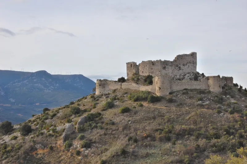
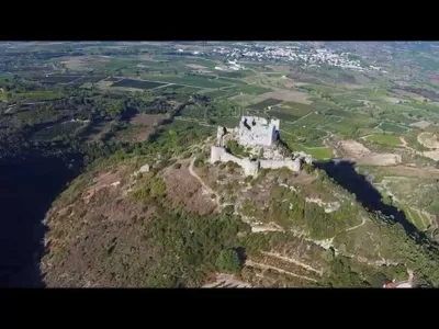
Ruins of Aguilar Fort
No reviews yet
Have you flown here? Share your experience with other pilots.
+ Write the first reviewHistory
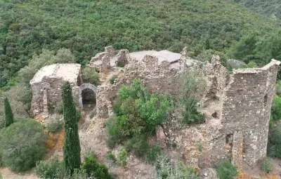
12e siècle ; 15e siècle La construction de l'édifice s'étend de la seconde moitié du 12e siècle jusqu'à la fin du 15e siècle. La partie la plus ancienne du château se compose d'une enceinte polygonale irrégulière en bordure d'un petit plateau rocheux. Quelques meurtrières longues et intérieurement ébrasées sous des arcs en plein cintre, situeraient la construction vers le milieu du 12e siècle. L'objectif de ce fort devait être la surveillance du débouché des chemins entre le Narbonnais et le Roussillon par le détour du col d'Extrême ou du ruisseau de Nouvelles. De 1240 à 1250, Aguilar devait être aux mains du roi. Il est rendu à Olivier de Termes en 1250, après qu'il se fut illustré en Terre sainte. En 1260, la forteresse retourna dans le giron royal et reçut les aménagements nécessaires à son rôle de place forte à la frontière du royaume. En 1525, le château tombe aux mains d'une armée espagnole et allemande. Il est probable que l'édifice fut alors démantelé et non remis en état. ££Le fortin primitif ainsi que la petite chapelle appartiennent à la première période de construction (seconde moitié du 12e siècle). La construction des tours et de l'enceinte extérieure peut avoir eu lieu après l'acquisition royale de 1260. Une autre campagne plus tardive est visible par deux vestiges : une casemate à voûte biaise appareillée et une tour carrée accolée au nord du réduit. Ces deux additions présentent quelques caractères du 15e siècle et remontent sans doute à la période des remises en état des fortifications du Languedoc, après la cession du Roussillon à l'Espagne, en 1493.
Map and restricted areas
Open in the main mapRestricted zones
| Zone | Category | Limits | Conditions |
|---|---|---|---|
| Istres | Zone réglementée | 5491 m above sea level → 30766 m above sea level | Vols interdits sauf lorsque the official document of the zone l'autorise explicitement ou avec l'accord du gestionnaire de la zone lorsqu'il est désigné par the official document of the zone |
| Zrt/zdt Perpignan High | ZRT/ZDT | FL 175 / FL 185 | SUP AIP 055/26 · Du jeudi 16 avril 2026 au mercredi 12 avril 2028 |
Nearby aerodromes
Open aerodromes within 25 km of the spot, heliports included, with their distance and direction from the spot. Near an aerodrome, drone flying is prohibited or height-limited: check the UAS zones map.
| Aerodrome | Type | Distance | Elevation |
|---|---|---|---|
| Perpignan-Rivesaltes (Llabanère) Airport | Airport | 20 km SE | 44 m |
| Base Hydro-ULM La Salanque Latécoère | Seaplane base | 22 km E | 0 m |
| Base ULM Corneilla de la Rivière | Aerodrome | 22 km S | 70 m |
| St Laurent de la Salanque Airbase | Aerodrome | 23 km SE | 9 m |
Aviation weather (METAR and TAF)
LFMP – Perpignan-Rivesaltes (Llabanère) Airport VFR
METAR
METAR LFMP 171330Z AUTO VRB02KT CAVOK 17/13 Q1006 NOSIG
- Wind
- Variable, 4 km/h
- Visibility
- 10 km or more
- Clouds
- –
- Temperature
- 17 °C, dew point 13 °C
- QNH
- 1006 hPa
- Flight category
- VFR: ceiling > 3,000 ft and visibility > 5 mi
TAF
TAF LFMP 170800Z 1709/1809 VRB02KT 9999 BKN008 BECMG 1710/1712 CAVOK BECMG 1806/1808 28012KT
| Period (local time) | Change | Wind | Visibility | Weather | Clouds |
|---|---|---|---|---|---|
| 17/11 10:00 → 17/11 11:00 | Initial conditions | Variable, 4 km/h | 10 km or more | Broken (5-7/8) at 800 ft (240 m) | |
| 17/11 11:00 → 18/11 07:00 | Becoming | Variable, 4 km/h | 10 km or more | No significant weather | No significant cloud |
| 18/11 07:00 → 18/11 10:00 | Becoming | 280°, 22 km/h | 10 km or more | No significant weather | No significant cloud |
Weather and Kp index
| Day | Weather | Temp. min. / max. | Wind | Rain | Max Kp |
|---|---|---|---|---|---|
| Tue 17 Nov | Light rain | 11° / 15° | 9 km/h NW | 0.4 mm | 5 |
| Wed 18 Nov | Clear sky | 9° / 17° | 33 km/h NW | – | 5 |
| Thu 19 Nov | Clear sky | 10° / 16° | 40 km/h NW | 1.4 mm | 3 |
| Fri 20 Nov | Cloudy | 8° / 16° | 22 km/h W | – | 3 |
| Sat 21 Nov | Cloudy | 9° / 16° | 10 km/h SE | – | – |
| Sun 22 Nov | Fair | 11° / 14° | 32 km/h NW | 0.1 mm | – |
| Mon 23 Nov | Cloudy | 9° / 15° | 17 km/h NW | – | – |
Hour by hour: Tuesday 17 November
| Time | Weather | Temp. | Wind | Rain | Clouds | Kp |
|---|---|---|---|---|---|---|
| 15:00 | Light rain | 15° | 5 km/h SE | 0.4 mm | 100 % | 4 |
| 16:00 | Cloudy | 14° | 8 km/h S | – | 99 % | 4 |
| 17:00 | Cloudy | 14° | 5 km/h NE | – | 100 % | 4 |
| 18:00 | Cloudy | 13° | 8 km/h N | – | 95 % | 4 |
| 19:00 | Cloudy | 12° | 8 km/h N | – | 94 % | 5 |
| 20:00 | Cloudy | 12° | 7 km/h NW | – | 90 % | 5 |
| 21:00 | Partly cloudy | 11° | 7 km/h NW | – | 66 % | 5 |
| 22:00 | Cloudy | 11° | 6 km/h NW | – | 90 % | 5 |
Hour by hour: Wednesday 18 November
| Time | Weather | Temp. | Wind | Rain | Clouds | Kp |
|---|---|---|---|---|---|---|
| 06:00 | Cloudy | 11° | 8 km/h NW | – | 98 % | 4 |
| 07:00 | Cloudy | 12° | 15 km/h NW | – | 92 % | 4 |
| 08:00 | Cloudy | 13° | 23 km/h NW | – | 99 % | 4 |
| 09:00 | Cloudy | 13° | 29 km/h NW | – | 94 % | 4 |
| 10:00 | Cloudy | 14° | 33 km/h NW | – | 99 % | 4 |
| 11:00 | Partly cloudy | 14° | 31 km/h NW | – | 63 % | 4 |
| 12:00 | Fair | 16° | 26 km/h NW | – | 35 % | 4 |
| 13:00 | Clear sky | 17° | 24 km/h NW | – | 11 % | 3 |
| 14:00 | Clear sky | 17° | 23 km/h NW | – | 11 % | 3 |
| 15:00 | Fair | 17° | 19 km/h NW | – | 27 % | 3 |
| 16:00 | Partly cloudy | 17° | 14 km/h W | – | 62 % | 3 |
| 17:00 | Partly cloudy | 15° | 9 km/h SW | – | 70 % | 3 |
| 18:00 | Cloudy | 13° | 7 km/h S | – | 91 % | 3 |
| 19:00 | Partly cloudy | 13° | 9 km/h S | – | 73 % | 2 |
| 20:00 | Partly cloudy | 12° | 12 km/h S | – | 43 % | 2 |
| 21:00 | Partly cloudy | 12° | 14 km/h SE | – | 77 % | 2 |
| 22:00 | Partly cloudy | 12° | 16 km/h SE | – | 70 % | 2 |
Sunrise and sunset
| Day | Dawn | Sunrise | Golden hour | Sunset | Dusk | Day length |
|---|---|---|---|---|---|---|
| Tue 17 Nov | 07:13 | 07:44 | 07:44–08:27 · 16:41–17:24 | 17:24 | 17:55 | 9 h 40 |
| Wed 18 Nov | 07:14 | 07:45 | 07:45–08:28 · 16:40–17:23 | 17:23 | 17:54 | 9 h 38 |
| Thu 19 Nov | 07:15 | 07:46 | 07:46–08:29 · 16:39–17:23 | 17:23 | 17:53 | 9 h 36 |
| Fri 20 Nov | 07:17 | 07:47 | 07:47–08:31 · 16:39–17:22 | 17:22 | 17:53 | 9 h 34 |
| Sat 21 Nov | 07:18 | 07:49 | 07:49–08:32 · 16:38–17:21 | 17:21 | 17:52 | 9 h 32 |
| Sun 22 Nov | 07:19 | 07:50 | 07:50–08:33 · 16:37–17:21 | 17:21 | 17:51 | 9 h 30 |
| Mon 23 Nov | 07:20 | 07:51 | 07:51–08:35 · 16:36–17:20 | 17:20 | 17:51 | 9 h 28 |


Reviews (0)
Log in to review this spot. Log in · Create a free account
No reviews yet. Share yours!