

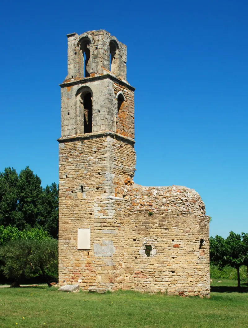
Ruins of Saint-Martin Chapel
No reviews yet
Have you flown here? Share your experience with other pilots.
+ Write the first reviewHistory
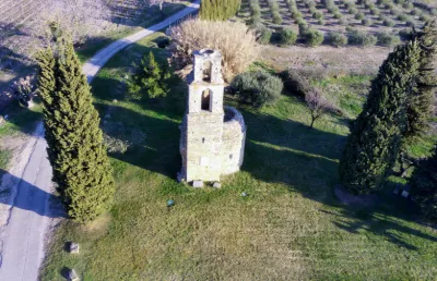
11e siècle ; 12e siècle L'église est dans la tradition des premiers édifices chrétiens construits en bordure des voies romaines, sur les emplacements d'anciens temples païens. Un itinéraire reliant la voie Nîmes-Alba aux routes longeant la vallée du Rhône, passait pas Saint-Martin. Une pierre en réemploi atteste l'origine païenne du site. Il s'agit semble-t-il d'une stèle funéraire romaine qui sert de soubassement au pilier droit sous le clocher. Des sondages effectués permettent d'évaluer l'importance de la nécropole entourant la chapelle et d'en déduire, d'après le type de sépulture, qu'une agglomération existait à Saint-Martin vers les 11e et 12e siècles. Délaissée par les marchés et les pèlerins, Saint-Martin n'a pas survécu. L'état actuel de l'église ne permet pas d'en connaître le plan d'ensemble. Seuls le clocher et le sanctuaire subsistent. Le clocher est à trois niveaux, chaque étage en retrait par rapport au niveau inférieur. Il est ajouré au premier étage par une baie unique. Le dernier étage est ajouré sur chacune de ses faces par une baie. L'abside semi-circulaire est divisée intérieurement en trois absidioles voûtées en cul de four, pratiquées dans l'épaisseur de la muraille. Les arcs d'ouverture de ces absidioles avaient pour support des colonnes dont il ne reste que les bases. Les retombées s'effectuent par l'intermédiaire de chapiteaux inspirés de l'ordre corinthien. De part et d'autre de l'entrée du choeur, les deux premiers chapiteaux supportent une demi-colonnette engagée, chargée d'un chapiteau d'inspiration ionique qui recevait probablement les retombées de l'arc triomphal.
Map and restricted areas
Open in the main mapRestricted zones
Nearby aerodromes
Open aerodromes within 25 km of the spot, heliports included, with their distance and direction from the spot. Near an aerodrome, drone flying is prohibited or height-limited: check the UAS zones map.
| Aerodrome | Type | Distance | Elevation |
|---|---|---|---|
| Aérodrome d'Avignon-Pujaut | Aerodrome | 13 km SE | 45 m |
| Uzès Airfield | Aerodrome | 19 km W | 270 m |
| Orange-Caritat (BA 115) Air Base | Airport | 20 km E | 60 m |
| Centre Hospitalier Heliport | Heliport | 21 km SE | 21 m |
Aviation weather (METAR and TAF)
LFMO – Orange-Caritat (BA 115) Air Base VFR
METAR
METAR LFMO 171400Z AUTO VRB01KT 9999 ///TCU 13/11 Q1004 BECMG BKN080
- Wind
- Variable, 2 km/h
- Visibility
- 10 km or more
- Clouds
- –
- Temperature
- 13 °C, dew point 11 °C
- QNH
- 1004 hPa
- Flight category
- VFR: ceiling > 3,000 ft and visibility > 5 mi
TAF
TAF LFMO 171400Z 1715/1815 13008KT CAVOK TX16/1814Z TN11/1804Z TEMPO 1717/1802 BKN010 PROB40 TEMPO 1717/1723 3000 BR BKN005 TEMPO 1804/1809 3000 BR PROB30 1805/1808 0800 FG BKN002
| Period (local time) | Change | Wind | Visibility | Weather | Clouds |
|---|---|---|---|---|---|
| 17/11 16:00 → 18/11 16:00 | Initial conditions | 130°, 15 km/h | 10 km or more | No significant cloud | |
| 17/11 18:00 → 18/11 03:00 | Temporarily | Broken (5-7/8) at 1,000 ft (300 m) | |||
| 17/11 18:00 → 18/11 00:00 | Temporarily, probability 40% | 3.0 km | Mist | Broken (5-7/8) at 500 ft (150 m) | |
| 18/11 05:00 → 18/11 10:00 | Temporarily | 3.0 km | Mist | ||
| 18/11 06:00 → 18/11 09:00 | probability 30% | 800 m | Fog | Broken (5-7/8) at 200 ft (60 m) |
Weather and Kp index
Sunrise and sunset
| Day | Dawn | Sunrise | Golden hour | Sunset | Dusk | Day length |
|---|---|---|---|---|---|---|
| Tue 17 Nov | 07:08 | 07:39 | 07:39–08:23 · 16:30–17:14 | 17:14 | 17:45 | 9 h 34 |
| Wed 18 Nov | 07:09 | 07:40 | 07:40–08:25 · 16:28–17:13 | 17:13 | 17:44 | 9 h 32 |
| Thu 19 Nov | 07:10 | 07:42 | 07:42–08:26 · 16:27–17:12 | 17:12 | 17:43 | 9 h 30 |
| Fri 20 Nov | 07:12 | 07:43 | 07:43–08:28 · 16:26–17:11 | 17:11 | 17:43 | 9 h 28 |
| Sat 21 Nov | 07:13 | 07:44 | 07:44–08:29 · 16:26–17:10 | 17:10 | 17:42 | 9 h 25 |
| Sun 22 Nov | 07:14 | 07:46 | 07:46–08:30 · 16:25–17:10 | 17:10 | 17:41 | 9 h 23 |
| Mon 23 Nov | 07:15 | 07:47 | 07:47–08:32 · 16:24–17:09 | 17:09 | 17:41 | 9 h 22 |


Reviews (0)
Log in to review this spot. Log in · Create a free account
No reviews yet. Share yours!