

Castle Ruins
No reviews yet
Have you flown here? Share your experience with other pilots.
+ Write the first reviewHistory
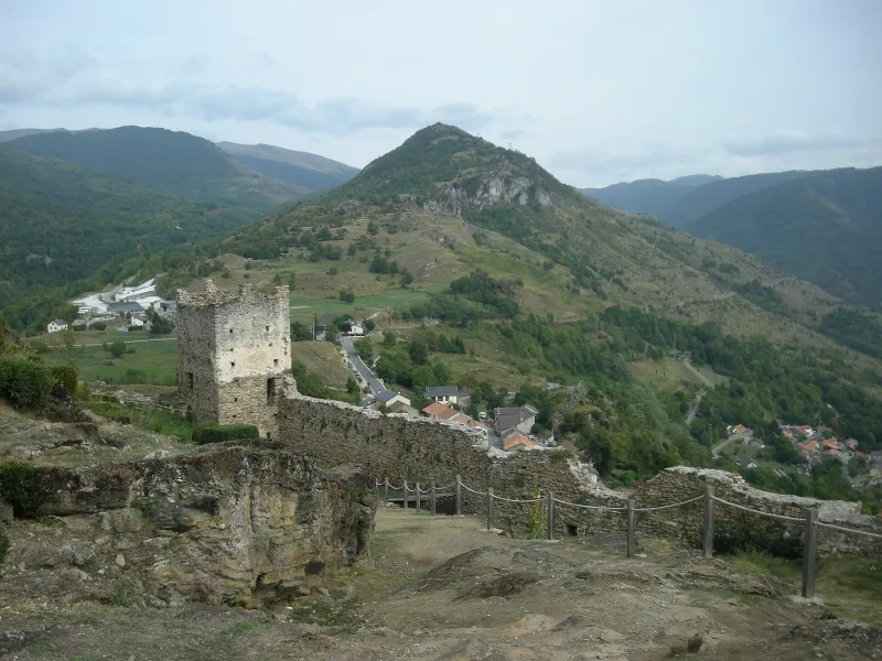
11e siècle ; 15e siècle Château mentionné dès 970. Le site servit de refuge aux Cathares persécutés. Il subit également les luttes de la Réforme puis de la révolte du duc de Montmorency. L'édifice fut une puissante forteresse par les trois enceintes concentriques qui venaient s'appuyer sur la face ouest bâtie au bord d'une falaise. Les portes de chaque enceinte sont percées dans des tours et sont chicanées. Les courtines suivent les inégalités des plans de rochers. Au centre de l'enceinte intérieure subsiste la base d'un donjon rectangulaire. A la fin du 13e siècle, le roi d'Aragon s'en empare et demande la destruction du château.
Map and restricted areas
Open in the main mapRestricted zones
Nearby aerodromes
Open aerodromes within 25 km of the spot, heliports included, with their distance and direction from the spot. Near an aerodrome, drone flying is prohibited or height-limited: check the UAS zones map.
| Aerodrome | Type | Distance | Elevation |
|---|---|---|---|
| Centre Hospitalier Heliport | Heliport | 23 km NW | 450 m |
Aviation weather (METAR and TAF)
No METAR station within 50 km.
Weather and Kp index
Sunrise and sunset
| Day | Dawn | Sunrise | Golden hour | Sunset | Dusk | Day length |
|---|---|---|---|---|---|---|
| Tue 17 Nov | 07:17 | 07:47 | 07:47–08:30 · 16:46–17:29 | 17:29 | 17:59 | 9 h 41 |
| Wed 18 Nov | 07:18 | 07:49 | 07:49–08:32 · 16:45–17:28 | 17:28 | 17:58 | 9 h 39 |
| Thu 19 Nov | 07:19 | 07:50 | 07:50–08:33 · 16:44–17:27 | 17:27 | 17:58 | 9 h 37 |
| Fri 20 Nov | 07:20 | 07:51 | 07:51–08:34 · 16:43–17:26 | 17:26 | 17:57 | 9 h 35 |
| Sat 21 Nov | 07:21 | 07:52 | 07:52–08:36 · 16:42–17:26 | 17:26 | 17:56 | 9 h 33 |
| Sun 22 Nov | 07:23 | 07:53 | 07:53–08:37 · 16:41–17:25 | 17:25 | 17:56 | 9 h 31 |
| Mon 23 Nov | 07:24 | 07:55 | 07:55–08:38 · 16:40–17:24 | 17:24 | 17:55 | 9 h 29 |
Reviews (0)
Log in to review this spot. Log in · Create a free account
No reviews yet. Share yours!