

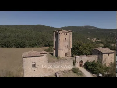
Cazaban Tower
No reviews yet
Have you flown here? Share your experience with other pilots.
+ Write the first reviewHistory
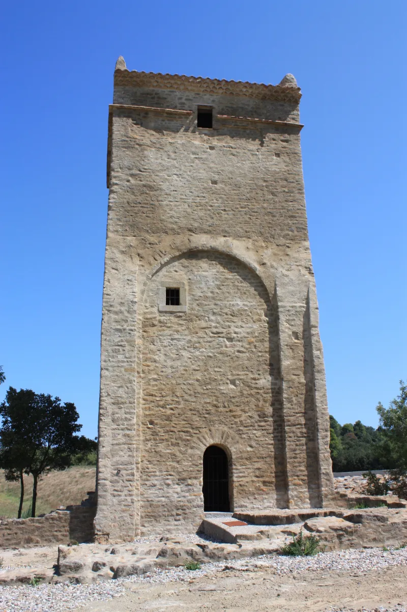
Sur un plan parcellaire du 18e siècle, un moulin à vent est dessiné qui pourrait correspondre à la tour, alors dénommée "moulin de Mme de Palaja". L'ouvrage se présente comme une tour carrée, renforcée aux deux angles de la face sud par des contreforts portant un grand arc de quatre mètres d'ouverture. La construction n'est pas appareillée mais en assises horizontales assez régulières. La partie haute de la tour est transformée en pigeonnier, avec bandeau. A la base de la tour, face sud, s'ouvre une porte en plein cintre. Un autre arc en plein cintre existait à cinq mètres du sol. Cette baie a été murée et transformée en fenêtre à pigeons. Cette tour ne semble pas antérieure au 12e siècle.
Map and restricted areas
Open in the main mapRestricted zones
| Zone | Category | Limits | Conditions |
|---|---|---|---|
| Ctr Carcassonne |
Zone de contrôle civile | 50 m above ground level → 914 m above sea level | Flights above 50 metres are forbidden without the prior agreement of air traffic control |
| Tma Toulouse |
Région de contrôle terminal | 457 m above ground level → 2297 m above sea level · 610 m above sea level → 914 m above sea level · 610 m above sea level → 2297 m above sea level · 732 m above sea level → 914 m above sea level · 762 m above sea level → 2297 m above sea level · 914 m above sea level → 1219 m above sea level · 914 m above sea level → 1219 m above sea level · 914 m above sea level → 2297 m above sea level · 914 m above sea level → 2297 m above sea level · 914 m above sea level → 2297 m above sea level · 1067 m above sea level → 2297 m above sea level · 1067 m above sea level → 3821 m above sea level · 1219 m above sea level → 2297 m above sea level · 1219 m above sea level → 2297 m above sea level · 1219 m above sea level → 2297 m above sea level · 1529 m above sea level → 3821 m above sea level · 1529 m above sea level → 3821 m above sea level · 1529 m above sea level → 3821 m above sea level | Drone flights inside this zone are forbidden without the prior agreement of air traffic control |
| Istres | Zone réglementée | 5491 m above sea level → 30766 m above sea level | Vols interdits sauf lorsque the official document of the zone l'autorise explicitement ou avec l'accord du gestionnaire de la zone lorsqu'il est désigné par the official document of the zone |
Nearby aerodromes
Open aerodromes within 25 km of the spot, heliports included, with their distance and direction from the spot. Near an aerodrome, drone flying is prohibited or height-limited: check the UAS zones map.
| Aerodrome | Type | Distance | Elevation |
|---|---|---|---|
| Gayraud Centre Hospitalier Heliport | Heliport | 2.8 km NW | 145 m |
| Carcassonne Airport | Airport | 6.7 km NW | 132 m |
| Ulmodrome de Limoux | Aerodrome | 18 km SW | 183 m |
Aviation weather (METAR and TAF)
LFMK – Carcassonne Airport VFR
METAR
METAR LFMK 171400Z AUTO VRB03KT 9999 FEW092/// BKN120/// ///TCU 15/14 Q1004 NOSIG
- Wind
- Variable, 6 km/h
- Visibility
- 10 km or more
- Clouds
- Few (1-2/8) at 9,200 ft (2800 m) ; Broken (5-7/8) at 12,000 ft (3660 m)
- Temperature
- 15 °C, dew point 14 °C
- QNH
- 1004 hPa
- Flight category
- VFR: ceiling > 3,000 ft and visibility > 5 mi
TAF
TAF LFMK 170800Z 1709/1809 08008KT 9999 BKN070 TEMPO 1709/1712 -RA SCT004 BKN010 BECMG 1710/1712 VRB03KT TEMPO 1712/1720 SCT025TCU BECMG 1720/1722 CAVOK PROB30 TEMPO 1801/1807 3000 BR BECMG 1806/1808 27010KT 4000 RA BKN020 BKN030
| Period (local time) | Change | Wind | Visibility | Weather | Clouds |
|---|---|---|---|---|---|
| 17/11 10:00 → 17/11 11:00 | Initial conditions | 080°, 15 km/h | 10 km or more | Broken (5-7/8) at 7,000 ft (2130 m) | |
| 17/11 10:00 → 17/11 13:00 | Temporarily | Rain light | Scattered (3-4/8) at 400 ft (120 m) ; Broken (5-7/8) at 1,000 ft (300 m) | ||
| 17/11 11:00 → 17/11 21:00 | Becoming | Variable, 6 km/h | 10 km or more | Broken (5-7/8) at 7,000 ft (2130 m) | |
| 17/11 13:00 → 17/11 21:00 | Temporarily | Scattered (3-4/8) at 2,500 ft (760 m) (towering cumulus) | |||
| 17/11 21:00 → 18/11 07:00 | Becoming | Variable, 6 km/h | 10 km or more | No significant weather | No significant cloud |
| 18/11 02:00 → 18/11 08:00 | Temporarily, probability 30% | 3.0 km | Mist | ||
| 18/11 07:00 → 18/11 10:00 | Becoming | 270°, 19 km/h | 4.0 km | Rain | Broken (5-7/8) at 2,000 ft (610 m) ; Broken (5-7/8) at 3,000 ft (910 m) |
Weather and Kp index
Sunrise and sunset
| Day | Dawn | Sunrise | Golden hour | Sunset | Dusk | Day length |
|---|---|---|---|---|---|---|
| Tue 17 Nov | 07:15 | 07:46 | 07:46–08:29 · 16:42–17:25 | 17:25 | 17:56 | 9 h 39 |
| Wed 18 Nov | 07:16 | 07:47 | 07:47–08:30 · 16:41–17:24 | 17:24 | 17:55 | 9 h 37 |
| Thu 19 Nov | 07:18 | 07:48 | 07:48–08:32 · 16:40–17:23 | 17:23 | 17:54 | 9 h 35 |
| Fri 20 Nov | 07:19 | 07:50 | 07:50–08:33 · 16:39–17:23 | 17:23 | 17:54 | 9 h 33 |
| Sat 21 Nov | 07:20 | 07:51 | 07:51–08:35 · 16:38–17:22 | 17:22 | 17:53 | 9 h 31 |
| Sun 22 Nov | 07:21 | 07:52 | 07:52–08:36 · 16:37–17:21 | 17:21 | 17:52 | 9 h 29 |
| Mon 23 Nov | 07:22 | 07:53 | 07:53–08:37 · 16:36–17:21 | 17:21 | 17:52 | 9 h 27 |
Reviews (0)
Log in to review this spot. Log in · Create a free account
No reviews yet. Share yours!