

Lécluse Castle
No reviews yet
Have you flown here? Share your experience with other pilots.
+ Write the first reviewHistory
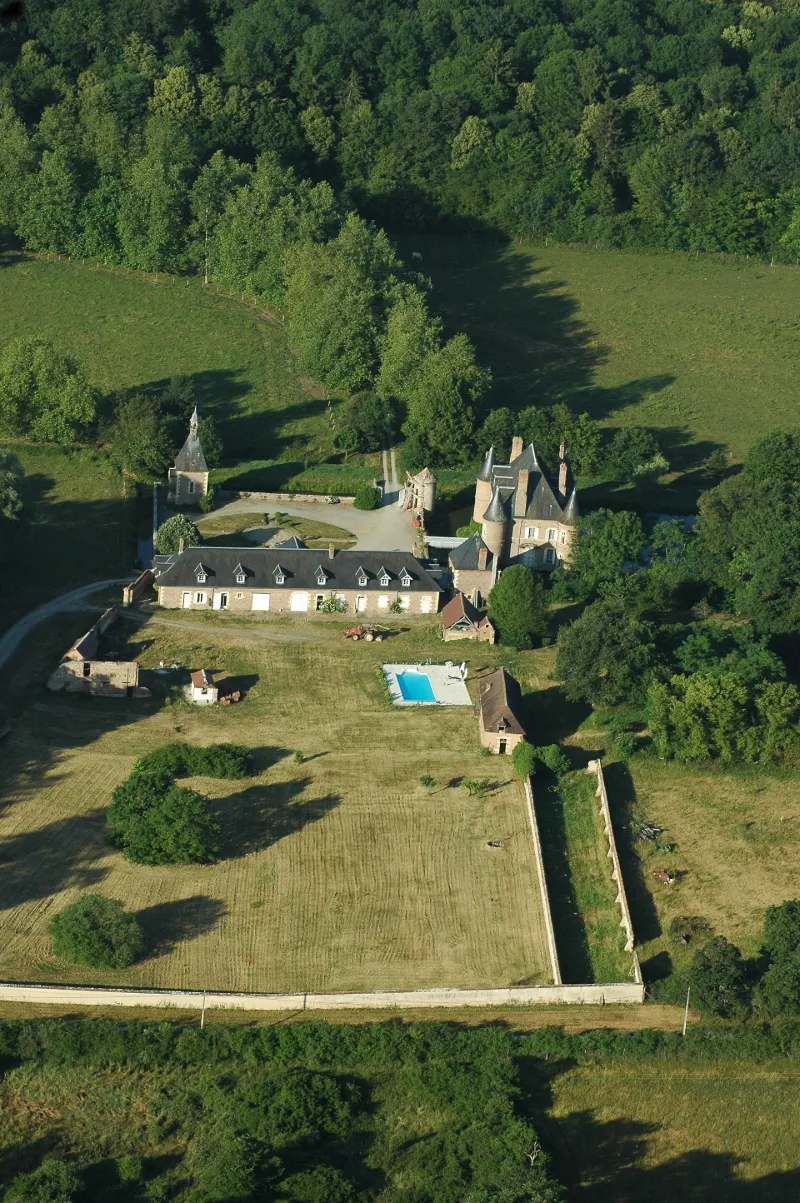
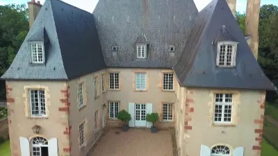
Initialement un ensemble fortifié médiéval entouré par des douves en eau, le château fut reconstruit au début du 17ème siècle, à la manière bourbonnaise, en briques polychromes et pierres. De plan massé, il est précédé, à l'est, d'une cour bornée par des douves. Dans les années 1860, d'importants travaux sont entrepris avec la réalisation de quatre tours aux angles du château, une aile de communs et un pavillon carré utilisé comme garde-manger et lingerie. Une chapelle à portail Néo-Renaissance est également édifiée. Un jardin est aménagé au nord abritant une orangerie et un bûcher tandis qu'un pigeonnier se dresse à l'ouest. Les intérieurs de la bâtisse renferment des aménagements datant des 17ème, 18ème et 19ème siècles.
Map and restricted areas
Open in the main mapRestricted zones
Nearby aerodromes
Open aerodromes within 25 km of the spot, heliports included, with their distance and direction from the spot. Near an aerodrome, drone flying is prohibited or height-limited: check the UAS zones map.
| Aerodrome | Type | Distance | Elevation |
|---|---|---|---|
| Aérodrome de Moulins - Montbeugny | Aerodrome | 6.3 km N | 279 m |
| Centre Hospitalier Heliport | Heliport | 12 km NW | 209 m |
| Verneuil en Bourbonnais | Aerodrome | 18 km SW | 264 m |
Aviation weather (METAR and TAF)
LFLV – Vichy-Charmeil Airport VFR
METAR
METAR LFLV 171400Z AUTO 21007KT 140V280 9999 SCT048 SCT056 OVC210 18/10 Q0999
- Wind
- 210°, 13 km/h
- Visibility
- 10 km or more
- Clouds
- Scattered (3-4/8) at 4,800 ft (1460 m) ; Scattered (3-4/8) at 5,600 ft (1710 m) ; Overcast (8/8) at 21,000 ft (6400 m)
- Temperature
- 18 °C, dew point 10 °C
- QNH
- 999 hPa
- Flight category
- VFR: ceiling > 3,000 ft and visibility > 5 mi
TAF
Weather and Kp index
Sunrise and sunset
| Day | Dawn | Sunrise | Golden hour | Sunset | Dusk | Day length |
|---|---|---|---|---|---|---|
| Tue 17 Nov | 07:18 | 07:51 | 07:51–08:38 · 16:25–17:12 | 17:12 | 17:44 | 9 h 20 |
| Wed 18 Nov | 07:19 | 07:52 | 07:52–08:39 · 16:24–17:11 | 17:11 | 17:44 | 9 h 18 |
| Thu 19 Nov | 07:21 | 07:54 | 07:54–08:41 · 16:22–17:10 | 17:10 | 17:43 | 9 h 15 |
| Fri 20 Nov | 07:22 | 07:55 | 07:55–08:42 · 16:21–17:09 | 17:09 | 17:42 | 9 h 13 |
| Sat 21 Nov | 07:23 | 07:56 | 07:56–08:44 · 16:20–17:08 | 17:08 | 17:41 | 9 h 11 |
| Sun 22 Nov | 07:25 | 07:58 | 07:58–08:46 · 16:19–17:07 | 17:07 | 17:40 | 9 h 09 |
| Mon 23 Nov | 07:26 | 07:59 | 07:59–08:47 · 16:18–17:06 | 17:06 | 17:40 | 9 h 07 |
Reviews (0)
Log in to review this spot. Log in · Create a free account
No reviews yet. Share yours!