

Querroig Castle
No reviews yet
Have you flown here? Share your experience with other pilots.
+ Write the first reviewHistory
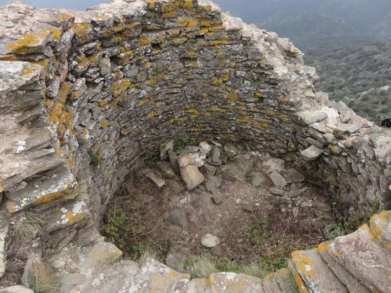
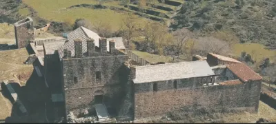
Le « château de Querroig » regroupe un ensemble de fortifications sur les hauteurs de Cerbère, aujourd'hui en ruines, situées à la frontière entre la France et l'Espagne. Son édification remonte sans doute au XIIIe ou au XIVe siècle. Les vestiges subsistants, une tour à signaux et quelques élévations en pierre sèche, pourraient dater des XVIe-XVIIe siècle.
Map and restricted areas
Open in the main mapRestricted zones
Nearby aerodromes
Open aerodromes within 25 km of the spot, heliports included, with their distance and direction from the spot. Near an aerodrome, drone flying is prohibited or height-limited: check the UAS zones map.
| Aerodrome | Type | Distance | Elevation |
|---|---|---|---|
| Centre Medical du Cap Peyrefite Heliport | Heliport | 3.9 km NE | 15 m |
| Ampuriabrava Airfield | Aerodrome | 20 km S | 1 m |
| Roses Aerial Military Radar Helipad | Heliport | 20 km SE | 405 m |
| Base ULM Saint Génis | Aerodrome | 21 km NW | 46 m |
Aviation weather (METAR and TAF)
LFMP – Perpignan-Rivesaltes (Llabanère) Airport VFR
METAR
METAR LFMP 171400Z AUTO 12005KT 090V150 CAVOK 16/13 Q1005 NOSIG
- Wind
- 120°, 9 km/h
- Visibility
- 10 km or more
- Clouds
- –
- Temperature
- 16 °C, dew point 13 °C
- QNH
- 1005 hPa
- Flight category
- VFR: ceiling > 3,000 ft and visibility > 5 mi
TAF
TAF LFMP 170800Z 1709/1809 VRB02KT 9999 BKN008 BECMG 1710/1712 CAVOK BECMG 1806/1808 28012KT
| Period (local time) | Change | Wind | Visibility | Weather | Clouds |
|---|---|---|---|---|---|
| 17/11 10:00 → 17/11 11:00 | Initial conditions | Variable, 4 km/h | 10 km or more | Broken (5-7/8) at 800 ft (240 m) | |
| 17/11 11:00 → 18/11 07:00 | Becoming | Variable, 4 km/h | 10 km or more | No significant weather | No significant cloud |
| 18/11 07:00 → 18/11 10:00 | Becoming | 280°, 22 km/h | 10 km or more | No significant weather | No significant cloud |
Weather and Kp index
Sunrise and sunset
| Day | Dawn | Sunrise | Golden hour | Sunset | Dusk | Day length |
|---|---|---|---|---|---|---|
| Tue 17 Nov | 07:11 | 07:41 | 07:41–08:23 · 16:41–17:24 | 17:24 | 17:54 | 9 h 43 |
| Wed 18 Nov | 07:12 | 07:42 | 07:42–08:25 · 16:41–17:23 | 17:23 | 17:54 | 9 h 41 |
| Thu 19 Nov | 07:13 | 07:43 | 07:43–08:26 · 16:40–17:22 | 17:22 | 17:53 | 9 h 39 |
| Fri 20 Nov | 07:14 | 07:45 | 07:45–08:28 · 16:39–17:22 | 17:22 | 17:52 | 9 h 37 |
| Sat 21 Nov | 07:15 | 07:46 | 07:46–08:29 · 16:38–17:21 | 17:21 | 17:52 | 9 h 35 |
| Sun 22 Nov | 07:16 | 07:47 | 07:47–08:30 · 16:37–17:20 | 17:20 | 17:51 | 9 h 33 |
| Mon 23 Nov | 07:17 | 07:48 | 07:48–08:32 · 16:36–17:20 | 17:20 | 17:50 | 9 h 31 |

Reviews (0)
Log in to review this spot. Log in · Create a free account
No reviews yet. Share yours!