

Lac de Roselend

2 pilot reviews
“La visite de nos amis en bleu au Col des prés, à côté du barrage de Roselend” — savoienumerique, 6 years ago
Read the reviews + Write my reviewDescription
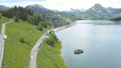
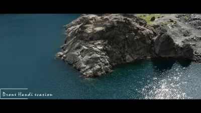
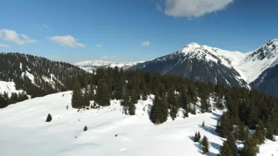
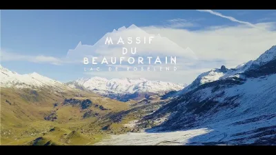
Drone 4k at the lake of Roselend in SAVOIE - August 15, 2017. The Roselend dam is at 1557m altitude, 150m high and 804m long. The Roselend dam is the most beautiful dam in Savoie. In front of the crowd of tourists around the dam, I preferred to film the lake and I don't regret it, it's beautiful!
Map and restricted areas
Open in the main mapNearby aerodromes
Open aerodromes within 25 km of the spot, heliports included, with their distance and direction from the spot. Near an aerodrome, drone flying is prohibited or height-limited: check the UAS zones map.
| Aerodrome | Type | Distance | Elevation | Difference |
|---|---|---|---|---|
| Altiport de Vaugellaz | Aerodrome | 11 km SE | 2,020 m | spot 456 m lower |
| Megève Altiport | Aerodrome | 16 km N | 1,470 m | spot 94 m higher |
| Crs Alpes Heliport | Heliport | 19 km W | 330 m | spot 1,234 m higher |
| Centre Hospitalier Heliport | Heliport | 19 km W | 335 m | spot 1,229 m higher |
| Mont Blanc Hélicoptères | Heliport | 21 km SE | 2,031 m | spot 467 m lower |
Aviation weather (METAR and TAF)
LFLP – Annecy-Haute-Savoie-Mont Blanc Airport VFR
METAR
METAR LFLP 211230Z AUTO VRB01KT CAVOK 12/06 Q1019 NOSIG
- Wind
- Variable, 2 km/h
- Visibility
- 10 km or more
- Clouds
- –
- Temperature
- 12 °C, dew point 6 °C
- QNH
- 1019 hPa
- Flight category
- VFR: ceiling > 3,000 ft and visibility > 5 mi
TAF
TAF LFLP 210800Z 2109/2209 VRB03KT 9999 SCT040 BECMG 2122/2124 RA BKN040 TEMPO 2200/2209 4000 RA SCT030TCU PROB40 TEMPO 2203/2209 2000 BKN012
| Period (local time) | Change | Wind | Visibility | Weather | Clouds |
|---|---|---|---|---|---|
| 21/11 10:00 → 21/11 23:00 | Initial conditions | Variable, 6 km/h | 10 km or more | Scattered (3-4/8) at 4,000 ft (1220 m) | |
| 21/11 23:00 → 22/11 10:00 | Becoming | Variable, 6 km/h | 10 km or more | Rain | Broken (5-7/8) at 4,000 ft (1220 m) |
| 22/11 01:00 → 22/11 10:00 | Temporarily | 4.0 km | Rain | Scattered (3-4/8) at 3,000 ft (910 m) (towering cumulus) | |
| 22/11 04:00 → 22/11 10:00 | Temporarily, probability 40% | 2.0 km | Broken (5-7/8) at 1,200 ft (370 m) |
Weather and Kp index
| Day | Weather | Temp. min. / max. | Wind | Rain | Max Kp |
|---|---|---|---|---|---|
| Sat 21 Nov | Fair | -6° / 2° | 5 km/h E | – | 2 |
| Sun 22 Nov | Sleet | -1° / 1° | 11 km/h E | 51 mm | 2 |
| Mon 23 Nov | Snow | -2° / -1° | 9 km/h NW | 30 mm | 4 |
| Tue 24 Nov | Cloudy | -7° / 2° | 5 km/h E | 0.7 mm | 2 |
| Wed 25 Nov | Snow | -4° / 0° | 9 km/h E | 10 mm | – |
| Thu 26 Nov | Snow | -4° / -1° | 3 km/h W | 5.5 mm | – |
| Fri 27 Nov | Clear sky | -9° / -0° | 4 km/h E | – | – |
Hour by hour: Saturday 21 November
| Time | Weather | Temp. | Wind | Rain | Clouds | Kp |
|---|---|---|---|---|---|---|
| 14:00 | Fair | 2° | 4 km/h E | – | 27 % | 2 |
| 15:00 | Fair | 2° | 4 km/h E | – | 29 % | 2 |
| 16:00 | Partly cloudy | 0° | 4 km/h E | – | 41 % | 2 |
| 17:00 | Partly cloudy | -3° | 5 km/h E | – | 88 % | 2 |
| 18:00 | Cloudy | -5° | 5 km/h E | – | 88 % | 2 |
| 19:00 | Partly cloudy | -6° | 5 km/h E | – | 81 % | 2 |
| 20:00 | Partly cloudy | -6° | 5 km/h E | – | 95 % | 2 |
| 21:00 | Cloudy | -5° | 5 km/h E | – | 93 % | 2 |
| 22:00 | Cloudy | -4° | 5 km/h E | – | 94 % | 2 |
Hour by hour: Sunday 22 November
| Time | Weather | Temp. | Wind | Rain | Clouds | Kp |
|---|---|---|---|---|---|---|
| 06:00 | Snow | -1° | 11 km/h E | 2.3 mm | 100 % | 2 |
| 07:00 | Snow | -1° | 11 km/h E | 2.9 mm | 100 % | 2 |
| 08:00 | Snow | -1° | 10 km/h E | 2.6 mm | 100 % | 2 |
| 09:00 | Sleet | 0° | 11 km/h E | 2.3 mm | 100 % | 2 |
| 10:00 | Sleet | 1° | 9 km/h E | 3.2 mm | 100 % | 2 |
| 11:00 | Sleet | 1° | 7 km/h SE | 4.7 mm | 100 % | 2 |
| 12:00 | Sleet | 1° | 6 km/h W | 3.0 mm | 100 % | 2 |
| 13:00 | Sleet | 1° | 7 km/h NW | 2.2 mm | 100 % | 2 |
| 14:00 | Snow | 1° | 8 km/h NW | 2.4 mm | 100 % | 2 |
| 15:00 | Snow | 0° | 8 km/h W | 3.3 mm | 100 % | 2 |
| 16:00 | Snow | -0° | 7 km/h W | 3.4 mm | 100 % | 2 |
| 17:00 | Snow | -0° | 8 km/h W | 1.6 mm | 100 % | 2 |
| 18:00 | Snow | -1° | 9 km/h W | 1.5 mm | 100 % | 2 |
| 19:00 | Snow | -1° | 10 km/h W | 0.9 mm | 100 % | 2 |
| 20:00 | Snow | -1° | 9 km/h W | 1.4 mm | 100 % | 2 |
| 21:00 | Snow | -1° | 8 km/h W | 2.3 mm | 100 % | 2 |
| 22:00 | Snow | -1° | 8 km/h W | 3.0 mm | 100 % | 2 |
Sunrise and sunset
| Day | Dawn | Sunrise | Golden hour | Sunset | Dusk | Day length |
|---|---|---|---|---|---|---|
| Sat 21 Nov | 07:09 | 07:41 | 07:41–08:28 · 16:11–16:58 | 16:58 | 17:30 | 9 h 16 |
| Sun 22 Nov | 07:10 | 07:43 | 07:43–08:29 · 16:10–16:57 | 16:57 | 17:30 | 9 h 14 |
| Mon 23 Nov | 07:11 | 07:44 | 07:44–08:31 · 16:09–16:56 | 16:56 | 17:29 | 9 h 12 |
| Tue 24 Nov | 07:12 | 07:45 | 07:45–08:32 · 16:08–16:55 | 16:55 | 17:28 | 9 h 10 |
| Wed 25 Nov | 07:13 | 07:46 | 07:46–08:34 · 16:07–16:55 | 16:55 | 17:28 | 9 h 08 |
| Thu 26 Nov | 07:15 | 07:48 | 07:48–08:35 · 16:07–16:54 | 16:54 | 17:27 | 9 h 06 |
| Fri 27 Nov | 07:16 | 07:49 | 07:49–08:37 · 16:06–16:53 | 16:53 | 17:27 | 9 h 04 |

Reviews
Log in to review this spot. Log in · Create a free account
savoienumerique
La visite de nos amis en bleu au Col des prés, à côté du barrage de Roselend
savoienumerique
Attention de ne pas voler directement sur le Barrage, il y a des panneaux drones interdit, mais pas signalé sur aucune application, (géoportail ou autre). Au col du pré tout proche, j'ai eu droit à la visite des gendarmes (pas de soucis, j'étais en règle) mais ils m'ont dit qu'ils étaient très régulièrement appelés par l'opérateur de vidéosurveillance situé à Lyon. Même restriction pour les barrages voisins qui font partis du même ensemble (girotte, gittaz)