

Abbey - Mont-Saint-Eloi
No reviews yet
Have you flown here? Share your experience with other pilots.
+ Write the first reviewDescription
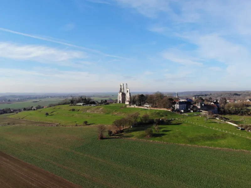
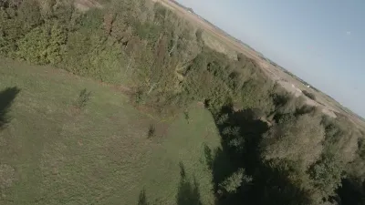
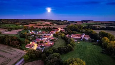
The Abbey of Mount St. Eloi, founded by St. Vindicio, which was destroyed when it was sold as a national property in 1793, was home to a community of Canons Regular of the Rule of St. Augustine, who carried out an important literary activity. The towers still present on the site were the facade of the abbey church rebuilt in the 18th century and then demolished in the early 19th century and during the First World War.
I advise you to take the D49 before arriving in the village, there is a small road (without name) on your right and from there you can take off without any problem. The abbey is located in front of you, at the top of the hill.
Map and restricted areas
Open in the main mapNearby aerodromes
Open aerodromes within 25 km of the spot, heliports included, with their distance and direction from the spot. Near an aerodrome, drone flying is prohibited or height-limited: check the UAS zones map.
| Aerodrome | Type | Distance | Elevation | Difference |
|---|---|---|---|---|
| Arras Roclincourt Airfield | Aerodrome | 7.8 km E | 103 m | spot 6 m lower |
| Polyclinique Heliport | Heliport | 15 km E | 62 m | spot 35 m higher |
| Lens Benifontaine Airfield | Aerodrome | 15 km NE | 51 m | spot 46 m higher |
| Vitry en Artois Airfield | Aerodrome | 21 km E | 53 m | spot 44 m higher |
| Usine Renault Heliport | Heliport | 24 km E | 29 m | spot 68 m higher |
Aviation weather (METAR and TAF)
LFQQ – Lille-Lesquin Airport VFR
METAR
METAR LFQQ 211200Z AUTO 14004KT 100V160 CAVOK 08/04 Q1019 NOSIG
- Wind
- 140°, 7 km/h
- Visibility
- 10 km or more
- Clouds
- –
- Temperature
- 8 °C, dew point 4 °C
- QNH
- 1019 hPa
- Flight category
- VFR: ceiling > 3,000 ft and visibility > 5 mi
TAF
TAF LFQQ 211100Z 2112/2218 VRB04KT CAVOK PROB40 2117/2120 4000 BR BKN009 PROB30 2120/2124 BKN013 BECMG 2200/2202 09007KT
| Period (local time) | Change | Wind | Visibility | Weather | Clouds |
|---|---|---|---|---|---|
| 21/11 13:00 → 22/11 01:00 | Initial conditions | Variable, 7 km/h | 10 km or more | No significant weather | No significant cloud |
| 21/11 18:00 → 21/11 21:00 | probability 40% | 4.0 km | Mist | Broken (5-7/8) at 900 ft (270 m) | |
| 21/11 21:00 → 22/11 01:00 | probability 30% | Broken (5-7/8) at 1,300 ft (400 m) | |||
| 22/11 01:00 → 22/11 19:00 | Becoming | 090°, 13 km/h | 10 km or more | No significant weather | No significant cloud |
Weather and Kp index
Sunrise and sunset
| Day | Dawn | Sunrise | Golden hour | Sunset | Dusk | Day length |
|---|---|---|---|---|---|---|
| Sat 21 Nov | 07:36 | 08:13 | 08:13–09:06 · 16:04–16:57 | 16:57 | 17:34 | 8 h 44 |
| Sun 22 Nov | 07:38 | 08:14 | 08:14–09:08 · 16:03–16:56 | 16:56 | 17:33 | 8 h 41 |
| Mon 23 Nov | 07:39 | 08:16 | 08:16–09:10 · 16:01–16:55 | 16:55 | 17:32 | 8 h 39 |
| Tue 24 Nov | 07:41 | 08:17 | 08:17–09:12 · 16:00–16:54 | 16:54 | 17:31 | 8 h 36 |
| Wed 25 Nov | 07:42 | 08:19 | 08:19–09:13 · 15:59–16:53 | 16:53 | 17:30 | 8 h 34 |
| Thu 26 Nov | 07:43 | 08:20 | 08:20–09:15 · 15:58–16:53 | 16:53 | 17:30 | 8 h 32 |
| Fri 27 Nov | 07:45 | 08:22 | 08:22–09:17 · 15:57–16:52 | 16:52 | 17:29 | 8 h 29 |

Reviews
Log in to review this spot. Log in · Create a free account
No reviews yet. Share yours!