

Heritage
Canadian Memorial

3 pilot reviews
“Merci pour la precision. Car c est en effet un spot magnifique. Ils ne vous ont pas donne…” — babac62, 4 years ago
Read the reviews + Write my reviewDescription
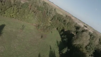
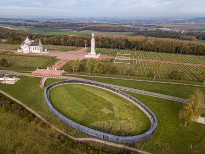
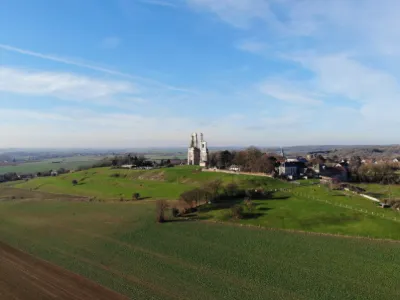
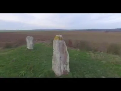
A wonderful spot where you can take off without too much trouble for static shots around the monument, or fly through the forest in FPV
Map and restricted areas
Open in the main mapNearby aerodromes
Open aerodromes within 25 km of the spot, heliports included, with their distance and direction from the spot. Near an aerodrome, drone flying is prohibited or height-limited: check the UAS zones map.
| Aerodrome | Type | Distance | Elevation | Difference |
|---|---|---|---|---|
| Arras Roclincourt Airfield | Aerodrome | 6.0 km S | 103 m | spot 34 m higher |
| Polyclinique Heliport | Heliport | 9.8 km E | 62 m | spot 75 m higher |
| Lens Benifontaine Airfield | Aerodrome | 11 km N | 51 m | spot 86 m higher |
| Vitry en Artois Airfield | Aerodrome | 16 km E | 53 m | spot 84 m higher |
| Usine Renault Heliport | Heliport | 19 km E | 29 m | spot 108 m higher |
Aviation weather (METAR and TAF)
LFQQ – Lille-Lesquin Airport VFR
METAR
METAR LFQQ 211200Z AUTO 14004KT 100V160 CAVOK 08/04 Q1019 NOSIG
- Wind
- 140°, 7 km/h
- Visibility
- 10 km or more
- Clouds
- –
- Temperature
- 8 °C, dew point 4 °C
- QNH
- 1019 hPa
- Flight category
- VFR: ceiling > 3,000 ft and visibility > 5 mi
TAF
TAF LFQQ 211100Z 2112/2218 VRB04KT CAVOK PROB40 2117/2120 4000 BR BKN009 PROB30 2120/2124 BKN013 BECMG 2200/2202 09007KT
| Period (local time) | Change | Wind | Visibility | Weather | Clouds |
|---|---|---|---|---|---|
| 21/11 13:00 → 22/11 01:00 | Initial conditions | Variable, 7 km/h | 10 km or more | No significant weather | No significant cloud |
| 21/11 18:00 → 21/11 21:00 | probability 40% | 4.0 km | Mist | Broken (5-7/8) at 900 ft (270 m) | |
| 21/11 21:00 → 22/11 01:00 | probability 30% | Broken (5-7/8) at 1,300 ft (400 m) | |||
| 22/11 01:00 → 22/11 19:00 | Becoming | 090°, 13 km/h | 10 km or more | No significant weather | No significant cloud |
Weather and Kp index
Sunrise and sunset
| Day | Dawn | Sunrise | Golden hour | Sunset | Dusk | Day length |
|---|---|---|---|---|---|---|
| Sat 21 Nov | 07:36 | 08:13 | 08:13–09:06 · 16:03–16:57 | 16:57 | 17:33 | 8 h 44 |
| Sun 22 Nov | 07:38 | 08:14 | 08:14–09:08 · 16:02–16:56 | 16:56 | 17:33 | 8 h 41 |
| Mon 23 Nov | 07:39 | 08:16 | 08:16–09:10 · 16:01–16:55 | 16:55 | 17:32 | 8 h 39 |
| Tue 24 Nov | 07:40 | 08:17 | 08:17–09:12 · 16:00–16:54 | 16:54 | 17:31 | 8 h 36 |
| Wed 25 Nov | 07:42 | 08:19 | 08:19–09:13 · 15:59–16:53 | 16:53 | 17:30 | 8 h 34 |
| Thu 26 Nov | 07:43 | 08:20 | 08:20–09:15 · 15:57–16:52 | 16:52 | 17:29 | 8 h 32 |
| Fri 27 Nov | 07:44 | 08:22 | 08:22–09:17 · 15:56–16:51 | 16:51 | 17:29 | 8 h 29 |

Reviews
Log in to review this spot. Log in · Create a free account
babac62
Merci pour la precision. Car c est en effet un spot magnifique. Ils ne vous ont pas donne la distance par rapport au monument?
KUB!
Merci pour votre commentaire, cela m'a permis de vérifier vos informations, et permettre à chacun un vol agréable et de qualité. Effectivement vous avez raison c'est un territoire canadien, j'ai contacté l'ambassade du Canada pour plus d'informations, il faut une autorisation à proximité du monument ainsi que dans certains périmètre, pour le reste je n'ai pas eu plus d'informations. Je n'ai jamais eu de problème avec les gardes Canadien pour faire voler mon quad sur ce terrain. De plus il n'a jamais été référencé comme domaine militaire... Sauf en 14-18... Légalement nous sommes autorisé à voler sous la hauteur des arbres et jusqu'à la limite visuel. Tant qu'il n'y a pas de précision de l'ambassade... Let's go
Léviosa
Territoire Canadien, vol soumit à autorisation de l‘exploitant de la zone !