

Tatihou Island
No reviews yet
Have you flown here? Share your experience with other pilots.
+ Write the first reviewDescription
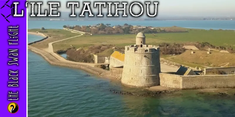
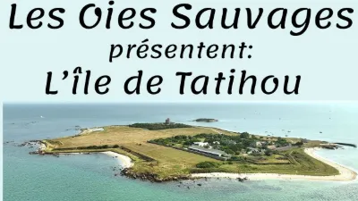
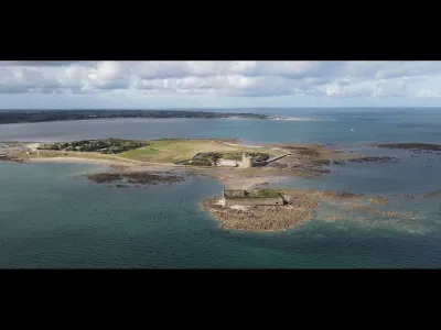
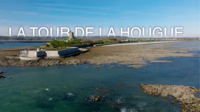
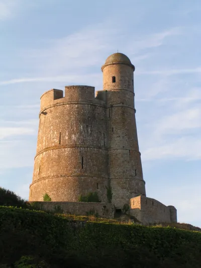
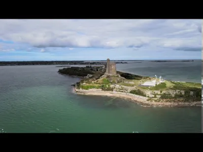
Tatihou Island is a French coastal island north-east of Cotentinsituated in the bay of Saint-Vaast-la-Hougue (department of Manche), to which it is administratively attached1. Covering an area of 29 hectares, it is accessible on foot at certain low tides. The island belongs to the Conservatoire du littoral and is not permanently inhabited. Its patrimony is composed of : Fort Vauban 2 built in 1694, after the Battle of La Hougue, including the Tour Vauban 3 (century), listed with its counterpart on the site of La Hougue as a World Heritage Site by UNESCO since 2008. Inside the fortifications ( century) there is also a chapel (end of the century), a powder magazine ( century) and a barracks which became a restaurant ; the former lazaret, built in 1720 to prevent the spread of the plague, which houses the maritime museum, a botanical garden, a naval carpentry workshop and accommodation buildings ; an ornithological reserve4 , located in the plain behind the Vauban tower and in the Ilet fort and managed by the Norman Ornithological Group5. of a customs house (1805), above the pier.
Map and restricted areas
Open in the main mapNearby aerodromes
Open aerodromes within 25 km of the spot, heliports included, with their distance and direction from the spot. Near an aerodrome, drone flying is prohibited or height-limited: check the UAS zones map.
| Aerodrome | Type | Distance | Elevation | Difference |
|---|---|---|---|---|
| Cherbourg-Maupertus Airport | Airport | 18 km W | 140 m | spot 137 m lower |
Aviation weather (METAR and TAF)
LFRC – Cherbourg-Maupertus Airport LIFR
METAR
METAR LFRC 211130Z AUTO 15009KT 0350 0300 R28/0400N FG VV/// 09/09 Q1016 BECMG 6000 NSW BKN003
- Wind
- 150°, 17 km/h
- Visibility
- 350 m
- Weather
- Fog
- Clouds
- –
- Temperature
- 9 °C, dew point 9 °C
- QNH
- 1016 hPa
- Flight category
- LIFR: ceiling < 500 ft or visibility < 1 mi
TAF
TAF LFRC 211100Z 2112/2121 17010KT 0300 FG VV/// BECMG 2112/2114 6000 NSW BKN003 BECMG 2114/2116 BKN008 TEMPO 2116/2120 BKN011 BECMG 2119/2121 13015G25KT
| Period (local time) | Change | Wind | Visibility | Weather | Clouds |
|---|---|---|---|---|---|
| 21/11 13:00 → 21/11 22:00 | Initial conditions | 170°, 19 km/h | 300 m | Fog | |
| 21/11 13:00 → 21/11 15:00 | Becoming | 170°, 19 km/h | 6 km | No significant weather | Broken (5-7/8) at 300 ft (90 m) |
| 21/11 15:00 → 21/11 20:00 | Becoming | 170°, 19 km/h | 6 km | No significant weather | Broken (5-7/8) at 800 ft (240 m) |
| 21/11 17:00 → 21/11 21:00 | Temporarily | Broken (5-7/8) at 1,100 ft (340 m) | |||
| 21/11 20:00 → 21/11 22:00 | Becoming | 130°, 28 km/h, gusts 46 km/h | 6 km | No significant weather | Broken (5-7/8) at 800 ft (240 m) |
Weather and Kp index
Sunrise and sunset
| Day | Dawn | Sunrise | Golden hour | Sunset | Dusk | Day length |
|---|---|---|---|---|---|---|
| Sat 21 Nov | 07:50 | 08:26 | 08:26–09:18 · 16:24–17:16 | 17:16 | 17:52 | 8 h 50 |
| Sun 22 Nov | 07:51 | 08:27 | 08:27–09:20 · 16:23–17:15 | 17:15 | 17:51 | 8 h 47 |
| Mon 23 Nov | 07:53 | 08:29 | 08:29–09:21 · 16:21–17:14 | 17:14 | 17:50 | 8 h 45 |
| Tue 24 Nov | 07:54 | 08:30 | 08:30–09:23 · 16:20–17:13 | 17:13 | 17:49 | 8 h 42 |
| Wed 25 Nov | 07:55 | 08:32 | 08:32–09:25 · 16:19–17:12 | 17:12 | 17:48 | 8 h 40 |
| Thu 26 Nov | 07:57 | 08:33 | 08:33–09:27 · 16:18–17:11 | 17:11 | 17:48 | 8 h 38 |
| Fri 27 Nov | 07:58 | 08:35 | 08:35–09:28 · 16:17–17:11 | 17:11 | 17:47 | 8 h 36 |

Reviews
Log in to review this spot. Log in · Create a free account
No reviews yet. Share yours!