

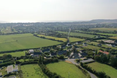
Old church Saint Germain de Carteret
No reviews yet
Have you flown here? Share your experience with other pilots.
+ Write the first reviewDescription
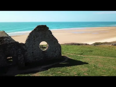
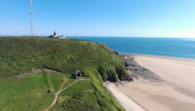
The old Saint-Germain church is a catholic building in Carteret. It was built at the beginning of the 12th century on Cap de Carteret and dedicated to Saint Germain le Scot. The first mention found dates from 1125, the year it was given to the Abbey of Mont-Saint-Michel by Renaud de Carteret. Other parts date from the 15th century, including a vaulted chapel with a cross vault. Only the north and south walls of the nave and choir remain today. Threatened by the sea, the church was abandoned between 1686 and 1689, and partially demolished: its stones were used to enlarge the church of Saint-Louis, which took over in 1684 for the celebration of worship.
Map and restricted areas
Open in the main mapNearby aerodromes
Open aerodromes within 25 km of the spot, heliports included, with their distance and direction from the spot. Near an aerodrome, drone flying is prohibited or height-limited: check the UAS zones map.
| Aerodrome | Type | Distance | Elevation | Difference |
|---|---|---|---|---|
| Flamanville Heliport | Heliport | 18 km N | 82 m | spot 31 m lower |
Aviation weather (METAR and TAF)
EGJJ – Jersey Airport LIFR
METAR
METAR EGJJ 211120Z 13013KT 0100 R08/0450D FG OVC000 09/09 Q1015
- Wind
- 130°, 24 km/h
- Visibility
- 100 m
- Weather
- Fog
- Clouds
- –
- Temperature
- 9 °C, dew point 9 °C
- QNH
- 1015 hPa
- Flight category
- LIFR: ceiling < 500 ft or visibility < 1 mi
TAF
TAF EGJJ 211112Z 2112/2121 13012KT 0200 FG BKN000 BECMG 2112/2114 9999 BKN008 PROB40 TEMPO 2112/2118 3000 BR BKN003 BECMG 2117/2119 SCT015
| Period (local time) | Change | Wind | Visibility | Weather | Clouds |
|---|---|---|---|---|---|
| 21/11 13:00 → 21/11 22:00 | Initial conditions | 130°, 22 km/h | 200 m | Fog | Broken (5-7/8) |
| 21/11 13:00 → 21/11 18:00 | Becoming | 130°, 22 km/h | 10 km or more | Fog | Broken (5-7/8) at 800 ft (240 m) |
| 21/11 13:00 → 21/11 19:00 | Temporarily, probability 40% | 3.0 km | Mist | Broken (5-7/8) at 300 ft (90 m) | |
| 21/11 18:00 → 21/11 22:00 | Becoming | 130°, 22 km/h | 10 km or more | Fog | Scattered (3-4/8) at 1,500 ft (460 m) |
Weather and Kp index
Sunrise and sunset
| Day | Dawn | Sunrise | Golden hour | Sunset | Dusk | Day length |
|---|---|---|---|---|---|---|
| Sat 21 Nov | 07:52 | 08:27 | 08:27–09:19 · 16:27–17:19 | 17:19 | 17:54 | 8 h 51 |
| Sun 22 Nov | 07:53 | 08:29 | 08:29–09:21 · 16:26–17:18 | 17:18 | 17:54 | 8 h 49 |
| Mon 23 Nov | 07:54 | 08:30 | 08:30–09:22 · 16:25–17:17 | 17:17 | 17:53 | 8 h 46 |
| Tue 24 Nov | 07:56 | 08:32 | 08:32–09:24 · 16:24–17:16 | 17:16 | 17:52 | 8 h 44 |
| Wed 25 Nov | 07:57 | 08:33 | 08:33–09:26 · 16:23–17:15 | 17:15 | 17:51 | 8 h 42 |
| Thu 26 Nov | 07:58 | 08:35 | 08:35–09:28 · 16:21–17:14 | 17:14 | 17:51 | 8 h 39 |
| Fri 27 Nov | 08:00 | 08:36 | 08:36–09:29 · 16:20–17:14 | 17:14 | 17:50 | 8 h 37 |


Reviews
Log in to review this spot. Log in · Create a free account
No reviews yet. Share yours!