

Carteret, La Potinière beach
No reviews yet
Have you flown here? Share your experience with other pilots.
+ Write the first reviewDescription
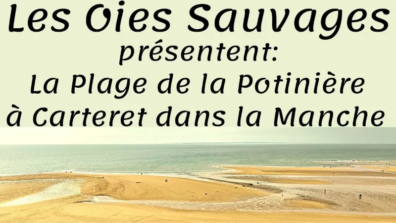
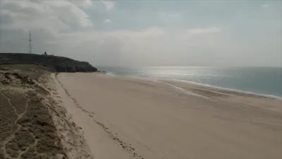
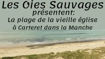
La Potinière beach (or Carteret beach) is the historic beach of Barneville-Carteret. Nestled between the harbor breakwater and Cap de Carteret, this wide sandy cove is well sheltered from the wind and enjoys the warmth of the Gulf Stream. The bathing cabins set along the seawall by the cliff remind us that this beach was popular back when sea bathing was in fashion.
The beach is split into two areas. On the Cap Carteret cliffs side, there is a seawall where the cabins are set. This part of the beach is covered at high tide. On the left, the beach ends at the harbor breakwater. The sand is finer there, there are a few dunes, and a strip of sand remains at high tide.
The beach is supervised during the summer season. It is accessible to people with reduced mobility (Tiralo beach wheelchairs are available) and has restrooms. There is a small kiosk where you can grab a quick bite. Free parking right next to the beach.
Outside the season, people surf and windsurf here.
To get to this beach from the center of Barneville, follow the signs for the ferry terminal and the beach (you go around the harbor).
Map and restricted areas
Open in the main mapNearby aerodromes
Open aerodromes within 25 km of the spot, heliports included, with their distance and direction from the spot. Near an aerodrome, drone flying is prohibited or height-limited: check the UAS zones map.
| Aerodrome | Type | Distance | Elevation | Difference |
|---|---|---|---|---|
| Flamanville Heliport | Heliport | 19 km N | 82 m | spot 81 m lower |
Aviation weather (METAR and TAF)
EGJJ – Jersey Airport VFR
METAR
METAR EGJJ 210650Z 18003KT 9999 FEW015 10/09 Q1016
- Wind
- 180°, 6 km/h
- Visibility
- 10 km or more
- Clouds
- Few (1-2/8) at 1,500 ft (460 m)
- Temperature
- 10 °C, dew point 9 °C
- QNH
- 1016 hPa
- Flight category
- VFR: ceiling > 3,000 ft and visibility > 5 mi
TAF
TAF EGJJ 210500Z 2106/2115 22003KT 9999 FEW015 BECMG 2107/2109 14010KT PROB40 TEMPO 2108/2113 1500 BR BKN002 PROB30 TEMPO 2110/2112 0200 FG BKN000
| Period (local time) | Change | Wind | Visibility | Weather | Clouds |
|---|---|---|---|---|---|
| 21/11 07:00 → 21/11 08:00 | Initial conditions | 220°, 6 km/h | 10 km or more | Few (1-2/8) at 1,500 ft (460 m) | |
| 21/11 08:00 → 21/11 16:00 | Becoming | 140°, 19 km/h | 10 km or more | Few (1-2/8) at 1,500 ft (460 m) | |
| 21/11 09:00 → 21/11 14:00 | Temporarily, probability 40% | 1.5 km | Mist | Broken (5-7/8) at 200 ft (60 m) | |
| 21/11 11:00 → 21/11 13:00 | Temporarily, probability 30% | 200 m | Fog | Broken (5-7/8) |
Weather and Kp index
Sunrise and sunset
| Day | Dawn | Sunrise | Golden hour | Sunset | Dusk | Day length |
|---|---|---|---|---|---|---|
| Sat 21 Nov | 07:52 | 08:27 | 08:27–09:19 · 16:27–17:19 | 17:19 | 17:54 | 8 h 51 |
| Sun 22 Nov | 07:53 | 08:29 | 08:29–09:21 · 16:26–17:18 | 17:18 | 17:54 | 8 h 49 |
| Mon 23 Nov | 07:54 | 08:30 | 08:30–09:22 · 16:25–17:17 | 17:17 | 17:53 | 8 h 46 |
| Tue 24 Nov | 07:56 | 08:32 | 08:32–09:24 · 16:24–17:16 | 17:16 | 17:52 | 8 h 44 |
| Wed 25 Nov | 07:57 | 08:33 | 08:33–09:26 · 16:22–17:15 | 17:15 | 17:51 | 8 h 42 |
| Thu 26 Nov | 07:58 | 08:34 | 08:34–09:27 · 16:21–17:14 | 17:14 | 17:51 | 8 h 39 |
| Fri 27 Nov | 08:00 | 08:36 | 08:36–09:29 · 16:20–17:14 | 17:14 | 17:50 | 8 h 37 |
Reviews
Log in to review this spot. Log in · Create a free account
No reviews yet. Share yours!