

Haute-Parthe - Career

No reviews yet
Have you flown here? Share your experience with other pilots.
+ Write the first reviewDescription
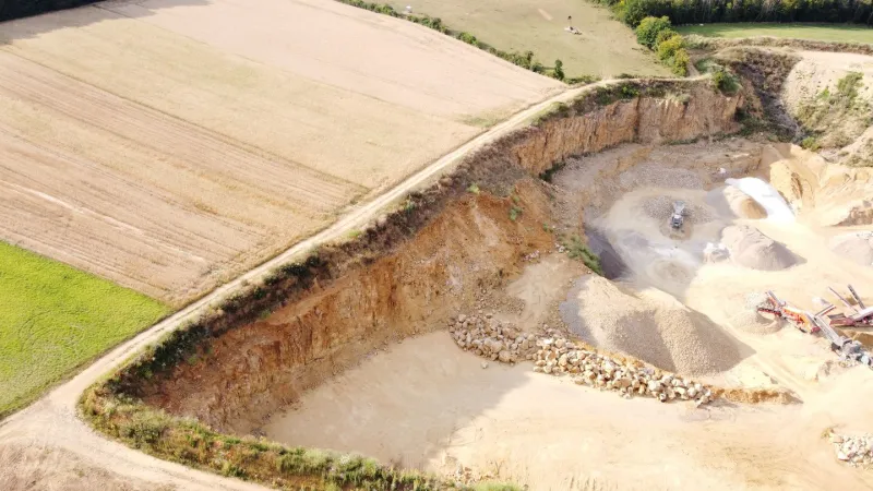
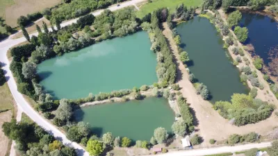
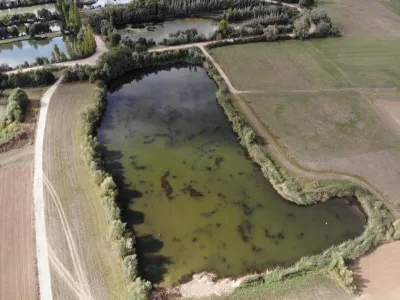
Small flying site around a quarry located in Haute-Parthe, commune of Boust, in a wooded valley bottom. Attention !!! I discovered that a colony of shore swallows lives in the cliffs of the quarry. Please do not visit the cliffs and do not fly on this site from spring to autumn. It is absolutely necessary to avoid disturbing these birds, whose species is in serious decline and threatened with extinction. Disturbed shore swallows could abandon their young and permanently lose an important nesting and breeding site for the maintenance of the species.
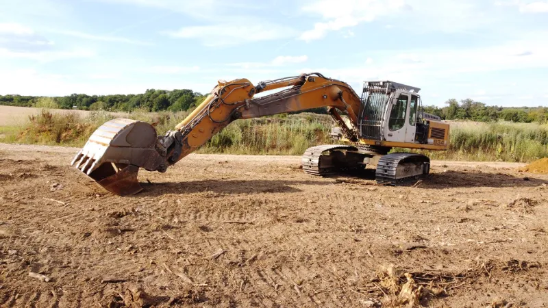
The no-fly zone of the Cattenom nuclear power plant is directly adjacent to the south, so be careful not to violate this airspace. No interference was observed on the day of the flight, and the woods protect this site well from the wind. Finally, as the quarry is still active, choose the days and times of flight intelligently.
Have a good flight!
Map and restricted areas
Open in the main mapNearby aerodromes
Open aerodromes within 25 km of the spot, heliports included, with their distance and direction from the spot. Near an aerodrome, drone flying is prohibited or height-limited: check the UAS zones map.
| Aerodrome | Type | Distance | Elevation | Difference |
|---|---|---|---|---|
| Centre Hospitalier Emile Mayrisch Heliport | Heliport | 17 km NW | 296 m | spot 98 m lower |
| Clinique Ste-Thérèse heliport | Heliport | 19 km N | 305 m | spot 107 m lower |
| Luxembourg-Findel International Airport | Major airport | 20 km N | 376 m | spot 178 m lower |
| Centre Hospitalier de Luxembourg Helipad | Heliport | 21 km N | 329 m | spot 130 m lower |
| Hôpital Kirchberg heliport | Heliport | 21 km N | 372 m | spot 173 m lower |
Aviation weather (METAR and TAF)
ELLX – Luxembourg-Findel International Airport VFR
METAR
METAR ELLX 210620Z 00000KT CAVOK 00/M00 Q1018 NOSIG
- Wind
- Calm
- Visibility
- 10 km or more
- Clouds
- –
- Temperature
- 0 °C, dew point 0 °C
- QNH
- 1018 hPa
- Flight category
- VFR: ceiling > 3,000 ft and visibility > 5 mi
TAF
TAF ELLX 210500Z 2106/2212 20005KT 9999 FEW045
| Period (local time) | Change | Wind | Visibility | Weather | Clouds |
|---|---|---|---|---|---|
| 21/11 07:00 → 22/11 13:00 | Initial conditions | 200°, 9 km/h | 10 km or more | Few (1-2/8) at 4,500 ft (1370 m) |
Weather and Kp index
Sunrise and sunset
| Day | Dawn | Sunrise | Golden hour | Sunset | Dusk | Day length |
|---|---|---|---|---|---|---|
| Sat 21 Nov | 07:20 | 07:55 | 07:55–08:47 · 15:55–16:47 | 16:47 | 17:22 | 8 h 51 |
| Sun 22 Nov | 07:21 | 07:57 | 07:57–08:49 · 15:54–16:46 | 16:46 | 17:21 | 8 h 48 |
| Mon 23 Nov | 07:23 | 07:58 | 07:58–08:51 · 15:52–16:45 | 16:45 | 17:21 | 8 h 46 |
| Tue 24 Nov | 07:24 | 08:00 | 08:00–08:52 · 15:51–16:44 | 16:44 | 17:20 | 8 h 44 |
| Wed 25 Nov | 07:25 | 08:01 | 08:01–08:54 · 15:50–16:43 | 16:43 | 17:19 | 8 h 41 |
| Thu 26 Nov | 07:27 | 08:03 | 08:03–08:56 · 15:49–16:42 | 16:42 | 17:18 | 8 h 39 |
| Fri 27 Nov | 07:28 | 08:04 | 08:04–08:58 · 15:48–16:41 | 16:41 | 17:18 | 8 h 37 |
Reviews
Log in to review this spot. Log in · Create a free account
No reviews yet. Share yours!