

Aincourt Sanatorium
2 pilot reviews
“On a le droit de survoler du coup ?” — madrone, 3 years ago
Read the reviews + Write my reviewDescription
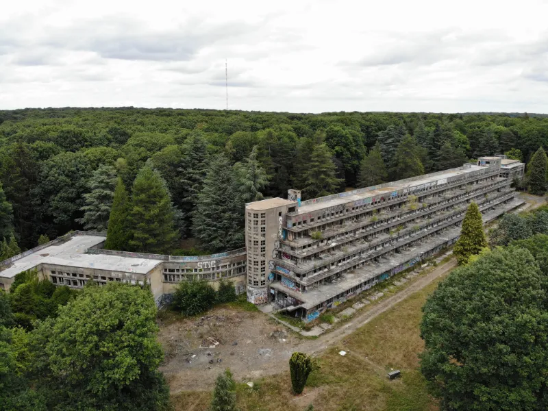
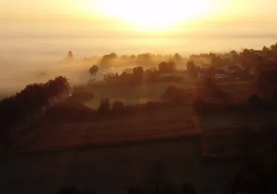
The Aincourt sanatorium was a treatment center specialized in pulmonary tuberculosis (phthisis), located in the village of Aincourt (Val-d'Oise department) in France.
The sanatorium, currently located in the Vexin français regional natural park, was built by the architects Édouard Crevel and Paul Decaux between 1931 and 1933. It is one of the largest complexes of its kind built in the 20th century. It was also a concentration camp between 1940 and 1942.
The building is currently partly occupied by the Vexin intercommunal hospital group. It has been listed as a historic monument since 1 February 1999.
Map and restricted areas
Open in the main mapNearby aerodromes
Open aerodromes within 25 km of the spot, heliports included, with their distance and direction from the spot. Near an aerodrome, drone flying is prohibited or height-limited: check the UAS zones map.
| Aerodrome | Type | Distance | Elevation | Difference |
|---|---|---|---|---|
| Mantes Chérence Airfield | Aerodrome | 4.8 km W | 156 m | spot 24 m higher |
| Base Paramoteurs d' Avernes | Aerodrome | 9.5 km E | 139 m | spot 41 m higher |
| Centre Hospitalier F. Quesnay Heliport | Heliport | 11 km SW | 28 m | spot 152 m higher |
| Flins Heliport | Heliport | 13 km SE | 25 m | spot 155 m higher |
| Les Mureaux Airfield | Aerodrome | 16 km SE | 27 m | spot 153 m higher |
Aviation weather (METAR and TAF)
LFPT – Aérodrome de Pontoise - Cormeilles en Vexin VFR
METAR
METAR LFPT 211130Z AUTO 14006KT 9999 FEW010 SCT016 BKN054 11/09 Q1018
- Wind
- 140°, 11 km/h
- Visibility
- 10 km or more
- Clouds
- Few (1-2/8) at 1,000 ft (300 m) ; Scattered (3-4/8) at 1,600 ft (490 m) ; Broken (5-7/8) at 5,400 ft (1650 m)
- Temperature
- 11 °C, dew point 9 °C
- QNH
- 1018 hPa
- Flight category
- VFR: ceiling > 3,000 ft and visibility > 5 mi
TAF
Weather and Kp index
Sunrise and sunset
| Day | Dawn | Sunrise | Golden hour | Sunset | Dusk | Day length |
|---|---|---|---|---|---|---|
| Sat 21 Nov | 07:37 | 08:12 | 08:12–09:03 · 16:14–17:06 | 17:06 | 17:41 | 8 h 53 |
| Sun 22 Nov | 07:38 | 08:13 | 08:13–09:05 · 16:13–17:05 | 17:05 | 17:40 | 8 h 51 |
| Mon 23 Nov | 07:39 | 08:15 | 08:15–09:07 · 16:12–17:04 | 17:04 | 17:39 | 8 h 49 |
| Tue 24 Nov | 07:41 | 08:16 | 08:16–09:08 · 16:11–17:03 | 17:03 | 17:39 | 8 h 46 |
| Wed 25 Nov | 07:42 | 08:18 | 08:18–09:10 · 16:10–17:02 | 17:02 | 17:38 | 8 h 44 |
| Thu 26 Nov | 07:43 | 08:19 | 08:19–09:12 · 16:09–17:01 | 17:01 | 17:37 | 8 h 42 |
| Fri 27 Nov | 07:45 | 08:21 | 08:21–09:13 · 16:08–17:01 | 17:01 | 17:37 | 8 h 40 |


Reviews
Log in to review this spot. Log in · Create a free account
madrone
On a le droit de survoler du coup ?
Olivier75
Le spot est en cours de travaux. Il a été fermé par un grillage de plus de 2 mètres et sous vidéos surveillance malheureusement