

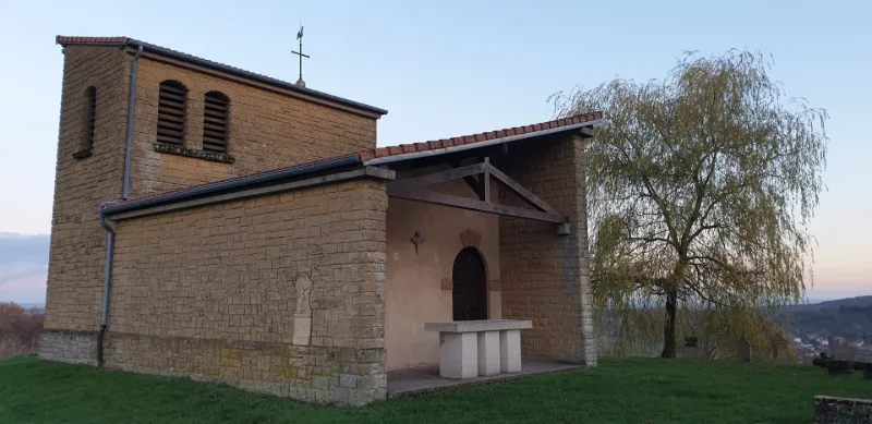
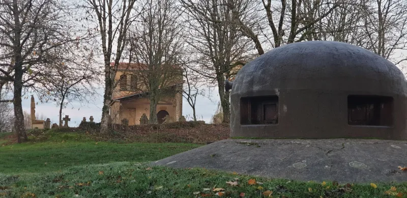
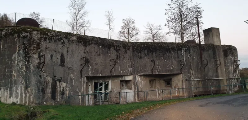
The biggest fortress of the Maginot Line - The Hackenberg fortress ... and its chapel!
1 pilot review
“Merci pour notre historique et notre histoire” — tyeb54230, 5 years ago
Read the reviews + Write my reviewDescription
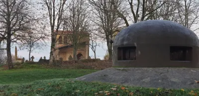
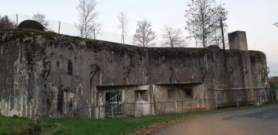
The Hackenberg is a hill that peaks at 347 meters above sea level between Budling and Veckring in Moselle. It is known for housing the largest fortress of the Maginot Line, the Hackenberg fortress, a promontory fort and a chapel, the Hackenberg chapel. The summit of the Hackenberg has been a protected site since 1924. Built between 1929 and 1935 astride the hill of the same name, the Hackenberg (A19) is the largest fortress of the Maginot Line. In this formidable fortress, buried in places at a depth of 96 meters, everything is on a massive scale: two entrances, 17 combat blocks divided into two half-fortresses, west and east, 25 guns including 7 anti-tank guns, 33 light mortars, 30 machine guns and 60 automatic rifles, a storage capacity of nearly 80,000 shells and 1.5 million 7.5 mm cartridges, 3.50 meters of concrete thickness for the walls of the blocks exposed to enemy fire, and 10 kilometers of underground galleries. In 1940, 43 officers and 1,040 crew soldiers lived inside the fortress. It unleashed the precise and deadly fire of its artillery in June 1940 but was spared a direct attack; the fortress was then reoccupied by the Germans and partially reused, notably to slow the Allied advance. Its block 8 was then attacked and neutralized by American troops of the 90th Infantry Division in November 1944. Maintained by the French army until the 1970s, it was handed over in 1975 to the Amifort-Veckring association. Since then, it has been partially open to the public and receives nearly 50,000 visitors a year.
https://www.maginot-hackenberg.com/index.php?page=home&lang=fr
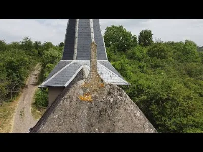
A first chapel, dependent on the lordship of Busbach, was built at the summit before 1535; some gravestones of the parish families dating from the 16th century are still visible. Around 1812, a school and a church were built for the parish of Hackenberg. At the turn of the century, when the parish was dissolved, they lost their purpose, were abandoned and then demolished. A small chapel and the parish cemetery remained as they were until November 15, 1944, when the chapel was destroyed by American bombing during the liberation fighting.
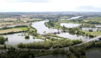
The takeoff site is at the top, in the parking area. A flight area opens up all around, with a radius of almost one kilometer. The flight ceiling is limited to 120 m, but as the area can be windy, be careful. No interference was noticed on the day of the flight.
Map and restricted areas
Open in the main mapNearby aerodromes
Open aerodromes within 25 km of the spot, heliports included, with their distance and direction from the spot. Near an aerodrome, drone flying is prohibited or height-limited: check the UAS zones map.
| Aerodrome | Type | Distance | Elevation | Difference |
|---|---|---|---|---|
| Flugplatz Saarlouis-Düren | Aerodrome | 22 km E | 341 m | same altitude as the spot |
Aviation weather (METAR and TAF)
ELLX – Luxembourg-Findel International Airport VFR
METAR
METAR ELLX 210950Z 16003KT 090V210 CAVOK 04/02 Q1019 NOSIG
- Wind
- 160°, 6 km/h
- Visibility
- 10 km or more
- Clouds
- –
- Temperature
- 4 °C, dew point 2 °C
- QNH
- 1019 hPa
- Flight category
- VFR: ceiling > 3,000 ft and visibility > 5 mi
TAF
TAF ELLX 210500Z 2106/2212 20005KT 9999 FEW045
| Period (local time) | Change | Wind | Visibility | Weather | Clouds |
|---|---|---|---|---|---|
| 21/11 07:00 → 22/11 13:00 | Initial conditions | 200°, 9 km/h | 10 km or more | Few (1-2/8) at 4,500 ft (1370 m) |
Weather and Kp index
Sunrise and sunset
| Day | Dawn | Sunrise | Golden hour | Sunset | Dusk | Day length |
|---|---|---|---|---|---|---|
| Sat 21 Nov | 07:19 | 07:54 | 07:54–08:46 · 15:55–16:46 | 16:46 | 17:22 | 8 h 51 |
| Sun 22 Nov | 07:20 | 07:56 | 07:56–08:48 · 15:53–16:45 | 16:45 | 17:21 | 8 h 49 |
| Mon 23 Nov | 07:22 | 07:57 | 07:57–08:50 · 15:52–16:44 | 16:44 | 17:20 | 8 h 47 |
| Tue 24 Nov | 07:23 | 07:59 | 07:59–08:51 · 15:51–16:44 | 16:44 | 17:19 | 8 h 44 |
| Wed 25 Nov | 07:24 | 08:00 | 08:00–08:53 · 15:50–16:43 | 16:43 | 17:19 | 8 h 42 |
| Thu 26 Nov | 07:26 | 08:02 | 08:02–08:55 · 15:49–16:42 | 16:42 | 17:18 | 8 h 40 |
| Fri 27 Nov | 07:27 | 08:03 | 08:03–08:56 · 15:48–16:41 | 16:41 | 17:17 | 8 h 38 |


Reviews
Log in to review this spot. Log in · Create a free account
tyeb54230
Merci pour notre historique et notre histoire