

Banon, Notre Dame des Anges chapel
No reviews yet
Have you flown here? Share your experience with other pilots.
+ Write the first reviewDescription
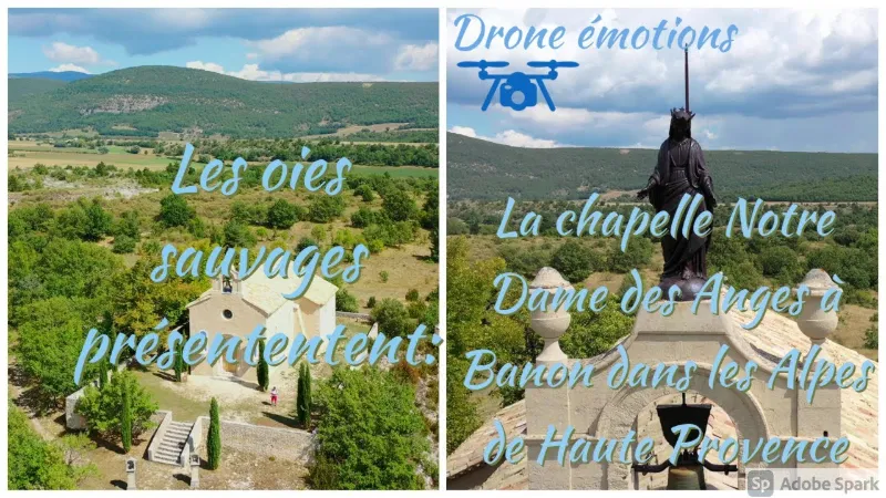
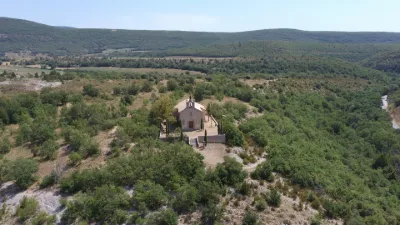
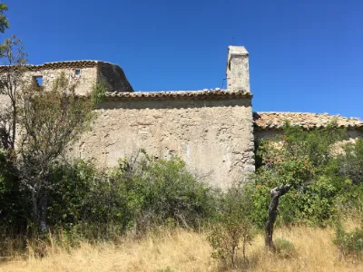
The Notre-Dame des Anges chapel in Banon is a religious building standing on an old oppidum, facing the village, in the Banon plain. The Romanesque parts of this chapel may date back to the end of the 13th century, and archaeology specialists would date it even earlier, to the early Middle Ages, on a Gallo-Roman site. The chapel is in a worrying condition, as shown by the state of the statues flanking the entrance. Much damage has appeared on the facades and on the interior walls. There are also leaks in the roof. The restoration concerns in particular the structure of the building. The work program will cover redoing the roofing, repairing the exterior and interior plaster as well as the floors. Care will also be taken in cleaning the bell tower and in restoring the statues and stained-glass windows. The entrance of the Notre-Dame des Anges chapel is flanked by two statues, Saint Joseph and Saint Anne. Both are supported by angels and seem to watch over the chapel and its visitors, and to gaze into the distance at the village of Banon. The cross-shaped apse of the chapel dates from the 13th century. 19th-century paintings cover the nave, the apse and the semi-dome. The nave walls carry five ex-votos. The wall of the chancel arch is covered with a fresco depicting the "Adoration of the Virgin by Saint Mark and Saint Clare". The altar of the Immaculate One supports a gilded Virgin that used to be carried in procession on the night of August 14 during a pilgrimage.
Map and restricted areas
Open in the main mapNearby aerodromes
Open aerodromes within 25 km of the spot, heliports included, with their distance and direction from the spot. Near an aerodrome, drone flying is prohibited or height-limited: check the UAS zones map.
| Aerodrome | Type | Distance | Elevation | Difference |
|---|---|---|---|---|
| Altisurface de Banon | Aerodrome | 2.9 km NW | 1,135 m | spot 395 m lower |
| Saint Martin de Castillon | Aerodrome | 23 km S | 335 m | spot 405 m higher |
Aviation weather (METAR and TAF)
No METAR station within 50 km.
Weather and Kp index
Sunrise and sunset
| Day | Dawn | Sunrise | Golden hour | Sunset | Dusk | Day length |
|---|---|---|---|---|---|---|
| Sat 21 Nov | 07:09 | 07:40 | 07:40–08:25 · 16:22–17:06 | 17:06 | 17:38 | 9 h 26 |
| Sun 22 Nov | 07:10 | 07:41 | 07:41–08:26 · 16:21–17:06 | 17:06 | 17:37 | 9 h 24 |
| Mon 23 Nov | 07:11 | 07:43 | 07:43–08:28 · 16:20–17:05 | 17:05 | 17:37 | 9 h 22 |
| Tue 24 Nov | 07:12 | 07:44 | 07:44–08:29 · 16:19–17:04 | 17:04 | 17:36 | 9 h 20 |
| Wed 25 Nov | 07:13 | 07:45 | 07:45–08:30 · 16:18–17:04 | 17:04 | 17:35 | 9 h 18 |
| Thu 26 Nov | 07:14 | 07:46 | 07:46–08:32 · 16:17–17:03 | 17:03 | 17:35 | 9 h 16 |
| Fri 27 Nov | 07:16 | 07:48 | 07:48–08:33 · 16:17–17:02 | 17:02 | 17:34 | 9 h 14 |


Reviews
Log in to review this spot. Log in · Create a free account
No reviews yet. Share yours!