

Mirabeau

No reviews yet
Have you flown here? Share your experience with other pilots.
+ Write the first reviewDescription
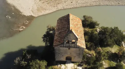
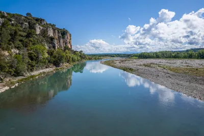
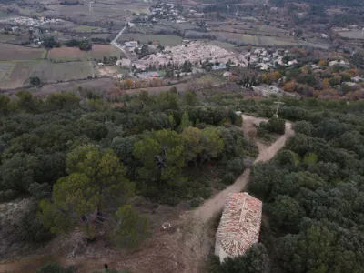
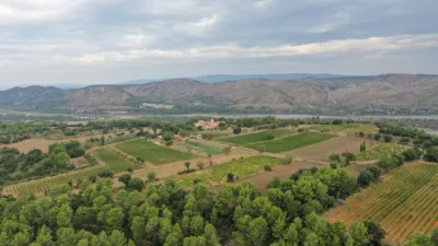
This little monument stands on the banks of the Durance, near the Mirabeau bridge and at the entrance to the Canterperdix gorge. Worth discovering or rediscovering! This chapel was most likely built by the monks of Saint-André de Villeneuve between 1165 and 1178.
From the 14th century, the building was also called Sainte-Madeleine du Pont, because of the ferry operating on the Durance at this spot. In 1343, the Archbishop of Aix found the place in good condition, but the furnishings were not substantial enough. He therefore required that at least two masses a week be celebrated there.
It is thought that the place was abandoned from the second half of the 14th century, like most buildings of this type in the region.
During the Revolution, it was sold as national property and became the property of the commune. The place was used as a warehouse for the ferry service and for the railway construction site. Then the commune sold it to the owner of the Château de Mirabeau.
The chapel was listed as a historic monument in 1928 and restored in 1948.
On one of the voussoirs of the door, you can read inscriptions meaning "In the year of the Lord 1239, on 3 June, there was a solar eclipse. Take care, if you begin, how you will end. Who does well will find well (?)".
Map and restricted areas
Open in the main mapNearby aerodromes
Open aerodromes within 25 km of the spot, heliports included, with their distance and direction from the spot. Near an aerodrome, drone flying is prohibited or height-limited: check the UAS zones map.
| Aerodrome | Type | Distance | Elevation | Difference |
|---|---|---|---|---|
| Aérodrome de Vinon | Aerodrome | 11 km NE | 275 m | spot 47 m lower |
| Saint Martin de Castillon | Aerodrome | 21 km NW | 335 m | spot 107 m lower |
Aviation weather (METAR and TAF)
LFML – Marseille Provence Airport VFR
METAR
METAR LFML 210630Z AUTO VRB03KT CAVOK 08/06 Q1020 NOSIG
- Wind
- Variable, 6 km/h
- Visibility
- 10 km or more
- Clouds
- –
- Temperature
- 8 °C, dew point 6 °C
- QNH
- 1020 hPa
- Flight category
- VFR: ceiling > 3,000 ft and visibility > 5 mi
TAF
TAF LFML 210200Z 2103/2209 VRB05KT CAVOK TX18/2115Z TN08/2107Z BECMG 2119/2121 11010KT -RA BKN025 PROB40 TEMPO 2121/2209 16015G25KT 4000 RA BKN012 BKN025
| Period (local time) | Change | Wind | Visibility | Weather | Clouds |
|---|---|---|---|---|---|
| 21/11 04:00 → 21/11 20:00 | Initial conditions | Variable, 9 km/h | 10 km or more | No significant cloud | |
| 21/11 20:00 → 22/11 10:00 | Becoming | 110°, 19 km/h | 10 km or more | Rain light | Broken (5-7/8) at 2,500 ft (760 m) |
| 21/11 22:00 → 22/11 10:00 | Temporarily, probability 40% | 160°, 28 km/h, gusts 46 km/h | 4.0 km | Rain | Broken (5-7/8) at 1,200 ft (370 m) ; Broken (5-7/8) at 2,500 ft (760 m) |
Weather and Kp index
Sunrise and sunset
| Day | Dawn | Sunrise | Golden hour | Sunset | Dusk | Day length |
|---|---|---|---|---|---|---|
| Sat 21 Nov | 07:08 | 07:39 | 07:39–08:23 · 16:23–17:07 | 17:07 | 17:39 | 9 h 28 |
| Sun 22 Nov | 07:09 | 07:40 | 07:40–08:25 · 16:22–17:07 | 17:07 | 17:38 | 9 h 26 |
| Mon 23 Nov | 07:10 | 07:42 | 07:42–08:26 · 16:21–17:06 | 17:06 | 17:37 | 9 h 24 |
| Tue 24 Nov | 07:11 | 07:43 | 07:43–08:28 · 16:20–17:05 | 17:05 | 17:37 | 9 h 22 |
| Wed 25 Nov | 07:12 | 07:44 | 07:44–08:29 · 16:20–17:05 | 17:05 | 17:36 | 9 h 20 |
| Thu 26 Nov | 07:13 | 07:45 | 07:45–08:30 · 16:19–17:04 | 17:04 | 17:36 | 9 h 18 |
| Fri 27 Nov | 07:15 | 07:46 | 07:46–08:32 · 16:18–17:03 | 17:03 | 17:35 | 9 h 17 |
Reviews
Log in to review this spot. Log in · Create a free account
No reviews yet. Share yours!