

The port des Champs
No reviews yet
Have you flown here? Share your experience with other pilots.
+ Write the first reviewDescription
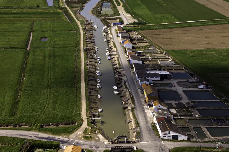
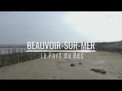
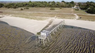
Bouin has the particularity of having four oyster-farming ports on its territory: the port des Brochets, the northernmost, which has undergone major sea-defense works because of rising ocean levels; the port de la Louippe; the port des Champs; the first port of the bay, built between 1854 and 1860 and the most important; the port du Bec.
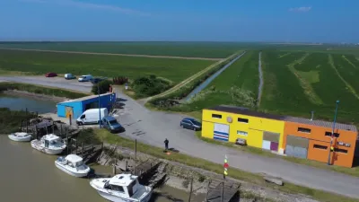
The Port des Champs is one of the oldest ports in the Bay of Bourgneuf. Today it is a tidal grounding port in the middle of nature. From the town center, departmental road 21 leads straight to the port, after winding its way through the old salt marshes.
The establishment of this seaside port followed the silting up of the Dain, further west. While salt was once shipped from this port, it was mainly grain that was exported. The Port des Champs changed toward the end of the 1940s with the arrival of oyster farmers, most of them from Charente, who inspired vocations among the local population. The economic boom in this sector helped stabilize the local workforce, which had tended to emigrate for lack of jobs.
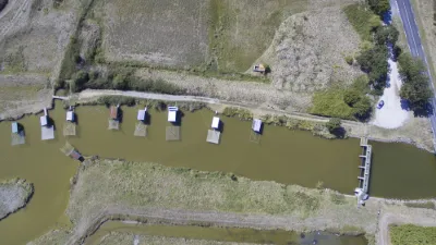
Huts were built all along the port for sorting the oysters. There are now only two oyster farmers left in this bucolic landscape. Treat yourself to a few oysters during your stroll!
Map and restricted areas
Open in the main mapNearby aerodromes
Open aerodromes within 25 km of the spot, heliports included, with their distance and direction from the spot. Near an aerodrome, drone flying is prohibited or height-limited: check the UAS zones map.
| Aerodrome | Type | Distance | Elevation | Difference |
|---|---|---|---|---|
| Beauvoir Fromentine Airport | Aerodrome | 9.7 km SW | 3 m | same altitude as the spot |
| Beauvoir-Sur-Mer Fromentine Heliport | Heliport | 9.7 km SW | 3 m | same altitude as the spot |
| Challans Heliport | Heliport | 20 km SE | 40 m | spot 37 m lower |
| Piste privée de La Cornélie | Aerodrome | 24 km SE | 61 m | spot 58 m lower |
Aviation weather (METAR and TAF)
LFRS – Nantes Atlantique Airport LIFR
METAR
METAR LFRS 211030Z AUTO 12009KT 060V150 0750 0650 R03/0900U R21/1400U FG VV/// 11/11 Q1016 BECMG 9999 NSW BKN014
- Wind
- 120°, 17 km/h
- Visibility
- 750 m
- Weather
- Fog
- Clouds
- –
- Temperature
- 11 °C, dew point 11 °C
- QNH
- 1016 hPa
- Flight category
- LIFR: ceiling < 500 ft or visibility < 1 mi
TAF
TAF AMD LFRS 211004Z 2110/2212 VRB03KT 2500 BR OVC002 TEMPO 2110/2111 0300 FG VV/// BECMG 2110/2112 13010KT 9999 NSW BKN003 BECMG 2112/2114 BKN014 BECMG 2114/2116 SCT016 BECMG 2118/2121 4500 -RA BKN014 TEMPO 2121/2202 2500 DZRA BKN006 OVC015 TEMPO 2202/2205 2500 RA BKN012 SCT025CB FM220500 25012KT 9999 SCT012 TEMPO 2205/2212 26020G35KT 3000 SHRA BKN020CB
| Period (local time) | Change | Wind | Visibility | Weather | Clouds |
|---|---|---|---|---|---|
| 21/11 11:00 → 22/11 13:00 | Initial conditions | Variable, 6 km/h | 2.5 km | Mist | Overcast (8/8) at 200 ft (60 m) |
| 21/11 11:00 → 21/11 12:00 | Temporarily | 300 m | Fog | ||
| 21/11 11:00 → 21/11 13:00 | Becoming | 130°, 19 km/h | 10 km or more | No significant weather | Broken (5-7/8) at 300 ft (90 m) |
| 21/11 13:00 → 21/11 15:00 | Becoming | 130°, 19 km/h | 10 km or more | No significant weather | Broken (5-7/8) at 1,400 ft (430 m) |
| 21/11 15:00 → 21/11 19:00 | Becoming | 130°, 19 km/h | 10 km or more | No significant weather | Scattered (3-4/8) at 1,600 ft (490 m) |
| 21/11 19:00 → 22/11 06:00 | Becoming | 130°, 19 km/h | 4.5 km | Rain light | Broken (5-7/8) at 1,400 ft (430 m) |
| 21/11 22:00 → 22/11 03:00 | Temporarily | 2.5 km | Drizzle ; rain | Broken (5-7/8) at 600 ft (180 m) ; Overcast (8/8) at 1,500 ft (460 m) | |
| 22/11 03:00 → 22/11 06:00 | Temporarily | 2.5 km | Rain | Broken (5-7/8) at 1,200 ft (370 m) ; Scattered (3-4/8) at 2,500 ft (760 m) (cumulonimbus) | |
| 22/11 06:00 → 22/11 13:00 | From | 250°, 22 km/h | 10 km or more | Scattered (3-4/8) at 1,200 ft (370 m) | |
| 22/11 06:00 → 22/11 13:00 | Temporarily | 260°, 37 km/h, gusts 65 km/h | 3.0 km | Showers of rain | Broken (5-7/8) at 2,000 ft (610 m) (cumulonimbus) |
Weather and Kp index
Sunrise and sunset
| Day | Dawn | Sunrise | Golden hour | Sunset | Dusk | Day length |
|---|---|---|---|---|---|---|
| Sat 21 Nov | 07:46 | 08:20 | 08:20–09:08 · 16:40–17:28 | 17:28 | 18:02 | 9 h 08 |
| Sun 22 Nov | 07:48 | 08:21 | 08:21–09:10 · 16:39–17:27 | 17:27 | 18:01 | 9 h 05 |
| Mon 23 Nov | 07:49 | 08:23 | 08:23–09:11 · 16:38–17:26 | 17:26 | 18:00 | 9 h 03 |
| Tue 24 Nov | 07:50 | 08:24 | 08:24–09:13 · 16:37–17:26 | 17:26 | 17:59 | 9 h 01 |
| Wed 25 Nov | 07:51 | 08:25 | 08:25–09:14 · 16:36–17:25 | 17:25 | 17:59 | 8 h 59 |
| Thu 26 Nov | 07:53 | 08:27 | 08:27–09:16 · 16:35–17:24 | 17:24 | 17:58 | 8 h 57 |
| Fri 27 Nov | 07:54 | 08:28 | 08:28–09:17 · 16:34–17:24 | 17:24 | 17:58 | 8 h 55 |
Reviews
Log in to review this spot. Log in · Create a free account
No reviews yet. Share yours!